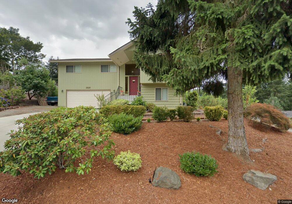
1017 NE Tollefson St Poulsbo, WA 98370
Estimated Value: $709,803 - $812,000
3
Beds
3
Baths
2,154
Sq Ft
$356/Sq Ft
Est. Value
About This Home
This home is located at 1017 NE Tollefson St, Poulsbo, WA 98370 and is currently estimated at $766,951, approximately $356 per square foot. 1017 NE Tollefson St is a home located in Kitsap County with nearby schools including Poulsbo Elementary School, Poulsbo Middle School, and North Kitsap High School.
Ownership History
Date
Name
Owned For
Owner Type
Purchase Details
Closed on
Oct 6, 2014
Sold by
Azcarate Marie and Azcarate Marie T
Bought by
Ohrel Ronald W and Ohrel Evonne M
Current Estimated Value
Purchase Details
Closed on
Nov 22, 2004
Sold by
Elliott Douglas Floyd and Elliott Carolyn Beatrice
Bought by
Azcarate Marie T
Home Financials for this Owner
Home Financials are based on the most recent Mortgage that was taken out on this home.
Original Mortgage
$205,500
Interest Rate
5.65%
Mortgage Type
Stand Alone First
Purchase Details
Closed on
Dec 20, 2002
Sold by
Wilson Robert D and Wilson Geraldine E
Bought by
Elliott Douglas F and Elliott Carolyn Beatrice
Create a Home Valuation Report for This Property
The Home Valuation Report is an in-depth analysis detailing your home's value as well as a comparison with similar homes in the area
Home Values in the Area
Average Home Value in this Area
Purchase History
| Date | Buyer | Sale Price | Title Company |
|---|---|---|---|
| Ohrel Ronald W | $359,000 | Pacific Nw Title | |
| Azcarate Marie T | $267,000 | Transnation Title | |
| Elliott Douglas F | $241,500 | Pacific Nw Title |
Source: Public Records
Mortgage History
| Date | Status | Borrower | Loan Amount |
|---|---|---|---|
| Previous Owner | Azcarate Marie T | $205,500 |
Source: Public Records
Tax History Compared to Growth
Tax History
| Year | Tax Paid | Tax Assessment Tax Assessment Total Assessment is a certain percentage of the fair market value that is determined by local assessors to be the total taxable value of land and additions on the property. | Land | Improvement |
|---|---|---|---|---|
| 2026 | $1,707 | $647,400 | $220,980 | $426,420 |
| 2025 | $1,707 | $647,400 | $220,980 | $426,420 |
| 2024 | $660 | $596,710 | $184,310 | $412,400 |
| 2023 | $1,285 | $596,710 | $184,310 | $412,400 |
| 2022 | $1,380 | $504,980 | $159,990 | $344,990 |
| 2021 | $1,488 | $452,650 | $143,350 | $309,300 |
| 2020 | $802 | $432,370 | $136,950 | $295,420 |
| 2019 | $812 | $405,570 | $127,990 | $277,580 |
| 2018 | $836 | $309,660 | $100,180 | $209,480 |
| 2017 | $877 | $309,660 | $100,180 | $209,480 |
| 2016 | $3,691 | $295,860 | $100,180 | $195,680 |
| 2015 | $3,594 | $289,590 | $100,180 | $189,410 |
| 2014 | -- | $280,200 | $100,180 | $180,020 |
| 2013 | -- | $280,200 | $100,180 | $180,020 |
Source: Public Records
Map
Nearby Homes
- 18330 9th Ave NE
- 18664 11th Ave NE
- 1610 NE Mount Kamela Ct
- 17667 State Highway 305 NE
- 0 XX Lemolo Shore Dr NE
- 18552 15th Loop NE
- 18130 Sunrise Ridge Ave NE
- 18637 Fjord Dr NE
- 18323 Sunrise Ridge Ave NE
- 493 NE Lincoln Rd
- 17915 Sunrise Ridge Ave NE
- 17787 Sunrise Ridge Ave NE
- 0 7th Ave NE Unit NWM2280996
- 600 NE Lincoln Rd Unit 41
- 17 Beargrass Ln NE
- Asher Plan at Liberty Bay Vista
- Rainier Plan at Liberty Bay Vista
- Raymond Plan at Liberty Bay Vista
- Luna Plan at Liberty Bay Vista
- Luna (Basement) Plan at Liberty Bay Vista
- 18146 10th Ave NE
- 1061 NE Tollefson St
- 1020 NE Tollefson St
- 1058 NE Sol Vei
- 18167 10th Ave NE
- 1048 NE Sol Vei
- 18193 10th Ave NE
- 18145 10th Ave NE
- 18215 10th Ave NE
- 1089 NE Tollefson St
- 18121 10th Ave NE
- 1082 NE Tollefson St
- 18244 10th Ave NE
- 1090 NE Sol Vei
- 1049 NE Rindal Ct
- 1049 NE Rindall Ct
- 18237 10th Ave NE
- 18082 10th Place NE
- 18091 10th Ave NE
- 1073 NE Rindall Ct