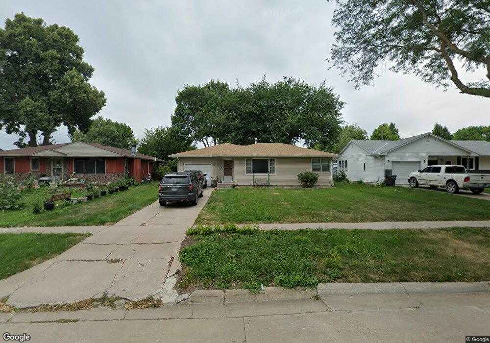
1017 Oswego Ave Hastings, NE 68901
Estimated Value: $158,000 - $174,000
2
Beds
1
Bath
902
Sq Ft
$184/Sq Ft
Est. Value
About This Home
This home is located at 1017 Oswego Ave, Hastings, NE 68901 and is currently estimated at $165,819, approximately $183 per square foot. 1017 Oswego Ave is a home located in Adams County with nearby schools including Hastings Senior High School, St. Michael's Preschool & Elementary School, and Zion Lutheran School.
Ownership History
Date
Name
Owned For
Owner Type
Purchase Details
Closed on
Jun 18, 2021
Sold by
Clancy David A and Clancy Jennifer A
Bought by
Shelton Jeffrey E and Shelton Kimberly J
Current Estimated Value
Home Financials for this Owner
Home Financials are based on the most recent Mortgage that was taken out on this home.
Original Mortgage
$265,162
Outstanding Balance
$240,071
Interest Rate
2.9%
Mortgage Type
Commercial
Estimated Equity
-$74,252
Purchase Details
Closed on
Mar 6, 2020
Sold by
Helzer Wade J
Bought by
Clancy David A and Clancy Jennifer A
Create a Home Valuation Report for This Property
The Home Valuation Report is an in-depth analysis detailing your home's value as well as a comparison with similar homes in the area
Home Values in the Area
Average Home Value in this Area
Purchase History
| Date | Buyer | Sale Price | Title Company |
|---|---|---|---|
| Shelton Jeffrey E | $142,000 | None Available | |
| Clancy David A | $88,000 | None Available |
Source: Public Records
Mortgage History
| Date | Status | Borrower | Loan Amount |
|---|---|---|---|
| Open | Shelton Jeffrey E | $265,162 |
Source: Public Records
Tax History Compared to Growth
Tax History
| Year | Tax Paid | Tax Assessment Tax Assessment Total Assessment is a certain percentage of the fair market value that is determined by local assessors to be the total taxable value of land and additions on the property. | Land | Improvement |
|---|---|---|---|---|
| 2024 | $1,925 | $120,539 | $19,544 | $100,995 |
| 2023 | $2,360 | $114,391 | $19,544 | $94,847 |
| 2022 | $2,672 | $118,615 | $19,544 | $99,071 |
| 2021 | $2,437 | $111,117 | $15,856 | $95,261 |
| 2020 | $2,298 | $106,581 | $15,856 | $90,725 |
| 2019 | $0 | $99,861 | $15,856 | $84,005 |
| 2018 | $0 | $95,070 | $11,065 | $84,005 |
| 2017 | $0 | $93,425 | $0 | $0 |
| 2016 | -- | $88,035 | $11,065 | $76,970 |
| 2011 | -- | $80,085 | $10,325 | $69,760 |
Source: Public Records
Map
Nearby Homes
- 1911 W 11th St
- 1814 Boyce St
- 1201 Pershing Rd
- 1513 Crane Ave
- 1505 Crane Ave
- 904 N Washington Ave
- 1225 Heritage Dr
- 1619 Boyce St
- 1223 Westwood Terrace
- 1108 N Baltimore Ave
- 736 N Barnes Ave
- 1330 Heritage Dr
- 1801 W 7th St
- 1001 N Webster Ave
- 1615 W 7th St
- 1334 W 12th St
- 514 Oswego Ave
- 2330 W 11th St
- 714 N Baltimore Ave
- 2229 W 8th St
- 1009 Oswego Ave
- 1021 Oswego Ave
- 1815 W 11th St
- 1003 Oswego Ave
- 1810 W 10th St
- 1025 Oswego Ave
- 1816 W 10th St
- 1008 Oswego Ave
- 1004 Oswego Ave
- 1018 Oswego Ave
- 1822 W 10th St
- 1000 Oswego Ave
- 1022 Oswego Ave
- 919 Oswego Ave
- 1831 W 11th St
- 1812 W 11th St
- 1828 W 10th St
- 922 Oswego Ave
- 913 Oswego Ave
- 1105 Oswego Ave