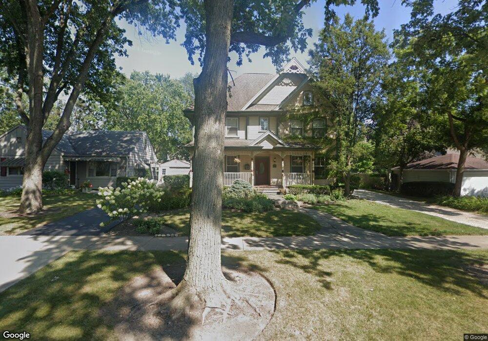
1017 Sheridan Rd Deerfield, IL 60015
Estimated Value: $1,210,000 - $1,446,000
4
Beds
3
Baths
3,640
Sq Ft
$352/Sq Ft
Est. Value
About This Home
This home is located at 1017 Sheridan Rd, Deerfield, IL 60015 and is currently estimated at $1,281,218, approximately $351 per square foot. 1017 Sheridan Rd is a home located in Lake County with nearby schools including Walden Elementary School, Alan B Shepard Middle School, and Deerfield High School.
Ownership History
Date
Name
Owned For
Owner Type
Purchase Details
Closed on
Dec 19, 2011
Sold by
Lew Laura D
Bought by
Michalak Stephen and Michalak Dawn
Current Estimated Value
Home Financials for this Owner
Home Financials are based on the most recent Mortgage that was taken out on this home.
Original Mortgage
$417,000
Outstanding Balance
$284,708
Interest Rate
3.97%
Mortgage Type
New Conventional
Estimated Equity
$996,510
Purchase Details
Closed on
Jan 9, 2008
Sold by
Lew Victor and Lew Laura
Bought by
Lew Laura D and Laura D Lew Trust
Purchase Details
Closed on
Oct 27, 2000
Sold by
Old Kent Bank
Bought by
Lew Victor and Lew Laura
Home Financials for this Owner
Home Financials are based on the most recent Mortgage that was taken out on this home.
Original Mortgage
$180,000
Interest Rate
8.96%
Purchase Details
Closed on
Mar 15, 1996
Sold by
Russell Charles F and Russell Ellen W
Bought by
Kobusch Williard H
Create a Home Valuation Report for This Property
The Home Valuation Report is an in-depth analysis detailing your home's value as well as a comparison with similar homes in the area
Home Values in the Area
Average Home Value in this Area
Purchase History
| Date | Buyer | Sale Price | Title Company |
|---|---|---|---|
| Michalak Stephen | $680,000 | Attorneys Title Guaranty Fun | |
| Lew Laura D | -- | None Available | |
| Lew Victor | $225,000 | -- | |
| Kobusch Williard H | $150,000 | Intercounty Title |
Source: Public Records
Mortgage History
| Date | Status | Borrower | Loan Amount |
|---|---|---|---|
| Open | Michalak Stephen | $417,000 | |
| Previous Owner | Lew Victor | $180,000 |
Source: Public Records
Tax History Compared to Growth
Tax History
| Year | Tax Paid | Tax Assessment Tax Assessment Total Assessment is a certain percentage of the fair market value that is determined by local assessors to be the total taxable value of land and additions on the property. | Land | Improvement |
|---|---|---|---|---|
| 2024 | $27,289 | $346,997 | $38,130 | $308,867 |
| 2023 | $28,630 | $298,000 | $36,593 | $261,407 |
| 2022 | $28,630 | $308,223 | $39,304 | $268,919 |
| 2021 | $27,022 | $297,168 | $37,894 | $259,274 |
| 2020 | $25,988 | $297,794 | $37,974 | $259,820 |
| 2019 | $25,389 | $297,289 | $37,910 | $259,379 |
| 2018 | $23,738 | $314,788 | $40,182 | $274,606 |
| 2017 | $25,632 | $313,784 | $40,054 | $273,730 |
| 2016 | $24,940 | $301,918 | $38,539 | $263,379 |
| 2015 | $24,460 | $284,618 | $36,211 | $248,407 |
| 2014 | $18,511 | $213,120 | $36,470 | $176,650 |
| 2012 | $18,052 | $211,240 | $36,148 | $175,092 |
Source: Public Records
Map
Nearby Homes
- 1103 Hazel Ave
- 1045 Fairoaks Ave
- 904 Forest Ave
- 934 Wayne Ave
- 745 Price Ln
- 970 Ivy Ln Unit C
- 926 Cedar St
- 1131 Linden Ave
- 1009 Central Ave
- 1423 Northwoods Rd
- 1038 Brookside Ln
- 956 Brookside Ln
- 677 Timber Hill Rd
- 816 Appletree Ln
- 1410 Berkley Ct
- 1265 Woodland Dr
- 610 Robert York Ave Unit 104
- 505 Margate Terrace
- 1504 Wincanton Dr
- 860 Kenton Rd
- 1021 Sheridan Rd
- 1025 Sheridan Rd
- 1030 Hazel Ave
- 1038 Hazel Ave
- 1028 Hazel Ave
- 1033 Sheridan Rd
- 1026 Forest Ave
- 1016 Hazel Ave
- 1020 Forest Ave
- 1030 Forest Ave
- 1048 Hazel Ave
- 1016 Sheridan Ave
- 1036 Forest Ave
- 1016 Sheridan Rd
- 1020 Sheridan Rd
- 1010 Hazel Ave
- 1026 Sheridan Rd
- 1041 Sheridan Rd
- 1032 Sheridan Ave
- 1040 Forest Ave