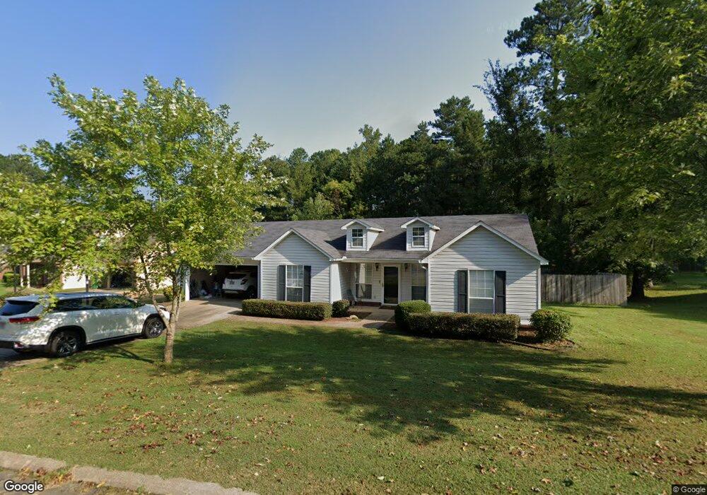
1017 Shobe Rd Bryant, AR 72022
Estimated Value: $202,205 - $219,000
Studio
2
Baths
1,690
Sq Ft
$125/Sq Ft
Est. Value
About This Home
This home is located at 1017 Shobe Rd, Bryant, AR 72022 and is currently estimated at $211,551, approximately $125 per square foot. 1017 Shobe Rd is a home located in Saline County with nearby schools including Bryant Elementary School, Arkansas Christian Academy, and Woodland Hills Christian School.
Ownership History
Date
Name
Owned For
Owner Type
Purchase Details
Closed on
Sep 12, 2005
Sold by
Blacklock Pamela A Newcomb
Bought by
Marvel Ronald and Marvel Jeanette
Current Estimated Value
Purchase Details
Closed on
Apr 21, 2003
Bought by
Newcomb
Purchase Details
Closed on
Aug 9, 1996
Bought by
Newcomb
Purchase Details
Closed on
Jul 2, 1996
Bought by
Newcomb
Purchase Details
Closed on
Feb 1, 1993
Bought by
Evans
Purchase Details
Closed on
Aug 1, 1992
Bought by
Childers
Create a Home Valuation Report for This Property
The Home Valuation Report is an in-depth analysis detailing your home's value as well as a comparison with similar homes in the area
Home Values in the Area
Average Home Value in this Area
Purchase History
| Date | Buyer | Sale Price | Title Company |
|---|---|---|---|
| Marvel Ronald | $119,000 | -- | |
| Newcomb | -- | -- | |
| Newcomb | $111,000 | -- | |
| Newcomb | $111,000 | -- | |
| Evans | $83,000 | -- | |
| Childers | $16,000 | -- |
Source: Public Records
Tax History
| Year | Tax Paid | Tax Assessment Tax Assessment Total Assessment is a certain percentage of the fair market value that is determined by local assessors to be the total taxable value of land and additions on the property. | Land | Improvement |
|---|---|---|---|---|
| 2025 | $1,245 | $33,574 | $5,980 | $27,594 |
| 2024 | $1,136 | $33,574 | $5,980 | $27,594 |
| 2023 | $1,136 | $33,574 | $5,980 | $27,594 |
| 2022 | $840 | $33,574 | $5,980 | $27,594 |
| 2021 | $845 | $28,120 | $4,600 | $23,520 |
| 2020 | $845 | $28,120 | $4,600 | $23,520 |
| 2019 | $845 | $28,120 | $4,600 | $23,520 |
| 2018 | $870 | $28,120 | $4,600 | $23,520 |
| 2017 | $870 | $28,120 | $4,600 | $23,520 |
| 2016 | $1,136 | $25,830 | $4,600 | $21,230 |
| 2015 | $1,136 | $25,830 | $4,600 | $21,230 |
| 2014 | $786 | $23,280 | $4,600 | $18,680 |
Source: Public Records
Map
Nearby Homes
- 1000 Shobe Rd
- 2500 Carywood Dr
- 3016 Olson Cir
- 3458 Garden Club Dr
- 2713 Johnswood Village Dr
- lot 7 Kindness Ct
- 3104 Debra Gaye Dr
- 3105 Debra Gaye Dr
- 1004 N Reynolds Rd
- 80 Bame Cir
- 15618 Linden Dr
- 23395 I-30 S
- 3107 Johnswood Village Dr
- 86 Bame Cir Unit 1
- 3393 Garden Club Dr
- 210 Dell Dr
- 3322 Moss Creek Dr
- 89 Bame Cir
- 37 Arcadia Cir
- East 1/2 Tract 4 Market Place E
- 1013 Shobe Rd
- 1021 S Shobe Rd
- 1021 Shobe Rd
- 0 Mills Parks Rd
- 2027 Mills Park Rd
- 1009 Shobe Rd
- 2101 Mills Park Rd
- 2118 Raintree Dr
- 1008 Shobe Rd
- 2007 Mills Park Rd
- 2114 Raintree Dr
- 2103 Mills Park Rd
- 2112 Raintree Dr
- 2122 Raintree Dr
- 1004 Shobe Rd
- 2107 Mills Park Rd
- 0 Mills Park Rd
- 2200 Raintree Dr
- 2119 Raintree Dr
- 2113 Mills Park Rd
Your Personal Tour Guide
Ask me questions while you tour the home.