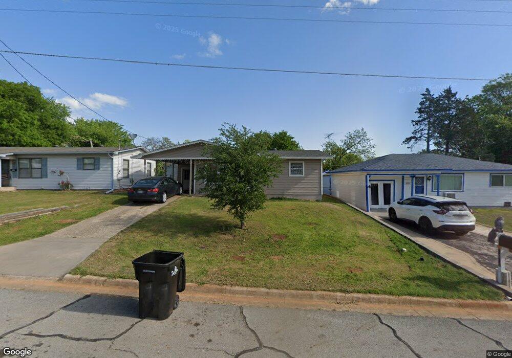
1017 Thatcher St Denison, TX 75020
Estimated Value: $123,854 - $150,000
2
Beds
1
Bath
780
Sq Ft
$176/Sq Ft
Est. Value
About This Home
This home is located at 1017 Thatcher St, Denison, TX 75020 and is currently estimated at $136,927, approximately $175 per square foot. 1017 Thatcher St is a home located in Grayson County with nearby schools including Scott Middle School, Denison High School, and St. Luke's Parish Day School.
Ownership History
Date
Name
Owned For
Owner Type
Purchase Details
Closed on
May 23, 2018
Sold by
Nicholas Debra E
Bought by
Hogan Ricky
Current Estimated Value
Home Financials for this Owner
Home Financials are based on the most recent Mortgage that was taken out on this home.
Original Mortgage
$17,827
Outstanding Balance
$15,350
Interest Rate
4.4%
Mortgage Type
Purchase Money Mortgage
Estimated Equity
$121,577
Purchase Details
Closed on
Jan 22, 2008
Sold by
Payne Eric and Payne Amanda
Bought by
Nichols Debra E
Home Financials for this Owner
Home Financials are based on the most recent Mortgage that was taken out on this home.
Original Mortgage
$34,579
Interest Rate
6.11%
Mortgage Type
Purchase Money Mortgage
Create a Home Valuation Report for This Property
The Home Valuation Report is an in-depth analysis detailing your home's value as well as a comparison with similar homes in the area
Home Values in the Area
Average Home Value in this Area
Purchase History
| Date | Buyer | Sale Price | Title Company |
|---|---|---|---|
| Hogan Ricky | -- | None Available | |
| Nichols Debra E | -- | Chapin Title Co Inc |
Source: Public Records
Mortgage History
| Date | Status | Borrower | Loan Amount |
|---|---|---|---|
| Open | Hogan Ricky | $17,827 | |
| Previous Owner | Nichols Debra E | $34,579 |
Source: Public Records
Tax History Compared to Growth
Tax History
| Year | Tax Paid | Tax Assessment Tax Assessment Total Assessment is a certain percentage of the fair market value that is determined by local assessors to be the total taxable value of land and additions on the property. | Land | Improvement |
|---|---|---|---|---|
| 2025 | $1,970 | $87,640 | $39,715 | $47,925 |
| 2024 | $1,970 | $84,810 | $36,660 | $48,150 |
| 2023 | $1,834 | $80,944 | $34,970 | $45,974 |
| 2022 | $1,861 | $78,340 | $34,970 | $43,370 |
| 2021 | $1,226 | $48,604 | $13,000 | $35,604 |
| 2020 | $1,245 | $47,184 | $9,750 | $37,434 |
| 2019 | $1,317 | $47,877 | $9,750 | $38,127 |
| 2018 | $1,001 | $49,498 | $10,010 | $39,488 |
| 2017 | $918 | $39,420 | $3,250 | $36,170 |
| 2016 | $834 | $35,525 | $3,250 | $32,275 |
| 2015 | $364 | $27,106 | $3,250 | $23,856 |
| 2014 | $554 | $28,559 | $3,250 | $25,309 |
Source: Public Records
Map
Nearby Homes
- 938 Amsden St
- 3101 S College Blvd
- 923 Dubois St
- 1130 Amsden Cir
- 905 Seymore Cir
- 903 Seymore Cir
- 603 W Star St
- 916 W Collins St
- 3312 Vine Ln
- 923 W Collins St
- 921 W Collins St
- 919 W Collins St
- 711 Dubois St
- 700 Dubois St
- 701 W Star St
- 1901 Woodlawn Blvd
- 601 Dubois St
- 930 W Florence St
- 608 W Baker St
- 611 W Baker St
- 1015 Thatcher St
- 1025 Thatcher St
- 1013 Thatcher St
- 1029 Thatcher St
- 1009 Thatcher St
- 1018 Dubois St
- 1014 Dubois St
- 1026 Thatcher St
- 1016 Thatcher St
- 1005 Thatcher St
- 1031 Thatcher St
- 1034 Dubois St
- 1010 Dubois St
- 1028 Thatcher St
- 1006 Thatcher St
- 1038 Dubois St
- 1038-1040 Dubois St
- 1006 Dubois St
- 1001 Thatcher St
- 1040 Dubois St