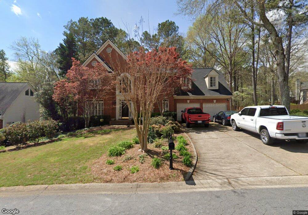
1017 Wellesley Crest Dr Unit 1 Woodstock, GA 30189
Oak Grove NeighborhoodEstimated Value: $648,095 - $691,000
5
Beds
4
Baths
3,936
Sq Ft
$170/Sq Ft
Est. Value
About This Home
This home is located at 1017 Wellesley Crest Dr Unit 1, Woodstock, GA 30189 and is currently estimated at $669,548, approximately $170 per square foot. 1017 Wellesley Crest Dr Unit 1 is a home located in Cherokee County with nearby schools including Bascomb Elementary School, E. T. Booth Middle School, and Etowah High School.
Ownership History
Date
Name
Owned For
Owner Type
Purchase Details
Closed on
Sep 12, 2003
Sold by
Prudential Residential Svcs
Bought by
Benton Bryan and Benton Sandy
Current Estimated Value
Home Financials for this Owner
Home Financials are based on the most recent Mortgage that was taken out on this home.
Original Mortgage
$214,480
Outstanding Balance
$99,309
Interest Rate
6.33%
Mortgage Type
New Conventional
Estimated Equity
$570,239
Purchase Details
Closed on
Nov 17, 1997
Sold by
Turan Edwin S and Turan Mary V
Bought by
Cook John W and Cook Sharon K
Home Financials for this Owner
Home Financials are based on the most recent Mortgage that was taken out on this home.
Original Mortgage
$184,800
Interest Rate
7.27%
Mortgage Type
New Conventional
Create a Home Valuation Report for This Property
The Home Valuation Report is an in-depth analysis detailing your home's value as well as a comparison with similar homes in the area
Home Values in the Area
Average Home Value in this Area
Purchase History
| Date | Buyer | Sale Price | Title Company |
|---|---|---|---|
| Benton Bryan | $268,100 | -- | |
| Prudential Residential Svcs | $268,100 | -- | |
| Cook John W | $231,000 | -- |
Source: Public Records
Mortgage History
| Date | Status | Borrower | Loan Amount |
|---|---|---|---|
| Open | Prudential Residential Svcs | $214,480 | |
| Previous Owner | Cook John W | $184,800 |
Source: Public Records
Tax History Compared to Growth
Tax History
| Year | Tax Paid | Tax Assessment Tax Assessment Total Assessment is a certain percentage of the fair market value that is determined by local assessors to be the total taxable value of land and additions on the property. | Land | Improvement |
|---|---|---|---|---|
| 2025 | $1,254 | $220,696 | $48,000 | $172,696 |
| 2024 | $1,504 | $216,504 | $46,000 | $170,504 |
| 2023 | $1,290 | $198,432 | $46,000 | $152,432 |
| 2022 | $1,098 | $163,480 | $30,560 | $132,920 |
| 2021 | $1,123 | $146,968 | $30,560 | $116,408 |
| 2020 | $1,083 | $135,056 | $27,800 | $107,256 |
| 2019 | $1,047 | $125,560 | $25,600 | $99,960 |
| 2018 | $1,045 | $119,760 | $23,200 | $96,560 |
| 2017 | $1,058 | $291,200 | $23,200 | $93,280 |
| 2016 | $3,232 | $283,300 | $23,200 | $90,120 |
| 2015 | $3,243 | $281,500 | $23,800 | $88,800 |
| 2014 | $3,282 | $284,300 | $23,800 | $89,920 |
Source: Public Records
Map
Nearby Homes
- 3009 High Vista Walk
- 509 Courtyard Way
- 3007 Clove Tree Ln
- 1086 Atherton Ln
- 125 Tambourine Trail
- 2012 Spicers Ln
- 331 Mirramont Ct
- 227 Strawberry Ln
- 223 Strawberry Ln
- 243 Cordova St
- Sanctuary Plan at Maple Grove at Towne Lake
- Stillhouse Plan at Maple Grove at Towne Lake
- Ridgeford Plan at Maple Grove at Towne Lake
- Copperdale Plan at Maple Grove at Towne Lake
- Octavia Plan at Maple Grove at Towne Lake
- Cartwright II Plan at Maple Grove at Towne Lake
- Montage Plan at Maple Grove at Towne Lake
- 613 Sweet Basil Ln
- 100 Eagle Glen Dr
- 2038 Britley Park Crossing
- 1015 Wellesley Crest Dr Unit 1
- 2001 Cresthaven Walk
- 2045 Cresthaven Walk Unit 3
- 2005 Cresthaven Walk
- 2041 Cresthaven Walk
- 1013 Wellesley Crest Dr
- 1014 Wellesley Crest Dr Unit 1
- 302 Westbriar Way
- 1012 Wellesley Crest Dr
- 1016 Wellesley Crest Dr
- 2037 Cresthaven Walk Unit 3
- 2009 Cresthaven Walk
- 1018 Wellesley Crest Dr
- 2044 Cresthaven Walk
- 1010 Wellesley Crest Dr
- 2000 Cresthaven Walk Unit 1
- 2033 Cresthaven Walk Unit 3
- 2013 Cresthaven Walk
- 304 Westbriar Way Unit 1
- 1020 Wellesley Crest Dr