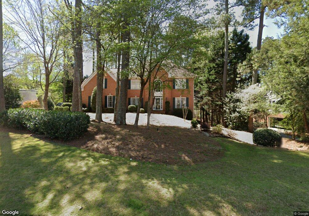
10170 Twingate Dr Alpharetta, GA 30022
Doublegate NeighborhoodEstimated Value: $901,662 - $1,009,000
5
Beds
5
Baths
3,327
Sq Ft
$290/Sq Ft
Est. Value
About This Home
This home is located at 10170 Twingate Dr, Alpharetta, GA 30022 and is currently estimated at $965,166, approximately $290 per square foot. 10170 Twingate Dr is a home located in Fulton County with nearby schools including State Bridge Crossing Elementary School, Autrey Mill Middle School, and Johns Creek High School.
Ownership History
Date
Name
Owned For
Owner Type
Purchase Details
Closed on
Jul 16, 2009
Sold by
Sutliff Stuart A and Sutliff Candy S
Bought by
Parker Phillip and Parker Mary C
Current Estimated Value
Home Financials for this Owner
Home Financials are based on the most recent Mortgage that was taken out on this home.
Original Mortgage
$326,000
Outstanding Balance
$215,135
Interest Rate
5.53%
Mortgage Type
New Conventional
Estimated Equity
$750,031
Create a Home Valuation Report for This Property
The Home Valuation Report is an in-depth analysis detailing your home's value as well as a comparison with similar homes in the area
Home Values in the Area
Average Home Value in this Area
Purchase History
| Date | Buyer | Sale Price | Title Company |
|---|---|---|---|
| Parker Phillip | $455,000 | -- |
Source: Public Records
Mortgage History
| Date | Status | Borrower | Loan Amount |
|---|---|---|---|
| Open | Parker Phillip | $326,000 |
Source: Public Records
Tax History Compared to Growth
Tax History
| Year | Tax Paid | Tax Assessment Tax Assessment Total Assessment is a certain percentage of the fair market value that is determined by local assessors to be the total taxable value of land and additions on the property. | Land | Improvement |
|---|---|---|---|---|
| 2025 | $5,141 | $324,880 | $108,880 | $216,000 |
| 2023 | $6,591 | $233,520 | $47,840 | $185,680 |
| 2022 | $4,912 | $215,840 | $42,640 | $173,200 |
| 2021 | $4,865 | $183,640 | $44,560 | $139,080 |
| 2020 | $4,898 | $173,840 | $49,120 | $124,720 |
| 2019 | $568 | $157,640 | $44,320 | $113,320 |
| 2018 | $4,615 | $153,960 | $43,280 | $110,680 |
| 2017 | $4,826 | $153,960 | $43,280 | $110,680 |
| 2016 | $4,779 | $155,480 | $36,880 | $118,600 |
| 2015 | $4,830 | $155,480 | $36,880 | $118,600 |
| 2014 | $4,449 | $139,200 | $31,440 | $107,760 |
Source: Public Records
Map
Nearby Homes
- 504 Winston Croft Cir Unit 54
- 510 Winston Croft Cir Unit 56
- 1019 Crown Oak St Unit 51
- 1011 Crown Oak St Unit 47
- 1017 Crown Oak St Unit 50
- 1007 Crown Oak St Unit 45
- 1003 Crown Oak St Unit 43
- 1005 Crown Oak St Unit 44
- 230 Skidaway Ct
- The Ellington Plan at Ward's Crossing
- The Jacobsen I Plan at Ward's Crossing
- The Jacobsen II Plan at Ward's Crossing
- The Benton III Plan at Ward's Crossing
- 149 Wards Crossing Way Unit 10
- 149 Wards Crossing Way
- 153 Wards Crossing Way Unit 8
- 153 Wards Crossing Way
- 608 Goldsmith Ct Unit 113
- 9950 Farmbrook Ln
- 606 Goldsmith Ct Unit 114
- 10180 Twingate Dr
- 5320 Laithbank Ln
- 5310 Laithbank Ln
- 5300 Laithbank Ln
- 10190 Twingate Dr
- 10185 Twingate Dr
- 10175 Twingate Dr
- 10195 Twingate Dr
- 10165 Twingate Dr
- 5290 Laithbank Ln
- 0 Twingate Dr Unit 10326290
- 0 Twingate Dr Unit 7397237
- 10140 Twingate Dr
- 10205 Twingate Dr
- 10200 Twingate Dr
- 5270 Laithbank Ln Unit VI
- 5370 Laithbank Ln
- 5305 Laithbank Ln
- 5260 Laithbank Ln
- 5345 Laithbank Ln