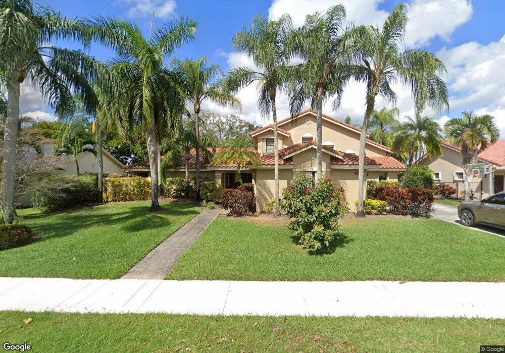
10175 SW 20th St Davie, FL 33324
Outer Davie NeighborhoodEstimated Value: $919,000 - $1,057,000
4
Beds
3
Baths
3,111
Sq Ft
$325/Sq Ft
Est. Value
About This Home
This home is located at 10175 SW 20th St, Davie, FL 33324 and is currently estimated at $1,011,509, approximately $325 per square foot. 10175 SW 20th St is a home located in Broward County with nearby schools including Fox Trail Elementary School, Indian Ridge Middle School, and Western High School.
Ownership History
Date
Name
Owned For
Owner Type
Purchase Details
Closed on
Aug 12, 2005
Sold by
Coutinho Artur and Coutinho Maria Angelica Velerio
Bought by
Slater Aaron N and Slater Jocelyn
Current Estimated Value
Home Financials for this Owner
Home Financials are based on the most recent Mortgage that was taken out on this home.
Original Mortgage
$520,000
Outstanding Balance
$272,285
Interest Rate
5.61%
Mortgage Type
Fannie Mae Freddie Mac
Estimated Equity
$739,224
Purchase Details
Closed on
Apr 19, 2003
Sold by
Long John L and Long Jolene D
Bought by
Coutinho Artur and Coutinho Maria Angelica Velerio
Home Financials for this Owner
Home Financials are based on the most recent Mortgage that was taken out on this home.
Original Mortgage
$364,500
Interest Rate
5.79%
Purchase Details
Closed on
Sep 1, 1992
Sold by
Available Not
Bought by
Available Not
Create a Home Valuation Report for This Property
The Home Valuation Report is an in-depth analysis detailing your home's value as well as a comparison with similar homes in the area
Home Values in the Area
Average Home Value in this Area
Purchase History
| Date | Buyer | Sale Price | Title Company |
|---|---|---|---|
| Slater Aaron N | $650,000 | -- | |
| Coutinho Artur | $420,000 | -- | |
| Available Not | $234,700 | -- |
Source: Public Records
Mortgage History
| Date | Status | Borrower | Loan Amount |
|---|---|---|---|
| Open | Slater Aaron N | $520,000 | |
| Previous Owner | Coutinho Artur | $364,500 |
Source: Public Records
Tax History Compared to Growth
Tax History
| Year | Tax Paid | Tax Assessment Tax Assessment Total Assessment is a certain percentage of the fair market value that is determined by local assessors to be the total taxable value of land and additions on the property. | Land | Improvement |
|---|---|---|---|---|
| 2025 | $9,574 | $496,930 | -- | -- |
| 2024 | $9,379 | $482,930 | -- | -- |
| 2023 | $9,379 | $468,870 | $0 | $0 |
| 2022 | $8,839 | $455,220 | $0 | $0 |
| 2021 | $8,569 | $441,970 | $0 | $0 |
| 2020 | $8,487 | $435,870 | $0 | $0 |
| 2019 | $8,253 | $426,080 | $0 | $0 |
| 2018 | $8,015 | $418,140 | $0 | $0 |
| 2017 | $7,877 | $409,540 | $0 | $0 |
| 2016 | $7,825 | $401,120 | $0 | $0 |
| 2015 | $8,007 | $398,340 | $0 | $0 |
| 2014 | $8,098 | $395,180 | $0 | $0 |
| 2013 | -- | $421,690 | $150,000 | $271,690 |
Source: Public Records
Map
Nearby Homes
- 10345 SW 23rd Ct
- 10991 Northstar St
- 9450 Live Oak Place Unit 109
- 9440 Live Oak Place Unit 307
- 1541 SW 102nd Terrace
- 9460 Live Oak Place Unit 309
- 9431 Live Oak Place Unit 203
- 9410 Live Oak Place Unit 103
- 9410 Live Oak Place Unit 109
- 10303 SW 26th St
- 2001 Meadows Dr
- 9531 Seagrape Dr Unit 304
- 9531 Seagrape Dr Unit 205
- 9400 Live Oak Place Unit 305
- 1636 SW 108th Terrace
- 9520 Seagrape Dr Unit 306
- 1911 Sabal Palm Dr Unit 307
- 1736 SW 109th Terrace
- 1931 Sabal Palm Dr Unit 301
- 1811 Sabal Palm Dr Unit 208
- 10151 SW 20th St
- 10201 SW 20th St
- 10190 SW 20th St
- 10225 SW 20th St Unit 102225
- 10125 SW 20th St
- 10160 SW 20th St
- 10220 SW 20th St
- 10101 SW 20th St
- 10251 SW 20th St
- 10130 SW 20th St
- 10250 SW 20th St
- 1975 SW 101st Ave
- 10275 SW 20th St
- 10100 SW 20th St
- 10280 SW 20th St
- 1955 SW 101st Ave
- 2211 SW 102nd Dr
- 1976 SW 101st Ave
- 10301 SW 20th St