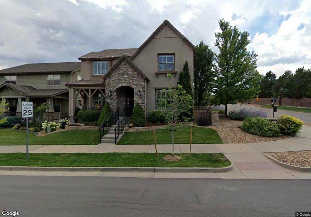
10177 Bluffmont Dr Lone Tree, CO 80124
Estimated Value: $1,183,000 - $1,311,000
3
Beds
3
Baths
3,522
Sq Ft
$348/Sq Ft
Est. Value
About This Home
This home is located at 10177 Bluffmont Dr, Lone Tree, CO 80124 and is currently estimated at $1,224,736, approximately $347 per square foot. 10177 Bluffmont Dr is a home located in Douglas County with nearby schools including Eagle Ridge Elementary School, Cresthill Middle School, and Highlands Ranch High School.
Ownership History
Date
Name
Owned For
Owner Type
Purchase Details
Closed on
Oct 31, 2025
Sold by
Savitsky Edmund and Savitsky Marian
Bought by
Edmund And Marian Savitsky Trust and Savitsky
Current Estimated Value
Purchase Details
Closed on
Aug 19, 2005
Sold by
Toll Co Lp
Bought by
Savitsky Edmund and Savitsky Marian
Home Financials for this Owner
Home Financials are based on the most recent Mortgage that was taken out on this home.
Original Mortgage
$330,000
Interest Rate
5.5%
Mortgage Type
Fannie Mae Freddie Mac
Purchase Details
Closed on
Apr 15, 2005
Sold by
Colony Investments Inc
Bought by
Toll Co Lp
Create a Home Valuation Report for This Property
The Home Valuation Report is an in-depth analysis detailing your home's value as well as a comparison with similar homes in the area
Home Values in the Area
Average Home Value in this Area
Purchase History
| Date | Buyer | Sale Price | Title Company |
|---|---|---|---|
| Edmund And Marian Savitsky Trust | -- | None Listed On Document | |
| Savitsky Edmund | $613,771 | Chicago Title Co | |
| Toll Co Lp | $74,500 | Chicago Title Co | |
| Toll Co Lp | $74,500 | -- |
Source: Public Records
Mortgage History
| Date | Status | Borrower | Loan Amount |
|---|---|---|---|
| Previous Owner | Savitsky Edmund | $330,000 |
Source: Public Records
Tax History
| Year | Tax Paid | Tax Assessment Tax Assessment Total Assessment is a certain percentage of the fair market value that is determined by local assessors to be the total taxable value of land and additions on the property. | Land | Improvement |
|---|---|---|---|---|
| 2025 | $9,823 | $74,810 | $12,980 | $61,830 |
| 2024 | $9,823 | $81,940 | $15,640 | $66,300 |
| 2023 | $9,891 | $81,940 | $15,640 | $66,300 |
| 2022 | $6,917 | $58,600 | $11,820 | $46,780 |
| 2021 | $7,147 | $58,600 | $11,820 | $46,780 |
| 2020 | $6,788 | $57,470 | $8,940 | $48,530 |
| 2019 | $6,803 | $57,470 | $8,940 | $48,530 |
| 2018 | $5,706 | $51,710 | $9,090 | $42,620 |
| 2017 | $6,700 | $51,710 | $9,090 | $42,620 |
| 2016 | $6,581 | $50,870 | $9,020 | $41,850 |
| 2015 | $3,341 | $50,870 | $9,020 | $41,850 |
| 2014 | $3,088 | $44,930 | $9,230 | $35,700 |
Source: Public Records
Map
Nearby Homes
- 10064 Bluffmont Ct
- 10205 Bluffmont Dr
- 9198 Ridgegate Pkwy
- 9227 Kornbrust Dr
- 10357 Bluffmont Dr
- 8561 Colonial Dr
- 10262 Greentrail Cir
- 10286 Greentrail Cir
- 10051 Belvedere Cir
- 10225 Bellwether Ln
- 9835 Firestone Cir
- 9873 Greensview Cir
- 9853 Greensview Cir
- 10091 Astoria Ct
- 7755 Barkway Ct
- 9594 Brook Hill Ln
- 9570 Brook Hill Ln
- 8555 Green Island Cir
- 9838 Cypress Point Cir
- 10560 Ladera Dr
- 10175 Bluffmont Dr
- 10173 Bluffmont Dr
- 10179 Bluffmont Dr
- 10181 Bluffmont Dr
- 10171 Bluffmont Dr
- 10085 Bluffmont Ct
- 10083 Bluffmont Ct
- 10083 Bluffmont Ct Unit 1008
- 10083 Bluffmont Ct Unit 121008
- 10142 Crooked Stick Trail
- 10185 Bluffmont Dr
- 10077 Bluffmont Ct
- 10079 Bluffmont Ct
- 10121 Crooked Stick Trail
- 10193 Bluffmont Dr
- 10075 Bluffmont Ct
- 10093 Bluffmont Ln
- 10164 Crooked Stick Trail
- 10089 Bluffmont Ln
- 10191 Bluffmont Dr
Your Personal Tour Guide
Ask me questions while you tour the home.