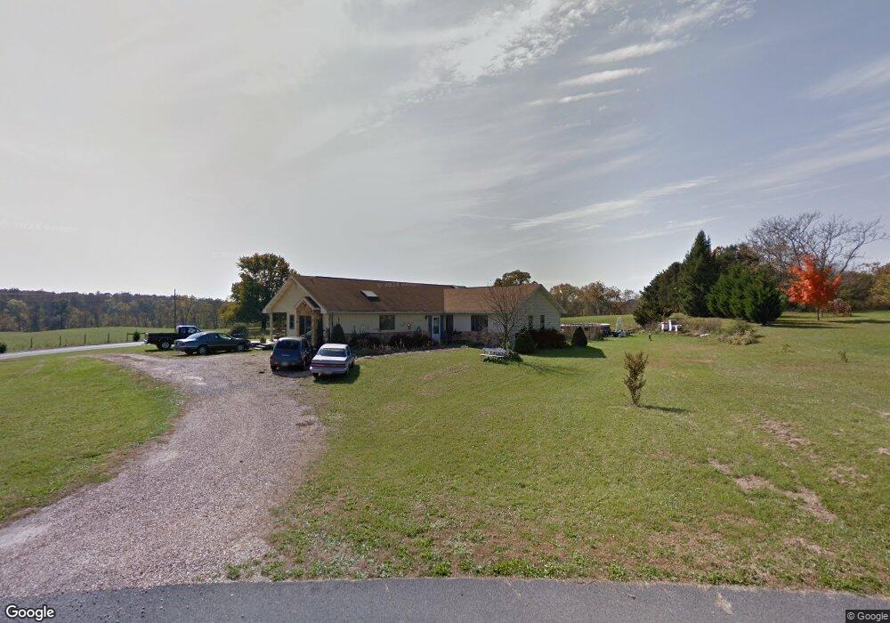
10178 Orenda Dr Greencastle, PA 17225
Estimated Value: $286,307 - $373,000
--
Bed
1
Bath
2,208
Sq Ft
$150/Sq Ft
Est. Value
About This Home
This home is located at 10178 Orenda Dr, Greencastle, PA 17225 and is currently estimated at $330,827, approximately $149 per square foot. 10178 Orenda Dr is a home located in Franklin County with nearby schools including Greencastle-Antrim Primary School, Greencastle-Antrim Elementary School, and Greencastle-Antrim Middle School.
Ownership History
Date
Name
Owned For
Owner Type
Purchase Details
Closed on
Dec 6, 2017
Sold by
Weller Vesta I
Bought by
Eyster Wanda R and Eyster Scott A
Current Estimated Value
Home Financials for this Owner
Home Financials are based on the most recent Mortgage that was taken out on this home.
Original Mortgage
$136,000
Outstanding Balance
$113,539
Interest Rate
3.62%
Mortgage Type
Adjustable Rate Mortgage/ARM
Estimated Equity
$217,288
Purchase Details
Closed on
Mar 18, 2014
Sold by
Kern Vesta
Bought by
Kern Vesta and Weller Vesta I
Create a Home Valuation Report for This Property
The Home Valuation Report is an in-depth analysis detailing your home's value as well as a comparison with similar homes in the area
Home Values in the Area
Average Home Value in this Area
Purchase History
| Date | Buyer | Sale Price | Title Company |
|---|---|---|---|
| Eyster Wanda R | $170,000 | None Available | |
| Kern Vesta | -- | None Available |
Source: Public Records
Mortgage History
| Date | Status | Borrower | Loan Amount |
|---|---|---|---|
| Open | Eyster Wanda R | $136,000 |
Source: Public Records
Tax History Compared to Growth
Tax History
| Year | Tax Paid | Tax Assessment Tax Assessment Total Assessment is a certain percentage of the fair market value that is determined by local assessors to be the total taxable value of land and additions on the property. | Land | Improvement |
|---|---|---|---|---|
| 2025 | $4,513 | $26,980 | $2,730 | $24,250 |
| 2024 | $4,095 | $26,980 | $2,730 | $24,250 |
| 2023 | $4,046 | $26,980 | $2,730 | $24,250 |
| 2022 | $4,046 | $26,980 | $2,730 | $24,250 |
| 2021 | $3,968 | $26,980 | $2,730 | $24,250 |
| 2020 | $3,865 | $26,980 | $2,730 | $24,250 |
| 2019 | $3,777 | $26,980 | $2,730 | $24,250 |
| 2018 | $3,736 | $26,980 | $2,730 | $24,250 |
| 2017 | $3,642 | $26,980 | $2,730 | $24,250 |
| 2016 | $773 | $26,980 | $2,730 | $24,250 |
| 2015 | $720 | $26,980 | $2,730 | $24,250 |
| 2014 | $720 | $26,980 | $2,730 | $24,250 |
Source: Public Records
Map
Nearby Homes
- 1256 Emilys Ct
- 9337 Lindale Ave
- 3632 Oakley Ln
- 3125 Buchanan Trail W
- 9705 Rabbit Rd S
- 3474 Harold Place
- 281 Toms Ln
- 707 Shook Ct W
- 5089 Buchanan Trail W
- 20 Helens Dr
- 11765 Melrose Ave
- 10937 Grant Shook Rd
- 10925 Grant Shook Rd
- 2384 Castlegreen Dr
- LOT 666B Maya Dr
- 7980 Golf Vista Dr
- 107 Makayla Dr
- 8140 Golf Vista Dr
- 112526 Delanie Dr
- 112521 Delanie Dr