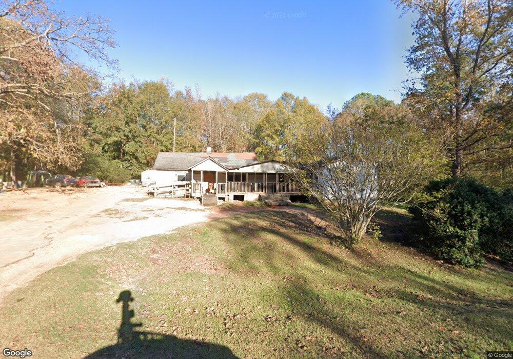
1018 Cannonville Rd Lagrange, GA 30240
Estimated Value: $97,544 - $248,000
3
Beds
2
Baths
2,083
Sq Ft
$87/Sq Ft
Est. Value
About This Home
This home is located at 1018 Cannonville Rd, Lagrange, GA 30240 and is currently estimated at $182,136, approximately $87 per square foot. 1018 Cannonville Rd is a home located in Troup County with nearby schools including Long Cane Elementary School, Whitesville Road Elementary School, and Berta Weathersbee Elementary School.
Ownership History
Date
Name
Owned For
Owner Type
Purchase Details
Closed on
Nov 12, 2024
Sold by
Brooks Jewell
Bought by
Brooks Jewell and Fields Dutchess
Current Estimated Value
Purchase Details
Closed on
Jul 12, 2010
Sold by
Brooks Carrie M
Bought by
Brooks Wanda
Purchase Details
Closed on
Nov 1, 1996
Sold by
Mattie Gilbert
Bought by
Brooks Carrie M
Purchase Details
Closed on
Jan 1, 1974
Bought by
Mattie Gilbert
Purchase Details
Closed on
Jan 1, 1958
Create a Home Valuation Report for This Property
The Home Valuation Report is an in-depth analysis detailing your home's value as well as a comparison with similar homes in the area
Home Values in the Area
Average Home Value in this Area
Purchase History
| Date | Buyer | Sale Price | Title Company |
|---|---|---|---|
| Brooks Jewell | -- | -- | |
| Brooks Wanda | -- | -- | |
| Brooks Carrie M | $3,000 | -- | |
| Mattie Gilbert | -- | -- | |
| -- | -- | -- |
Source: Public Records
Tax History Compared to Growth
Tax History
| Year | Tax Paid | Tax Assessment Tax Assessment Total Assessment is a certain percentage of the fair market value that is determined by local assessors to be the total taxable value of land and additions on the property. | Land | Improvement |
|---|---|---|---|---|
| 2024 | $75 | $17,444 | $5,000 | $12,444 |
| 2023 | $85 | $18,500 | $5,000 | $13,500 |
| 2022 | $83 | $17,740 | $5,000 | $12,740 |
| 2021 | $115 | $20,056 | $4,280 | $15,776 |
| 2020 | $304 | $20,056 | $4,280 | $15,776 |
| 2019 | $341 | $21,264 | $4,280 | $16,984 |
| 2018 | $294 | $19,712 | $4,280 | $15,432 |
| 2017 | $294 | $19,712 | $4,280 | $15,432 |
| 2016 | $601 | $19,939 | $4,288 | $15,652 |
| 2015 | $124 | $14,048 | $3,200 | $10,848 |
| 2014 | $121 | $13,944 | $3,200 | $10,744 |
| 2013 | -- | $13,838 | $3,200 | $10,638 |
Source: Public Records
Map
Nearby Homes
- 0 Robert Hayes Rd Unit 10611067
- 1248 Cannonville Rd
- 345 Robert Taylor Rd
- 0 Cannonville Rd
- 797 Gabbettville Rd
- 118 Woodstream Trail
- 5714 W Point Rd
- Sandtown Road Unit: 1 2+ - Acre
- 0 Sandtown Rd Unit 10255987
- 0 Hanson Dr Unit 10641272
- 22 Freeman Rd
- 275 Hanson Dr
- 648 Warner Rd
- 266 Glass Bridge Rd
- 288 Bradfield Dr
- 103 Hawthorne Cir
- 0 Lambert Rd
- 110 Hawthorne Cir
- 808 S Fling Rd
- 114 Westgate Dr
- 1017 Cannonville Rd
- 35 Tucker Cir
- 1064 Cannonville Rd
- 1073 Cannonville Rd
- 928 Cannonville Rd
- 1083 Cannonville Rd
- 959 Long Cane Rd
- 1093 Cannonville Rd
- 1086 Cannonville Rd
- 947 Long Cane Rd
- 98 Tucker Cir
- 955 Long Cane Rd
- 902 Cannonville Rd
- 88 Robert Taylor Rd
- 1103 Cannonville Rd
- 79 Robert Taylor Rd
- 114 Tucker Cir
- 96 Robert Taylor Rd
- 125 Tucker Cir
- 1144 Cannonville Rd