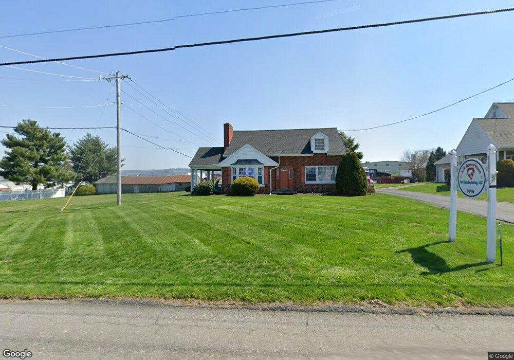
1018 E Main St New Holland, PA 17557
Estimated Value: $385,000 - $906,199
2
Beds
2
Baths
1,584
Sq Ft
$349/Sq Ft
Est. Value
About This Home
This home is located at 1018 E Main St, New Holland, PA 17557 and is currently estimated at $552,300, approximately $348 per square foot. 1018 E Main St is a home with nearby schools including Garden Spot Middle School, Garden Spot Senior High School, and Crossroads Mennonite School.
Ownership History
Date
Name
Owned For
Owner Type
Purchase Details
Closed on
Dec 29, 2016
Sold by
Stoltzfus Levi L and Stoltzfus Arianna
Bought by
Lantz Melvin F
Current Estimated Value
Home Financials for this Owner
Home Financials are based on the most recent Mortgage that was taken out on this home.
Original Mortgage
$380,000
Outstanding Balance
$311,533
Interest Rate
3.94%
Mortgage Type
Purchase Money Mortgage
Estimated Equity
$240,767
Purchase Details
Closed on
Nov 17, 2015
Sold by
Horst Sharon L and Horst David R
Bought by
Lantz Melvin F
Create a Home Valuation Report for This Property
The Home Valuation Report is an in-depth analysis detailing your home's value as well as a comparison with similar homes in the area
Home Values in the Area
Average Home Value in this Area
Purchase History
| Date | Buyer | Sale Price | Title Company |
|---|---|---|---|
| Lantz Melvin F | $475,000 | None Available | |
| Lantz Melvin F | $195,000 | Attorney |
Source: Public Records
Mortgage History
| Date | Status | Borrower | Loan Amount |
|---|---|---|---|
| Open | Lantz Melvin F | $380,000 |
Source: Public Records
Tax History Compared to Growth
Tax History
| Year | Tax Paid | Tax Assessment Tax Assessment Total Assessment is a certain percentage of the fair market value that is determined by local assessors to be the total taxable value of land and additions on the property. | Land | Improvement |
|---|---|---|---|---|
| 2025 | $3,913 | $218,500 | $53,500 | $165,000 |
| 2024 | $3,913 | $218,500 | $53,500 | $165,000 |
| 2023 | $3,857 | $218,500 | $53,500 | $165,000 |
| 2022 | $3,815 | $218,500 | $53,500 | $165,000 |
| 2021 | $2,990 | $174,000 | $53,500 | $120,500 |
| 2020 | $2,990 | $174,000 | $53,500 | $120,500 |
| 2019 | $2,957 | $174,000 | $53,500 | $120,500 |
| 2018 | $4,310 | $174,000 | $53,500 | $120,500 |
| 2017 | $2,938 | $141,100 | $30,300 | $110,800 |
| 2016 | $2,938 | $141,100 | $30,300 | $110,800 |
| 2015 | $816 | $141,100 | $30,300 | $110,800 |
| 2014 | $2,034 | $141,100 | $30,300 | $110,800 |
Source: Public Records
Map
Nearby Homes
- 210 Musser Rd
- 529 Ranck Rd Unit 1
- 529 Ranck Rd Unit 2
- 529 Ranck Rd Unit 3
- 529 Ranck Rd Unit 4
- 529 Ranck Rd Unit 5
- 529 Ranck Rd Unit 9
- 529 Ranck Rd Unit 6
- 529 Ranck Rd Unit 8
- 529 Ranck Rd Unit 10
- 4 Hearth Dr
- 1258 Main St
- 13 Amber Cir
- 391 E Jackson St
- 385 Valley View Dr
- 20 N Kinzer Ave
- 406 Brimmer Ave
- 148 E Broad St
- 144 W Conestoga St
- 227 Locust St