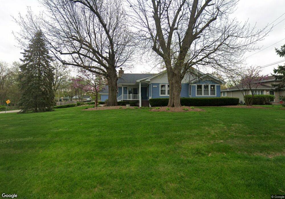
1018 N Cedar Rd New Lenox, IL 60451
Estimated Value: $353,509 - $377,000
--
Bed
--
Bath
--
Sq Ft
0.45
Acres
About This Home
This home is located at 1018 N Cedar Rd, New Lenox, IL 60451 and is currently estimated at $366,127. 1018 N Cedar Rd is a home located in Will County with nearby schools including Oster-Oakview School, Haines Elementary School, and Lincoln Way West.
Ownership History
Date
Name
Owned For
Owner Type
Purchase Details
Closed on
May 25, 2023
Sold by
Carey Susan
Bought by
Susan Carey Trust
Current Estimated Value
Purchase Details
Closed on
Oct 21, 1997
Sold by
Fouts Kenneth and Fouts Veronica
Bought by
Carey Susan
Home Financials for this Owner
Home Financials are based on the most recent Mortgage that was taken out on this home.
Original Mortgage
$95,625
Interest Rate
7.37%
Create a Home Valuation Report for This Property
The Home Valuation Report is an in-depth analysis detailing your home's value as well as a comparison with similar homes in the area
Home Values in the Area
Average Home Value in this Area
Purchase History
| Date | Buyer | Sale Price | Title Company |
|---|---|---|---|
| Susan Carey Trust | -- | None Listed On Document | |
| Carey Susan | $112,000 | -- |
Source: Public Records
Mortgage History
| Date | Status | Borrower | Loan Amount |
|---|---|---|---|
| Previous Owner | Carey Susan | $95,625 |
Source: Public Records
Tax History Compared to Growth
Tax History
| Year | Tax Paid | Tax Assessment Tax Assessment Total Assessment is a certain percentage of the fair market value that is determined by local assessors to be the total taxable value of land and additions on the property. | Land | Improvement |
|---|---|---|---|---|
| 2024 | $8,571 | $113,617 | $32,729 | $80,888 |
| 2023 | $8,571 | $103,571 | $29,835 | $73,736 |
| 2022 | $7,737 | $95,413 | $27,485 | $67,928 |
| 2021 | $7,338 | $89,733 | $25,849 | $63,884 |
| 2020 | $7,126 | $86,532 | $24,927 | $61,605 |
| 2019 | $6,817 | $83,849 | $24,154 | $59,695 |
| 2018 | $6,656 | $80,959 | $23,321 | $57,638 |
| 2017 | $6,322 | $78,632 | $22,651 | $55,981 |
| 2016 | $6,134 | $76,528 | $22,045 | $54,483 |
| 2015 | $4,336 | $74,119 | $21,351 | $52,768 |
| 2014 | $4,336 | $55,316 | $21,087 | $34,229 |
| 2013 | $4,336 | $56,061 | $21,371 | $34,690 |
Source: Public Records
Map
Nearby Homes
- 125 Kimber Dr
- 203 Fir St
- 217 Aspen Dr
- 224 Hauser Ct
- 1231 Town Crest Dr Unit E
- 133 Barbara Ln
- 202 Hickory St
- 331 Old Hickory Rd
- 338 Willow St
- 1344 N Cedar Rd
- 200 Redwood Ave
- 208 Redwood Ave
- 807 Picardy Place
- 416 Manor Ct Unit B
- 328 E Lincoln Hwy
- 315 S Pine St
- 574 Prairie Crossing Dr
- 00 NE Corner Cherry Hill Road and Moss Lane Rd
- Vacant W Maple St
- 1261 S Regan Rd
- 1012 N Cedar Rd
- 120 Gall Ln
- 1006 N Cedar Rd
- 1040 N Cedar Rd
- 108 E Wood St
- 117 Hawthorne Ln
- 114 E Wood St
- 122 Gall Ln
- 105 Forest St
- 1017 N Cedar Rd
- 1019 N Cedar Rd
- 121 Hawthorne Ln
- 917 N Cedar Rd
- 120 E Wood St
- 913 N Cedar Rd
- 128 W Wood St
- 102 Hawthorne Ln
- 127 Hawthorne Ln
- 106 Hawthorne Ln
- 124 Gall Ln