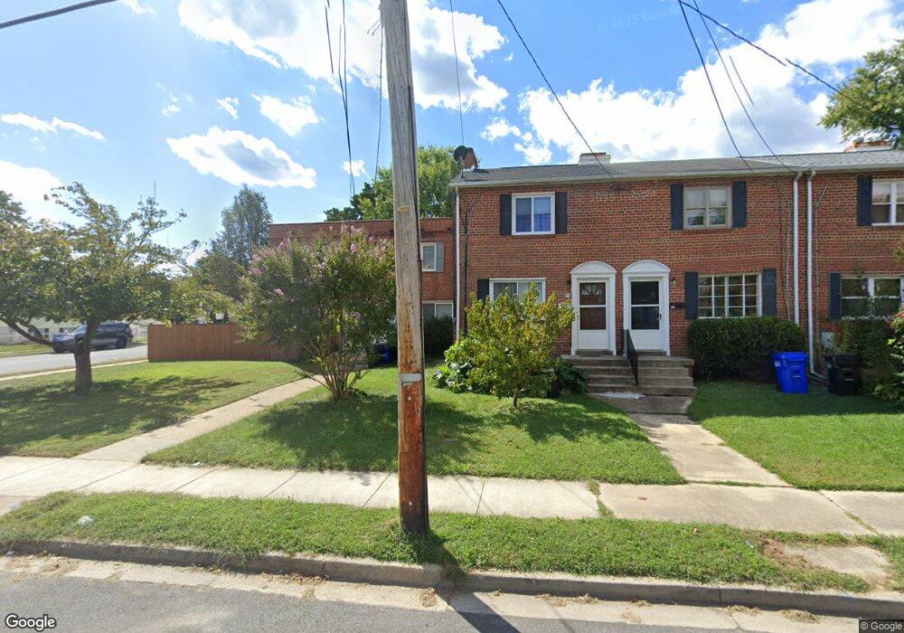
1018 Philip Powers Dr Laurel, MD 20707
Estimated Value: $291,471 - $331,000
--
Bed
1
Bath
800
Sq Ft
$387/Sq Ft
Est. Value
About This Home
This home is located at 1018 Philip Powers Dr, Laurel, MD 20707 and is currently estimated at $309,368, approximately $386 per square foot. 1018 Philip Powers Dr is a home located in Prince George's County with nearby schools including Laurel Elementary School, Dwight D. Eisenhower Middle School, and Laurel High School.
Ownership History
Date
Name
Owned For
Owner Type
Purchase Details
Closed on
Jun 26, 2006
Sold by
Perez Anibal E
Bought by
Hernandez Mario
Current Estimated Value
Home Financials for this Owner
Home Financials are based on the most recent Mortgage that was taken out on this home.
Original Mortgage
$52,000
Interest Rate
6.62%
Mortgage Type
Stand Alone Second
Purchase Details
Closed on
May 23, 2006
Sold by
Perez Anibal E
Bought by
Hernandez Mario
Home Financials for this Owner
Home Financials are based on the most recent Mortgage that was taken out on this home.
Original Mortgage
$52,000
Interest Rate
6.62%
Mortgage Type
Stand Alone Second
Purchase Details
Closed on
Feb 9, 2004
Sold by
Haley Jean E
Bought by
Perez Anibal E
Create a Home Valuation Report for This Property
The Home Valuation Report is an in-depth analysis detailing your home's value as well as a comparison with similar homes in the area
Home Values in the Area
Average Home Value in this Area
Purchase History
| Date | Buyer | Sale Price | Title Company |
|---|---|---|---|
| Hernandez Mario | $260,000 | -- | |
| Hernandez Mario | $260,000 | -- | |
| Perez Anibal E | $125,000 | -- |
Source: Public Records
Mortgage History
| Date | Status | Borrower | Loan Amount |
|---|---|---|---|
| Closed | Hernandez Mario | $52,000 | |
| Open | Hernandez Mario | $208,000 | |
| Closed | Hernandez Mario | $208,000 |
Source: Public Records
Tax History Compared to Growth
Tax History
| Year | Tax Paid | Tax Assessment Tax Assessment Total Assessment is a certain percentage of the fair market value that is determined by local assessors to be the total taxable value of land and additions on the property. | Land | Improvement |
|---|---|---|---|---|
| 2025 | $1,713 | $246,200 | $90,000 | $156,200 |
| 2024 | $1,713 | $231,700 | $0 | $0 |
| 2023 | $577 | $217,200 | $0 | $0 |
| 2022 | $1,525 | $202,700 | $75,000 | $127,700 |
| 2021 | $822 | $192,633 | $0 | $0 |
| 2020 | $1,064 | $182,567 | $0 | $0 |
| 2019 | $2,867 | $172,500 | $75,000 | $97,500 |
| 2018 | $2,773 | $165,867 | $0 | $0 |
| 2017 | $2,693 | $159,233 | $0 | $0 |
| 2016 | -- | $152,600 | $0 | $0 |
| 2015 | $2,255 | $149,167 | $0 | $0 |
| 2014 | $2,255 | $145,733 | $0 | $0 |
Source: Public Records
Map
Nearby Homes
- 1016 Phillip Powers Dr
- 1210 Westview Terrace
- 1103 Montgomery St
- 200 1/2 11th St
- 612 9th St
- 211 Patuxent Rd
- 903 Montrose Ave
- 1009 Turney Ave
- 9420 Fairview Ave
- 1004 Marton St
- 610 Main St Unit 413
- 1000 8th St
- 9401 Riverbrink Ct
- 7709 Brooklyn Bridge Rd
- 16035 Dorset Rd
- 19 Post Office Ave Unit 203
- 413 Montgomery St
- 8218 Londonderry Ct
- 9351 Cabot Ct
- 9260 Old Scaggsville Rd
- 1020 Philip Powers Dr
- 1016 Philip Powers Dr
- 1022 Philip Powers Dr
- 1014 Philip Powers Dr
- 1024 Philip Powers Dr
- 1026 Philip Powers Dr
- 1028 Philip Powers Dr
- 1030 Philip Powers Dr
- 1032 Philip Powers Dr
- 1019 Philip Powers Dr
- 1021 Philip Powers Dr
- 920 Philip Powers Dr
- 1017 Philip Powers Dr
- 1023 Philip Powers Dr
- 1015 Philip Powers Dr
- 1025 Philip Powers Dr
- 1013 Philip Powers Dr
- 1011 Philip Powers Dr
- 926 Park Ave
- 1029 Philip Powers Dr