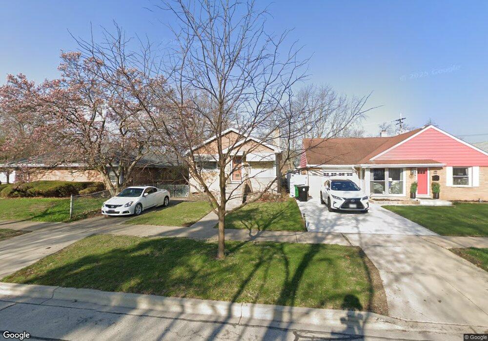
1018 Portsmouth Ave Westchester, IL 60154
Estimated Value: $295,000 - $310,000
3
Beds
2
Baths
1,094
Sq Ft
$276/Sq Ft
Est. Value
About This Home
This home is located at 1018 Portsmouth Ave, Westchester, IL 60154 and is currently estimated at $301,828, approximately $275 per square foot. 1018 Portsmouth Ave is a home located in Cook County with nearby schools including Westchester Primary School, Westchester Intermediate School, and Westchester Middle School.
Ownership History
Date
Name
Owned For
Owner Type
Purchase Details
Closed on
Oct 18, 2005
Sold by
Gayles Angela
Bought by
Owens Julius and Owens Kathryn
Current Estimated Value
Home Financials for this Owner
Home Financials are based on the most recent Mortgage that was taken out on this home.
Original Mortgage
$192,150
Outstanding Balance
$103,689
Interest Rate
5.89%
Mortgage Type
Fannie Mae Freddie Mac
Estimated Equity
$198,139
Purchase Details
Closed on
Oct 17, 2003
Sold by
Stockholm Jon A
Bought by
Gayles Angela
Home Financials for this Owner
Home Financials are based on the most recent Mortgage that was taken out on this home.
Original Mortgage
$229,000
Interest Rate
6.01%
Mortgage Type
Unknown
Create a Home Valuation Report for This Property
The Home Valuation Report is an in-depth analysis detailing your home's value as well as a comparison with similar homes in the area
Home Values in the Area
Average Home Value in this Area
Purchase History
| Date | Buyer | Sale Price | Title Company |
|---|---|---|---|
| Owens Julius | $213,500 | Atg Search | |
| Gayles Angela | $229,000 | Prairie Title |
Source: Public Records
Mortgage History
| Date | Status | Borrower | Loan Amount |
|---|---|---|---|
| Open | Owens Julius | $192,150 | |
| Previous Owner | Gayles Angela | $229,000 |
Source: Public Records
Tax History Compared to Growth
Tax History
| Year | Tax Paid | Tax Assessment Tax Assessment Total Assessment is a certain percentage of the fair market value that is determined by local assessors to be the total taxable value of land and additions on the property. | Land | Improvement |
|---|---|---|---|---|
| 2024 | $5,166 | $23,000 | $2,756 | $20,244 |
| 2023 | $4,377 | $23,000 | $2,756 | $20,244 |
| 2022 | $4,377 | $17,767 | $2,426 | $15,341 |
| 2021 | $4,263 | $17,766 | $2,425 | $15,341 |
| 2020 | $4,231 | $17,766 | $2,425 | $15,341 |
| 2019 | $3,661 | $16,389 | $2,205 | $14,184 |
| 2018 | $3,612 | $16,389 | $2,205 | $14,184 |
| 2017 | $3,559 | $16,389 | $2,205 | $14,184 |
| 2016 | $3,170 | $13,367 | $1,984 | $11,383 |
| 2015 | $3,093 | $13,367 | $1,984 | $11,383 |
| 2014 | $3,037 | $13,367 | $1,984 | $11,383 |
| 2013 | $3,603 | $16,962 | $1,984 | $14,978 |
Source: Public Records
Map
Nearby Homes
- 920 Suffolk Ave
- 1119 Newcastle Ave
- 814 Norfolk Ave
- 805 Norfolk Ave
- 923 Manchester Ave
- 10072 Drury Ln
- 750 Bristol Ave
- 723 Balmoral Ave
- 626 Manchester Ave
- 1136 Park Place
- 1108 31st Ave
- 1102 31st Ave
- 1035 Bohland Ave
- 1247 S Mannheim Rd Unit 3
- 1023 Rice Ave
- 1102 Marshall Ave
- 1022 Eastern Ave
- 1034 31st Ave
- 1013 Bellwood Ave
- 3401 Jackson St
- 1014 Portsmouth Ave
- 10040 Devonshire St
- 1010 Portsmouth Ave
- 1023 Newcastle Ave
- 1004 Portsmouth Ave
- 1011 Newcastle Ave
- 1025 Newcastle Ave
- 1100 Portsmouth Ave
- 1009 Newcastle Ave
- 1000 Portsmouth Ave
- 1023 Portsmouth Ave
- 1013 Portsmouth Ave
- 10020 Devonshire St
- 1003 Newcastle Ave
- 1108 Portsmouth Ave
- 1103 Newcastle Ave
- 1007 Portsmouth Ave
- 926 Portsmouth Ave
- 1101 Portsmouth Ave
- 1003 Portsmouth Ave