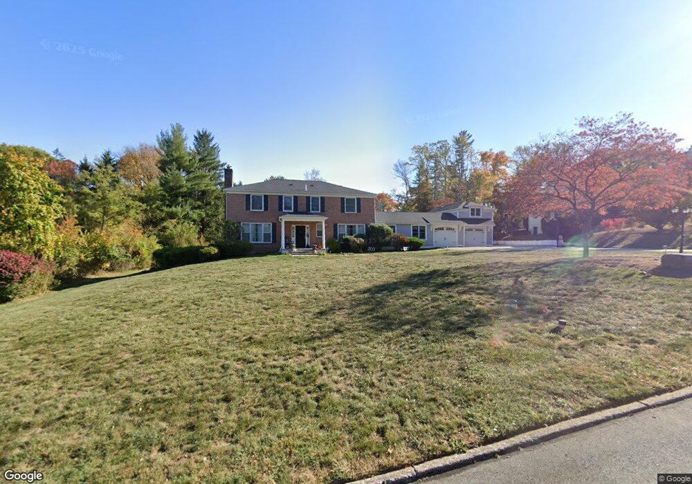
1018 Tenby Rd Berwyn, PA 19312
Estimated Value: $1,301,000 - $1,516,000
4
Beds
3
Baths
3,190
Sq Ft
$443/Sq Ft
Est. Value
About This Home
This home is located at 1018 Tenby Rd, Berwyn, PA 19312 and is currently estimated at $1,414,211, approximately $443 per square foot. 1018 Tenby Rd is a home located in Chester County with nearby schools including Beaumont Elementary School, Tredyffrin-Easttown Middle School, and Conestoga Senior High School.
Ownership History
Date
Name
Owned For
Owner Type
Purchase Details
Closed on
Jul 29, 2011
Sold by
Guo Binbin and Hu Yahong R
Bought by
Kelly Sean Patrick and Kelly Tara L
Current Estimated Value
Purchase Details
Closed on
Sep 11, 2008
Sold by
Hastings Robert Taylor
Bought by
Guo Binbin and Hu Yahong R
Home Financials for this Owner
Home Financials are based on the most recent Mortgage that was taken out on this home.
Original Mortgage
$399,000
Interest Rate
5.25%
Mortgage Type
Purchase Money Mortgage
Create a Home Valuation Report for This Property
The Home Valuation Report is an in-depth analysis detailing your home's value as well as a comparison with similar homes in the area
Home Values in the Area
Average Home Value in this Area
Purchase History
| Date | Buyer | Sale Price | Title Company |
|---|---|---|---|
| Kelly Sean Patrick | $655,000 | None Available | |
| Guo Binbin | $636,000 | None Available |
Source: Public Records
Mortgage History
| Date | Status | Borrower | Loan Amount |
|---|---|---|---|
| Previous Owner | Guo Binbin | $399,000 |
Source: Public Records
Tax History Compared to Growth
Tax History
| Year | Tax Paid | Tax Assessment Tax Assessment Total Assessment is a certain percentage of the fair market value that is determined by local assessors to be the total taxable value of land and additions on the property. | Land | Improvement |
|---|---|---|---|---|
| 2025 | $12,951 | $347,210 | $83,180 | $264,030 |
| 2024 | $12,951 | $347,210 | $83,180 | $264,030 |
| 2023 | $12,109 | $347,210 | $83,180 | $264,030 |
| 2022 | $11,778 | $347,210 | $83,180 | $264,030 |
| 2021 | $11,522 | $347,210 | $83,180 | $264,030 |
| 2020 | $11,202 | $347,210 | $83,180 | $264,030 |
| 2019 | $10,119 | $322,630 | $83,180 | $239,450 |
| 2018 | $9,944 | $322,630 | $83,180 | $239,450 |
| 2017 | $9,719 | $322,630 | $83,180 | $239,450 |
| 2016 | -- | $322,630 | $83,180 | $239,450 |
| 2015 | -- | $322,630 | $83,180 | $239,450 |
| 2014 | -- | $322,630 | $83,180 | $239,450 |
Source: Public Records
Map
Nearby Homes
- 709 Newtown Rd
- 837 Nathan Hale Rd
- 1179 Beaumont Rd
- 191 Stony Point Dr
- 206 Yorktown Place Unit 106
- 718 Lot 1 Waterloo
- 0 Prescott Rd Unit PACT2110528
- 1052 Prescott Rd
- 6 Wingstone Ln
- 659 Andover Rd
- 641 Andover Rd
- 422 S Waterloo Rd
- 600 Waynesfield Dr
- 520 Hawthorne Place
- 201 Church Rd
- 404 Dorset Rd
- 120 S Devon Ave
- 119 Waterloo Ave
- 91 Central Ave
- 650 Augusta Ct