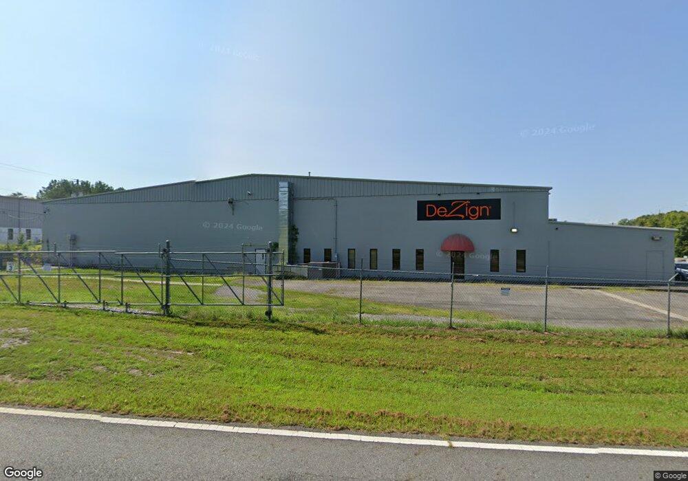
1018 Vista Dr Dalton, GA 30721
--
Bed
2
Baths
2,700
Sq Ft
2,178
Sq Ft Lot
About This Home
This home is located at 1018 Vista Dr, Dalton, GA 30721. 1018 Vista Dr is a home located in Whitfield County with nearby schools including Park Creek Elementary School, Dalton Middle School, and Dalton High School.
Ownership History
Date
Name
Owned For
Owner Type
Purchase Details
Closed on
Mar 23, 2020
Sold by
Cofield Charles D
Bought by
Cofield Family Lllp
Purchase Details
Closed on
Sep 11, 2018
Sold by
Ashland Specialty Ingredients Gp
Bought by
Cofield Charles D and Cofield Bernita P
Home Financials for this Owner
Home Financials are based on the most recent Mortgage that was taken out on this home.
Original Mortgage
$1,122,000
Interest Rate
4.5%
Mortgage Type
Commercial
Purchase Details
Closed on
Jan 12, 2006
Sold by
Terramark L P
Bought by
Aqualon Co
Purchase Details
Closed on
Jan 15, 2002
Sold by
Whitfield Limited Partnership
Bought by
Terramark Lp
Purchase Details
Closed on
Nov 1, 1999
Bought by
Whitfield Limited Partnership
Create a Home Valuation Report for This Property
The Home Valuation Report is an in-depth analysis detailing your home's value as well as a comparison with similar homes in the area
Home Values in the Area
Average Home Value in this Area
Purchase History
| Date | Buyer | Sale Price | Title Company |
|---|---|---|---|
| Cofield Family Lllp | -- | -- | |
| Cofield Charles D | $885,500 | -- | |
| Aqualon Co | $1,009,848 | -- | |
| Terramark Lp | $750,000 | -- | |
| Whitfield Limited Partnership | $736,000 | -- |
Source: Public Records
Mortgage History
| Date | Status | Borrower | Loan Amount |
|---|---|---|---|
| Previous Owner | Cofield Charles D | $1,122,000 |
Source: Public Records
Tax History Compared to Growth
Tax History
| Year | Tax Paid | Tax Assessment Tax Assessment Total Assessment is a certain percentage of the fair market value that is determined by local assessors to be the total taxable value of land and additions on the property. | Land | Improvement |
|---|---|---|---|---|
| 2024 | $12,530 | $391,675 | $47,200 | $344,475 |
| 2023 | $16,304 | $473,375 | $40,120 | $433,255 |
| 2022 | $10,076 | $292,558 | $40,120 | $252,438 |
| 2021 | $10,092 | $292,558 | $40,120 | $252,438 |
| 2020 | $10,482 | $292,558 | $40,120 | $252,438 |
| 2019 | $4,193 | $113,496 | $40,120 | $73,376 |
| 2018 | $12,577 | $335,392 | $40,120 | $295,272 |
| 2017 | $12,106 | $335,392 | $40,120 | $295,272 |
| 2016 | $12,183 | $335,392 | $40,120 | $295,272 |
| 2014 | $11,069 | $335,392 | $40,120 | $295,272 |
| 2013 | -- | $304,324 | $40,120 | $264,204 |
Source: Public Records
Map
Nearby Homes
- 108 Avis Dr
- 413 Gillum Dr
- 1493 Hale Bowen Dr
- 0 Smith Industrial Blvd
- 117 Connie Dr
- 2100 Cleveland Hwy
- 1713 Brighton Way
- 1696 Red Oak Dr Unit 184
- 1696 Red Oak Dr
- 1696 Red Oak Dr Unit 181
- 2117 Cleveland Hwy
- 1730 Brighton Way
- 1326 Veterans Dr
- 2201 Cleveland Hwy
- 1600 Puryear Dr NW
- 1411 Classic Chase Dr
- 1699 Burnt Oak Dr Unit 195
- 1699 Burnt Oak Dr
- 1699 Pin Oak Dr Unit 133
- 1702 Chestnut Oak Dr
- 1022 Vista Dr
- 1030 Vista Dr
- 1016 Vista Dr
- 1502 Bentgrass Ln
- 1502 Bentgrass Ln
- 1502 Bentgrass Ln
- 1502 Bentgrass Ln
- 1502 Bentgrass Ln
- 1502 Bentgrass Ln
- 1502 Bentgrass Ln Unit 3
- 1502 4 Bentgrass Ln Unit 4
- 1502 4 Bentgrass Ln
- 1501-5 Bentgrass Ln
- 1501-4 Bentgrass Ln
- 1501 Bentgrass Ln Unit 3
- 1501 Bentgrass Ln Unit 6
- 1501 Bentgrass Ln Unit 5
- 1501 Bentgrass Ln Unit 4
- 1501 Bentgrass Ln Unit 3
- 1501 Bentgrass Ln Unit 2