Estimated Value: $825,000 - $1,053,535
6
Beds
3
Baths
4,133
Sq Ft
$225/Sq Ft
Est. Value
About This Home
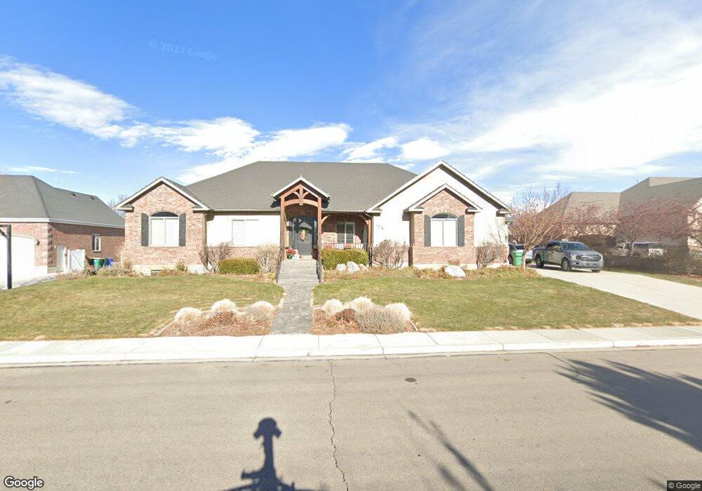
This home is located at 1018 W 430 N, Lehi, UT 84043 and is currently estimated at $931,134, approximately $225 per square foot. 1018 W 430 N is a home located in Utah County with nearby schools including Lehi Elementary School, Lehi Junior High School, and Lehi High School.
Ownership History
Date
Name
Owned For
Owner Type
Purchase Details
Closed on
Oct 2, 2019
Sold by
Cole Alex S and Cole Amy S
Bought by
Adamson Greg and Adamson Crystal D
Current Estimated Value
Home Financials for this Owner
Home Financials are based on the most recent Mortgage that was taken out on this home.
Original Mortgage
$484,350
Outstanding Balance
$424,315
Interest Rate
3.5%
Mortgage Type
New Conventional
Estimated Equity
$506,819
Purchase Details
Closed on
Feb 27, 2013
Sold by
Pilling Christopher and Melissa Pilling A
Bought by
Cole Alex S and Jones Amy S
Home Financials for this Owner
Home Financials are based on the most recent Mortgage that was taken out on this home.
Original Mortgage
$417,000
Interest Rate
3.34%
Mortgage Type
New Conventional
Purchase Details
Closed on
Apr 4, 2006
Sold by
Pilling Joel D
Bought by
Pilling Christopher and Melissa Pilling A
Home Financials for this Owner
Home Financials are based on the most recent Mortgage that was taken out on this home.
Original Mortgage
$82,000
Interest Rate
6.04%
Mortgage Type
New Conventional
Purchase Details
Closed on
Mar 1, 2006
Sold by
Pilling Christopher and Melissa Pilling A
Bought by
Pilling Christopher and Pilling Melissa
Home Financials for this Owner
Home Financials are based on the most recent Mortgage that was taken out on this home.
Original Mortgage
$82,000
Interest Rate
6.04%
Mortgage Type
New Conventional
Create a Home Valuation Report for This Property
The Home Valuation Report is an in-depth analysis detailing your home's value as well as a comparison with similar homes in the area
Home Values in the Area
Average Home Value in this Area
Purchase History
| Date | Buyer | Sale Price | Title Company |
|---|---|---|---|
| Adamson Greg | -- | Utah First Title Ins Agcy | |
| Cole Alex S | -- | None Available | |
| Pilling Christopher | -- | Accommodation | |
| Pilling Christopher | -- | First American Title Insuran |
Source: Public Records
Mortgage History
| Date | Status | Borrower | Loan Amount |
|---|---|---|---|
| Open | Adamson Greg | $484,350 | |
| Previous Owner | Cole Alex S | $417,000 | |
| Previous Owner | Pilling Christopher | $82,000 |
Source: Public Records
Tax History Compared to Growth
Tax History
| Year | Tax Paid | Tax Assessment Tax Assessment Total Assessment is a certain percentage of the fair market value that is determined by local assessors to be the total taxable value of land and additions on the property. | Land | Improvement |
|---|---|---|---|---|
| 2025 | $4,219 | $537,020 | $330,400 | $646,000 |
| 2024 | $4,219 | $493,680 | $0 | $0 |
| 2023 | $4,006 | $508,970 | $0 | $0 |
| 2022 | $4,181 | $515,075 | $0 | $0 |
| 2021 | $3,786 | $705,100 | $191,200 | $513,900 |
| 2020 | $3,571 | $657,300 | $177,000 | $480,300 |
| 2019 | $2,682 | $513,300 | $177,000 | $336,300 |
| 2018 | $2,605 | $471,200 | $151,700 | $319,500 |
| 2017 | $2,646 | $254,540 | $0 | $0 |
| 2016 | $2,736 | $244,145 | $0 | $0 |
| 2015 | $2,772 | $234,795 | $0 | $0 |
| 2014 | $2,417 | $203,500 | $0 | $0 |
Source: Public Records
Map
Nearby Homes
- 578 N Woods Dr
- 1035 W Main St
- 975 W 125 S
- 953 W 125 S
- 1031 W 125 St S
- 1215 W 125 S
- 443 W 820 N
- 485 W Main St
- 285 S 660 W
- 161 S 1475 W
- 1032 Titan Dr
- 1012 W 425 S Unit 5
- 1012 W 425 S
- 255 W 100 N
- 374 S 1330 West St
- 1132 Titan Dr
- 1356 W 425 S
- 143 W 300 N
- 1301 N 900 W Unit 12
- The Annie Plan at Longhorn Meadows
- 1036 W 430 N
- 998 W 430 N
- 1017 W 550 N
- 413 N 1000 W
- 413 N 1000 W Unit 19
- 1031 W 550 N
- 524 N 960 W
- 1052 W 430 N
- 993 W 550 N Unit 52
- 977 W 550 N Unit 51
- 418 N 1060 W
- 418 N 1060 W Unit 18
- 412 N 1000 W
- 412 N 1000 W Unit 29
- 414 N 1000 W
- 971 W 550 N
- 393 N 1000 W
- 393 N 1000 W Unit 20
- 961 W 525 N
- 1012 W 550 N