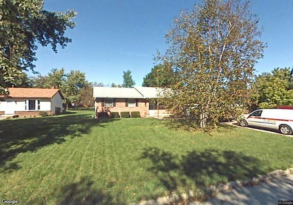
1018 W Erie St Woodville, OH 43469
Estimated Value: $170,000 - $203,000
3
Beds
2
Baths
1,220
Sq Ft
$158/Sq Ft
Est. Value
About This Home
This home is located at 1018 W Erie St, Woodville, OH 43469 and is currently estimated at $192,842, approximately $158 per square foot. 1018 W Erie St is a home located in Sandusky County with nearby schools including Woodmore Elementary School, Woodmore Middle School, and Solomon Lutheran School.
Ownership History
Date
Name
Owned For
Owner Type
Purchase Details
Closed on
Aug 1, 2022
Sold by
All Wardt Keith William
Bought by
Keith Allwardt Trust
Current Estimated Value
Purchase Details
Closed on
Aug 11, 1994
Sold by
Allwardt Theodore M
Bought by
Allwardt Keith W
Purchase Details
Closed on
Sep 1, 1992
Sold by
Allwardt Keith William
Bought by
Allwardt Keith William
Purchase Details
Closed on
Jul 1, 1985
Bought by
Allwardt Keith William
Create a Home Valuation Report for This Property
The Home Valuation Report is an in-depth analysis detailing your home's value as well as a comparison with similar homes in the area
Home Values in the Area
Average Home Value in this Area
Purchase History
| Date | Buyer | Sale Price | Title Company |
|---|---|---|---|
| Keith Allwardt Trust | -- | -- | |
| Keith Allwardt Trust | -- | None Listed On Document | |
| Allwardt Keith W | $75,000 | -- | |
| Allwardt Keith William | -- | -- | |
| Allwardt Keith William | -- | -- |
Source: Public Records
Tax History Compared to Growth
Tax History
| Year | Tax Paid | Tax Assessment Tax Assessment Total Assessment is a certain percentage of the fair market value that is determined by local assessors to be the total taxable value of land and additions on the property. | Land | Improvement |
|---|---|---|---|---|
| 2024 | $2,188 | $46,340 | $9,800 | $36,540 |
| 2023 | $2,332 | $37,700 | $7,980 | $29,720 |
| 2022 | $2,198 | $37,700 | $7,980 | $29,720 |
| 2021 | $2,209 | $37,700 | $7,980 | $29,720 |
| 2020 | $2,191 | $35,740 | $7,980 | $27,760 |
| 2019 | $2,192 | $35,740 | $7,980 | $27,760 |
| 2018 | $2,201 | $35,740 | $7,980 | $27,760 |
| 2017 | $2,097 | $33,220 | $7,980 | $25,240 |
| 2016 | $2,034 | $33,220 | $7,980 | $25,240 |
| 2015 | $2,035 | $33,220 | $7,980 | $25,240 |
| 2014 | $2,097 | $32,620 | $7,630 | $24,990 |
| 2013 | $2,127 | $32,620 | $7,630 | $24,990 |
Source: Public Records
Map
Nearby Homes
- 571 Parklane Dr
- 421 Parklane Dr
- 739 Riverside Dr
- 612 W Main St
- 219 Lime St
- 212 S Perry St
- 415 Fort Findlay Rd
- 110 E 1st St
- 712 Lueke Ave Unit 572 p
- 20180 Us Highway 23
- 20240 W Portage River South Rd
- 0 Recker Rd
- 2067 Devils Hole Rd
- 0 Pemberville Rd
- 1936 County Road 32
- 3291 Middleton Pike
- 510 Wilson St
- 416 Castle Cove
- 514 West St
- 19383 Courtland Ave
- 1026 W Erie St
- 1010 W Erie St
- 1017 W College Ave
- 1019 W College Ave
- 1011 W College Ave
- 1002 W Erie St
- 1075 W Erie St
- 1035 W Erie St
- 1005 W College Ave
- 310 Hartman St
- 215 Hartman St
- 504 Woodpointe Dr
- 402 Woodpointe Dr
- 506 Woodpointe Dr
- 325 W Riverview Dr
- 1012 W College Ave Unit 10
- 205 Hartman St
- 1020 W College Ave Unit 10
- 1010 W College Ave