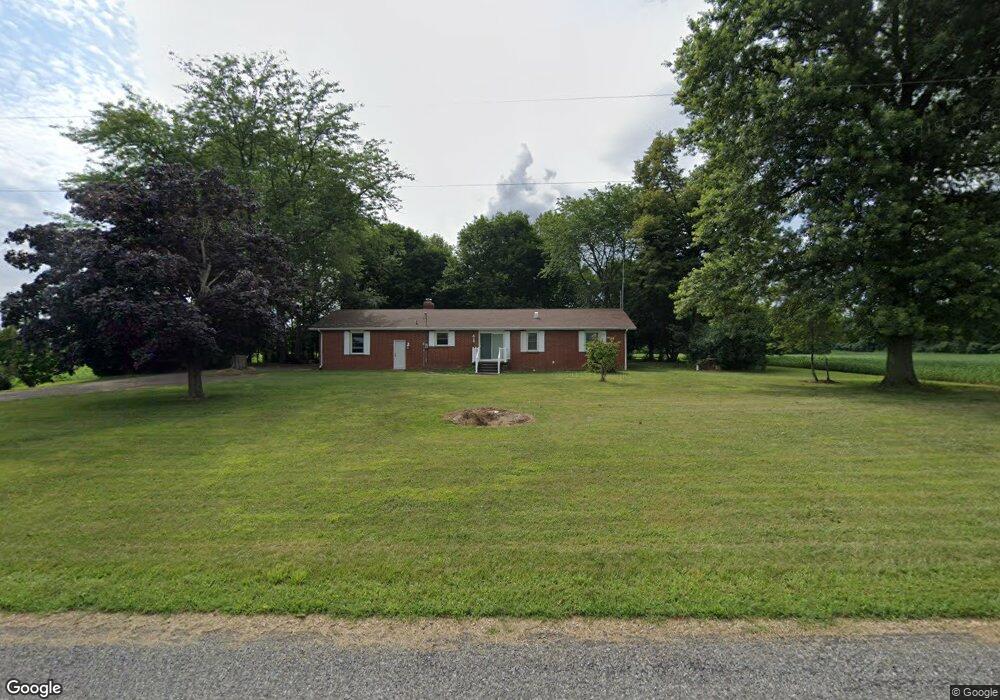
10180 Jones Rd Berrien Center, MI 49102
Estimated Value: $188,000 - $309,000
3
Beds
1
Bath
1,664
Sq Ft
$156/Sq Ft
Est. Value
About This Home
This home is located at 10180 Jones Rd, Berrien Center, MI 49102 and is currently estimated at $259,954, approximately $156 per square foot. 10180 Jones Rd is a home located in Berrien County with nearby schools including Mars Elementary School, Sylvester Elementary School, and Berrien Springs Middle School.
Ownership History
Date
Name
Owned For
Owner Type
Purchase Details
Closed on
Jul 13, 2015
Sold by
Toney Charles R
Bought by
Simpson Clifford
Current Estimated Value
Home Financials for this Owner
Home Financials are based on the most recent Mortgage that was taken out on this home.
Original Mortgage
$66,000
Outstanding Balance
$51,409
Interest Rate
3.83%
Mortgage Type
Seller Take Back
Estimated Equity
$208,545
Purchase Details
Closed on
Jul 31, 2012
Sold by
Toney Charles R and Gorski Ruth A
Bought by
Toney Charles R
Purchase Details
Closed on
Jan 28, 2012
Sold by
Toney Charles R
Bought by
Toney Charles R and Gorski Ruth A
Purchase Details
Closed on
Aug 22, 2002
Sold by
Toney Doris R
Bought by
Toney Doris R
Purchase Details
Closed on
Aug 27, 1982
Create a Home Valuation Report for This Property
The Home Valuation Report is an in-depth analysis detailing your home's value as well as a comparison with similar homes in the area
Home Values in the Area
Average Home Value in this Area
Purchase History
| Date | Buyer | Sale Price | Title Company |
|---|---|---|---|
| Simpson Clifford | $82,000 | Multiple | |
| Toney Charles R | -- | None Available | |
| Toney Charles R | -- | Multiple | |
| Toney Doris R | -- | -- | |
| -- | -- | -- | |
| -- | $100 | -- |
Source: Public Records
Mortgage History
| Date | Status | Borrower | Loan Amount |
|---|---|---|---|
| Open | Simpson Clifford | $66,000 |
Source: Public Records
Tax History Compared to Growth
Tax History
| Year | Tax Paid | Tax Assessment Tax Assessment Total Assessment is a certain percentage of the fair market value that is determined by local assessors to be the total taxable value of land and additions on the property. | Land | Improvement |
|---|---|---|---|---|
| 2025 | $1,622 | $118,000 | $0 | $0 |
| 2024 | $1,319 | $102,700 | $0 | $0 |
| 2023 | $1,270 | $91,100 | $0 | $0 |
| 2022 | $1,249 | $68,500 | $0 | $0 |
| 2021 | $1,428 | $65,200 | $10,900 | $54,300 |
| 2020 | $1,409 | $65,300 | $0 | $0 |
| 2019 | $1,383 | $65,200 | $10,600 | $54,600 |
| 2018 | $1,208 | $65,200 | $0 | $0 |
| 2017 | $1,251 | $59,700 | $0 | $0 |
| 2016 | $1,212 | $57,800 | $0 | $0 |
| 2015 | $2,120 | $54,500 | $0 | $0 |
| 2014 | $1,910 | $53,400 | $0 | $0 |
Source: Public Records
Map
Nearby Homes
- 10239 Painter School Rd
- 11276 Bridlewood Trail
- 6211 Whitetail Ct
- 10999 M 140
- 5728 Orchard Dr
- 6860 Long Lake Rd
- 5835 Windy Acres Ln
- 8974 Michigan 140
- 11575 Us Highway 31
- 6274 Pollys Path
- 6244 Polly's Path
- 6097 Polly's Path
- 6129 Polly's Path
- 6244 Pollys Path
- 5939 Vrana Dr
- 5917 Vrana Dr
- Integrity 1610 Plan at Kantorberry Trails South
- Integrity 1605 Plan at Kantorberry Trails South
- Elements 2390 Plan at Kantorberry Trails South - Elements
- Integrity 1530 Plan at Kantorberry Trails South