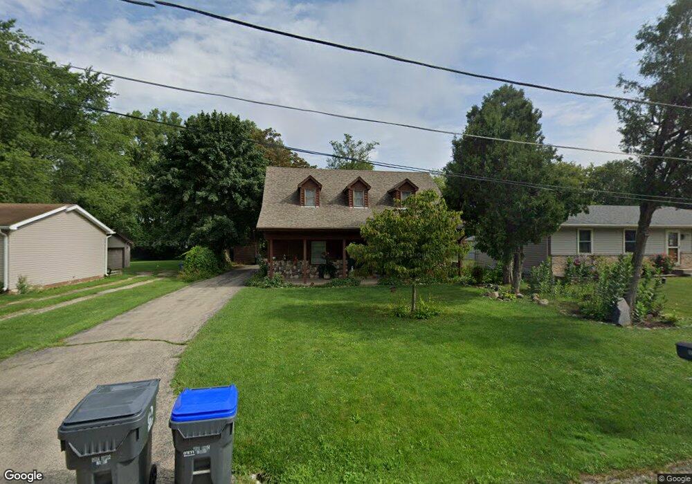
10182 W Crissy Ave Beach Park, IL 60099
Estimated Value: $231,880 - $302,000
3
Beds
2
Baths
1,296
Sq Ft
$204/Sq Ft
Est. Value
About This Home
This home is located at 10182 W Crissy Ave, Beach Park, IL 60099 and is currently estimated at $264,470, approximately $204 per square foot. 10182 W Crissy Ave is a home located in Lake County with nearby schools including Howe Elementary School, Beach Park Middle School, and Zion-Benton Township High School.
Ownership History
Date
Name
Owned For
Owner Type
Purchase Details
Closed on
Jun 28, 2002
Sold by
Mcdonald Angela K
Bought by
Vukovich Victor I and Easley Kimberly D
Current Estimated Value
Home Financials for this Owner
Home Financials are based on the most recent Mortgage that was taken out on this home.
Original Mortgage
$144,688
Outstanding Balance
$61,293
Interest Rate
6.7%
Mortgage Type
FHA
Estimated Equity
$203,177
Purchase Details
Closed on
May 2, 1994
Sold by
Grand National Bank
Bought by
Ward Spencer T and Ward Tammy L
Create a Home Valuation Report for This Property
The Home Valuation Report is an in-depth analysis detailing your home's value as well as a comparison with similar homes in the area
Home Values in the Area
Average Home Value in this Area
Purchase History
| Date | Buyer | Sale Price | Title Company |
|---|---|---|---|
| Vukovich Victor I | $147,000 | Ticor Title | |
| Ward Spencer T | -- | -- |
Source: Public Records
Mortgage History
| Date | Status | Borrower | Loan Amount |
|---|---|---|---|
| Open | Vukovich Victor I | $144,688 |
Source: Public Records
Tax History Compared to Growth
Tax History
| Year | Tax Paid | Tax Assessment Tax Assessment Total Assessment is a certain percentage of the fair market value that is determined by local assessors to be the total taxable value of land and additions on the property. | Land | Improvement |
|---|---|---|---|---|
| 2024 | $4,260 | $54,697 | $8,343 | $46,354 |
| 2023 | $4,408 | $47,954 | $8,054 | $39,900 |
| 2022 | $4,408 | $46,769 | $7,887 | $38,882 |
| 2021 | $4,535 | $45,579 | $7,686 | $37,893 |
| 2020 | $4,430 | $43,496 | $7,335 | $36,161 |
| 2019 | $4,402 | $41,267 | $6,959 | $34,308 |
| 2018 | $4,324 | $39,534 | $8,390 | $31,144 |
| 2017 | $4,277 | $37,191 | $7,893 | $29,298 |
| 2016 | $4,145 | $35,406 | $7,514 | $27,892 |
| 2015 | $3,984 | $32,471 | $6,891 | $25,580 |
| 2014 | $5,969 | $48,627 | $10,758 | $37,869 |
| 2012 | $6,027 | $50,532 | $11,179 | $39,353 |
Source: Public Records
Map
Nearby Homes
- 10209 W Crissy Ave
- 10295 W Crissy Ave
- 10156 W Beach Rd
- 10038 W Beach Rd
- 38402 N Russell Ave
- 38703 N Sheridan Rd Unit 186
- 38842-60 Sheridan Rd
- 38878 N Sheridan Rd
- 38455 N Sheridan Rd Unit 707
- 9802 W Oak Forest Dr
- 10133 W Wadsworth Rd
- 10381 Country Ln
- 9752 W Oak Forest Dr
- 10205 W Ames Ave
- 39161 N Holdridge Ave
- 38101 N Sheridan Rd
- 10765 W Liberty Ave
- 3931 Bertrand Ln
- 1121 Otto Graham Ln
- 38571 N Cedar Ave
- 10208 W Crissy Ave
- 10178 W Crissy Ave
- 10174 W Crissy Ave
- 10222 W Crissy Ave
- 10201 W Chaney Ave
- 10217 W Chaney Ave
- 10170 W Crissy Ave
- 10185 W Chaney Ave
- 10183 W Crissy Ave
- 10171 W Chaney Ave
- 10225 W Chaney Ave
- 10175 W Crissy Ave
- 10221 W Crissy Ave
- 10242 W Crissy Ave
- 38674 N Harding Ave
- 10159 W Crissy Ave
- 10243 W Chaney Ave
- 10243 W Crissy Ave
- 10196 W Ford Ave
- 10208 W Ford Ave