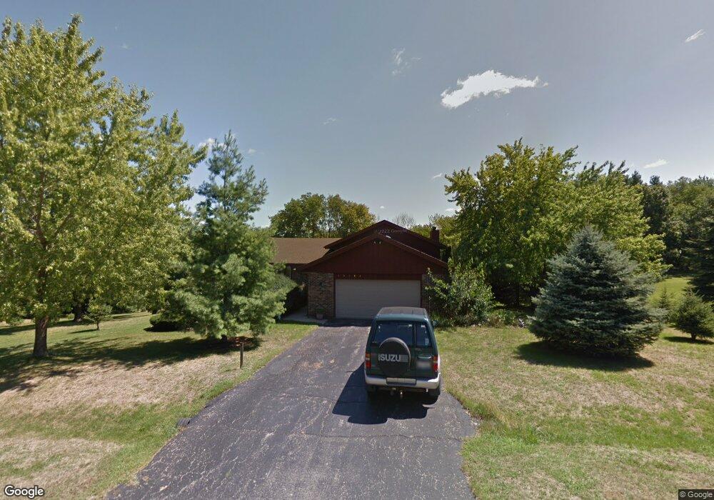
10183 Kings Ct Roscoe, IL 61073
Estimated Value: $321,000 - $356,000
4
Beds
2
Baths
2,200
Sq Ft
$153/Sq Ft
Est. Value
About This Home
This home is located at 10183 Kings Ct, Roscoe, IL 61073 and is currently estimated at $337,148, approximately $153 per square foot. 10183 Kings Ct is a home located in Winnebago County with nearby schools including Ledgewood Elementary School, Stone Creek School, and Kinnikinnick School.
Ownership History
Date
Name
Owned For
Owner Type
Purchase Details
Closed on
Sep 17, 2018
Sold by
Wagner David L
Bought by
Wagner Kathleen M
Current Estimated Value
Home Financials for this Owner
Home Financials are based on the most recent Mortgage that was taken out on this home.
Original Mortgage
$125,000
Outstanding Balance
$110,483
Interest Rate
5.25%
Mortgage Type
New Conventional
Estimated Equity
$226,665
Purchase Details
Closed on
Aug 29, 1994
Bought by
Wagner David Lee and Wagner Kathleen
Create a Home Valuation Report for This Property
The Home Valuation Report is an in-depth analysis detailing your home's value as well as a comparison with similar homes in the area
Home Values in the Area
Average Home Value in this Area
Purchase History
| Date | Buyer | Sale Price | Title Company |
|---|---|---|---|
| Wagner David Lee | $137,000 | -- | |
| Wagner Kathleen M | -- | -- |
Source: Public Records
Mortgage History
| Date | Status | Borrower | Loan Amount |
|---|---|---|---|
| Open | Wagner Kathleen M | $125,000 |
Source: Public Records
Tax History Compared to Growth
Tax History
| Year | Tax Paid | Tax Assessment Tax Assessment Total Assessment is a certain percentage of the fair market value that is determined by local assessors to be the total taxable value of land and additions on the property. | Land | Improvement |
|---|---|---|---|---|
| 2024 | $3,438 | $83,233 | $16,061 | $67,172 |
| 2023 | $3,574 | $73,919 | $14,264 | $59,655 |
| 2022 | $3,749 | $67,420 | $13,010 | $54,410 |
| 2021 | $3,826 | $62,705 | $12,100 | $50,605 |
| 2020 | $3,908 | $59,730 | $11,526 | $48,204 |
| 2019 | $3,995 | $57,212 | $11,040 | $46,172 |
| 2018 | $4,433 | $55,336 | $10,678 | $44,658 |
| 2017 | $4,210 | $53,818 | $10,385 | $43,433 |
| 2016 | $4,602 | $52,747 | $10,178 | $42,569 |
| 2015 | $4,459 | $51,825 | $10,000 | $41,825 |
| 2014 | $4,264 | $51,511 | $9,398 | $42,113 |
Source: Public Records
Map
Nearby Homes
- 0 Atwood Rd Unit 22063958
- 0 Atwood Rd Unit MRD12204329
- 0 Atwood Rd Unit 202406609
- 10472 Atwood Rd
- 10282 Ray Dr
- 10401 Ray Dr
- 10620 Grover Oaks Rd
- 10912 Necedah Ct
- 7822 Burr Oak Rd
- Lot 1 & 2 Lovesee Rd
- 9430 Reserve Dr
- 11371 Havenswood Rd
- 9885 Highstone Dr
- 7344 Amorin Ct
- 8306 E Crockett Rd
- 6427 Greystone
- 9350 Cherrywood
- 11752 Love Rd
- 11810 Love Rd
- 466 Quail Trap Rd
- 10213 Kings Ct
- 10155 Kings Ct
- 10188 Kings Ct
- 10166 Kings Ct
- 10210 Kings Ct
- 10243 Kings Ct
- 10150 Kings Ct
- 10232 Kings Ct
- 8235 Prince Charming Ln
- 8211 Prince Charming Ln
- 8155 Round Table Ln
- 8195 Prince Charming Ln
- 10271 Kings Ct
- 8154 Prince Charming Ln
- 8163 Prince Charming Ln
- 8139 Round Table Ln
- 8146 Round Table Ln
- 8138 Prince Charming Ln
- 10282 Kings Ct
- 10287 Kings Ct