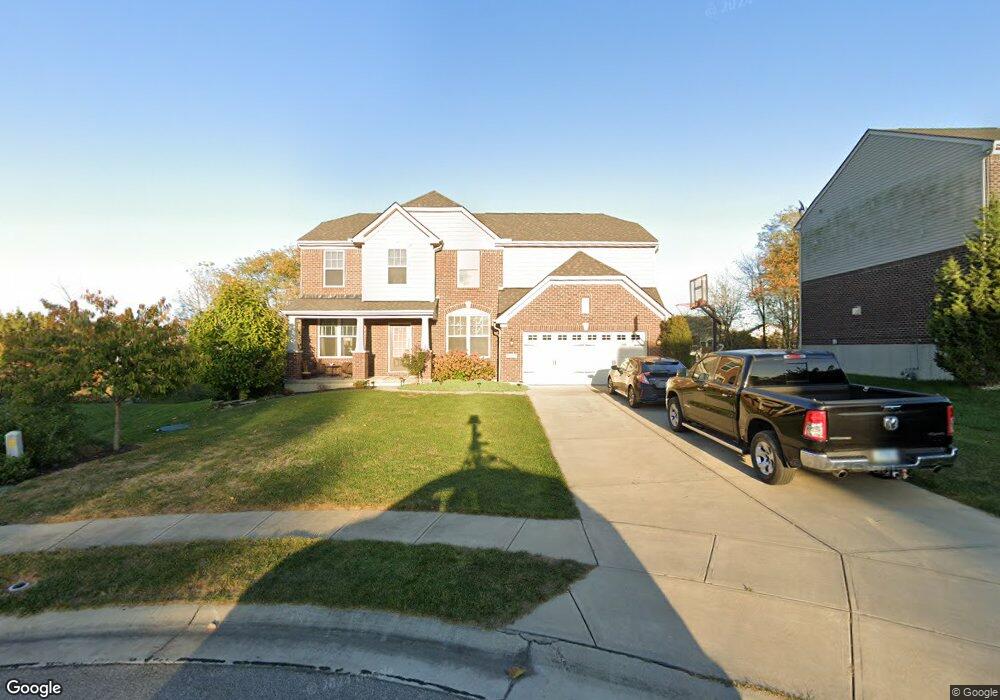
10185 Limerick Cir Covington, KY 41015
Estimated Value: $491,869 - $551,000
4
Beds
4
Baths
3,367
Sq Ft
$158/Sq Ft
Est. Value
About This Home
This home is located at 10185 Limerick Cir, Covington, KY 41015 and is currently estimated at $532,467, approximately $158 per square foot. 10185 Limerick Cir is a home located in Kenton County with nearby schools including Ryland Heights Elementary School, Woodland Middle School, and Scott High School.
Ownership History
Date
Name
Owned For
Owner Type
Purchase Details
Closed on
Feb 29, 2016
Sold by
Mills Road Llc
Bought by
The Drees Company
Current Estimated Value
Purchase Details
Closed on
Jul 27, 2015
Sold by
The Drees Co
Bought by
Henderson Aaron D and Henderson Melissa A
Home Financials for this Owner
Home Financials are based on the most recent Mortgage that was taken out on this home.
Original Mortgage
$275,405
Interest Rate
4.19%
Mortgage Type
New Conventional
Create a Home Valuation Report for This Property
The Home Valuation Report is an in-depth analysis detailing your home's value as well as a comparison with similar homes in the area
Home Values in the Area
Average Home Value in this Area
Purchase History
| Date | Buyer | Sale Price | Title Company |
|---|---|---|---|
| The Drees Company | $40,000 | Kentucky Land Title Agency I | |
| Henderson Aaron D | $289,900 | Terry Monnie Title |
Source: Public Records
Mortgage History
| Date | Status | Borrower | Loan Amount |
|---|---|---|---|
| Previous Owner | Henderson Aaron D | $275,405 |
Source: Public Records
Tax History
| Year | Tax Paid | Tax Assessment Tax Assessment Total Assessment is a certain percentage of the fair market value that is determined by local assessors to be the total taxable value of land and additions on the property. | Land | Improvement |
|---|---|---|---|---|
| 2025 | $4,359 | $374,800 | $45,000 | $329,800 |
| 2024 | $4,084 | $333,400 | $40,000 | $293,400 |
| 2023 | $4,208 | $333,400 | $40,000 | $293,400 |
| 2022 | $4,257 | $333,400 | $40,000 | $293,400 |
| 2021 | $4,321 | $333,400 | $40,000 | $293,400 |
| 2020 | $3,847 | $289,900 | $40,000 | $249,900 |
| 2019 | $3,857 | $289,900 | $40,000 | $249,900 |
| 2018 | $3,878 | $289,900 | $40,000 | $249,900 |
| 2017 | $3,771 | $289,900 | $40,000 | $249,900 |
Source: Public Records
Map
Nearby Homes
- 10171 Desmond Ct
- 3576 Gilford Ct
- 3668 Mills Rd
- 3827 Pruett Rd
- 3845 Pruett Rd
- 3056 Belleglade Dr
- 748 Stablewatch Dr
- 712 Lakefield Dr
- 3118 Belleglade Dr
- 718 Willow Green Dr
- 714 Willow Green Dr
- 838 Stablewatch Dr
- 3044 Belleglade Dr
- 692 Sycamore Dr
- 6409 Stonemill Dr
- 3199 Summitrun Dr
- 685 Skyway Dr
- 907 Stablewatch Dr
- 951 Stablewatch Dr
- 765 Jimae Ave
- 10189 Limerick Cir
- 10189 Limerick Cir
- 10181 Limerick Cir
- 10184 Hibernia Ct
- 10193 Limerick Cir
- 10176 Limerick Cir
- 10180 Hibernia Ct
- 10188 Hibernia Ct
- 3548 Ashford Rd
- 10184 Limerick Cir
- 10197 Limerick Cir
- 10176 Hibernia Ct
- 10176 Hibernia Ct
- 10197 Limerick Cir
- 10180 Limerick Cir
- 10188 Limerick Cir
- 3552 Ashford Rd
- 10172 Hibernia Ct
- 10149 Waterford Ct
- 10192 Limerick Cir
Your Personal Tour Guide
Ask me questions while you tour the home.