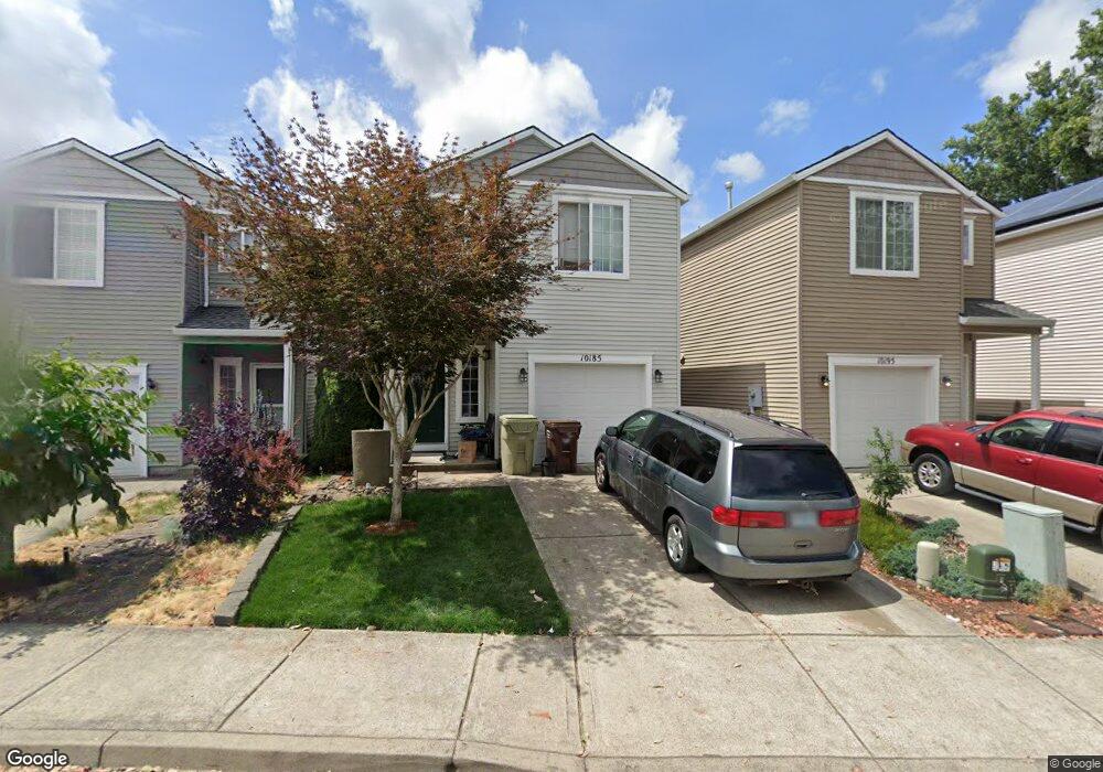
10185 NW Curtis St North Plains, OR 97133
Estimated Value: $412,113 - $434,000
3
Beds
3
Baths
1,432
Sq Ft
$295/Sq Ft
Est. Value
About This Home
This home is located at 10185 NW Curtis St, North Plains, OR 97133 and is currently estimated at $421,778, approximately $294 per square foot. 10185 NW Curtis St is a home located in Washington County with nearby schools including Evergreen Jr High School, Glencoe High School, and Carden Cascade Academy.
Ownership History
Date
Name
Owned For
Owner Type
Purchase Details
Closed on
Jul 1, 2014
Sold by
Hester William J and Hester Robin C
Bought by
Storm Desirae
Current Estimated Value
Home Financials for this Owner
Home Financials are based on the most recent Mortgage that was taken out on this home.
Original Mortgage
$218,673
Outstanding Balance
$166,376
Interest Rate
4.13%
Mortgage Type
New Conventional
Estimated Equity
$255,402
Purchase Details
Closed on
Apr 14, 2005
Sold by
Davis Claud E and Davis Virginia R
Bought by
Hester William J and Hester Robin C
Home Financials for this Owner
Home Financials are based on the most recent Mortgage that was taken out on this home.
Original Mortgage
$124,700
Interest Rate
1.37%
Mortgage Type
Unknown
Create a Home Valuation Report for This Property
The Home Valuation Report is an in-depth analysis detailing your home's value as well as a comparison with similar homes in the area
Home Values in the Area
Average Home Value in this Area
Purchase History
| Date | Buyer | Sale Price | Title Company |
|---|---|---|---|
| Storm Desirae | $214,300 | Ticor Title | |
| Hester William J | $155,900 | Fidelity Natl Title Co Of Or |
Source: Public Records
Mortgage History
| Date | Status | Borrower | Loan Amount |
|---|---|---|---|
| Open | Storm Desirae | $218,673 | |
| Previous Owner | Hester William J | $124,700 |
Source: Public Records
Tax History Compared to Growth
Tax History
| Year | Tax Paid | Tax Assessment Tax Assessment Total Assessment is a certain percentage of the fair market value that is determined by local assessors to be the total taxable value of land and additions on the property. | Land | Improvement |
|---|---|---|---|---|
| 2025 | $3,248 | $220,730 | -- | -- |
| 2024 | $3,156 | $214,310 | -- | -- |
| 2023 | $3,156 | $208,070 | $0 | $0 |
| 2022 | $3,073 | $208,070 | $0 | $0 |
| 2021 | $3,015 | $196,130 | $0 | $0 |
| 2020 | $2,948 | $190,420 | $0 | $0 |
| 2019 | $2,842 | $184,880 | $0 | $0 |
| 2018 | $2,752 | $179,500 | $0 | $0 |
| 2017 | $2,660 | $174,280 | $0 | $0 |
| 2016 | $2,525 | $169,210 | $0 | $0 |
| 2015 | $2,421 | $164,290 | $0 | $0 |
| 2014 | $2,403 | $159,510 | $0 | $0 |
Source: Public Records
Map
Nearby Homes
- 10095 NW Curtis St
- 10090 NW Bartlett Loop
- 30970 NW Kaybern St
- 31020 NW Kaybern St
- 10735 NW McKay Creek Ct
- 30140 NW West Union Rd
- 10282 NW Oak Terrace
- 11308 NW 317th Ave
- 11310 NW 317th Ave
- 31380 NW Turel Dr
- 31452 NW Turel Dr
- 31303 NW Turel Dr
- 31075 NW Yorkshire St
- 11308 317th Ave
- Ash Plan at Brynhill - The Cedar Collection
- Chambrey Plan at Brynhill - The Cedar Collection
- Calloway Plan at Brynhill - The Cedar Collection
- Clark Plan at Brynhill - The Cedar Collection
- Daphne Plan at Brynhill - The Aspen Collection
- Savoie Plan at Brynhill - The Cedar Collection
- 10155 NW Curtis St
- 10195 NW Curtis St
- 10145 NW Curtis St
- 10205 NW Curtis St
- 10143 NW Curtis St
- 10215 NW Curtis St
- 10180 NW Curtis St
- 10139 NW Curtis St
- 30750 NW Pacific St
- 10142 NW Curtis St
- 30780 NW Pacific St Unit 1
- 10170 NW Glencoe Rd
- 10135 NW Curtis St
- 30740 NW Pacific St
- 30730 NW Pacific St
- 10135 NW 307th Ave
- 10131 NW Curtis St
- 10115 NW 307th Ave
- 10165 NW 307th Ave
- 10150 NW Glencoe Rd