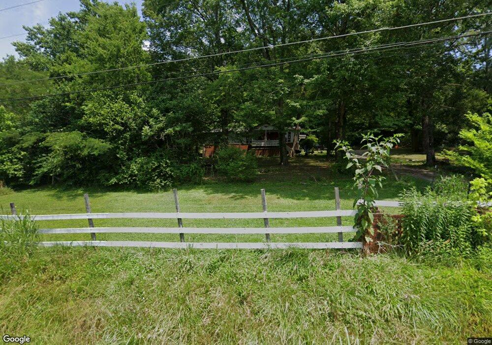
1019 Arnold Rd Rock Spring, GA 30739
Rock Spring NeighborhoodEstimated Value: $175,865 - $317,000
--
Bed
2
Baths
1,220
Sq Ft
$194/Sq Ft
Est. Value
About This Home
This home is located at 1019 Arnold Rd, Rock Spring, GA 30739 and is currently estimated at $236,216, approximately $193 per square foot. 1019 Arnold Rd is a home located in Walker County with nearby schools including Lafayette High School and Oakwood Christian Academy.
Ownership History
Date
Name
Owned For
Owner Type
Purchase Details
Closed on
Jul 30, 2008
Sold by
Not Provided
Bought by
Snider Bobby Vernell and Snider Ann
Current Estimated Value
Purchase Details
Closed on
Jul 15, 2008
Sold by
Parker Doris Marie
Bought by
Snider Bobby Varnell and Snider Mary Ann
Purchase Details
Closed on
Dec 3, 2007
Sold by
Parker James Edward
Bought by
Parker Doris Marie
Purchase Details
Closed on
Jan 18, 1990
Sold by
Parker W A
Bought by
Parker James E
Purchase Details
Closed on
Sep 27, 1979
Sold by
Parker Emma B
Bought by
Parker W A
Purchase Details
Closed on
Mar 19, 1976
Sold by
Parker W A
Bought by
Parker Emma B
Purchase Details
Closed on
Sep 28, 1964
Bought by
Parker W A
Create a Home Valuation Report for This Property
The Home Valuation Report is an in-depth analysis detailing your home's value as well as a comparison with similar homes in the area
Home Values in the Area
Average Home Value in this Area
Purchase History
| Date | Buyer | Sale Price | Title Company |
|---|---|---|---|
| Snider Bobby Vernell | $32,000 | -- | |
| Snider Bobby Varnell | $32,000 | -- | |
| Parker Doris Marie | -- | -- | |
| Parker James E | -- | -- | |
| Parker W A | -- | -- | |
| Parker Emma B | -- | -- | |
| Parker W A | -- | -- |
Source: Public Records
Tax History Compared to Growth
Tax History
| Year | Tax Paid | Tax Assessment Tax Assessment Total Assessment is a certain percentage of the fair market value that is determined by local assessors to be the total taxable value of land and additions on the property. | Land | Improvement |
|---|---|---|---|---|
| 2024 | $1,393 | $60,191 | $21,631 | $38,560 |
| 2023 | $1,286 | $53,809 | $17,167 | $36,642 |
| 2022 | $1,227 | $47,584 | $16,123 | $31,461 |
| 2021 | $1,075 | $37,053 | $16,123 | $20,930 |
| 2020 | $1,020 | $33,633 | $16,123 | $17,510 |
| 2019 | $1,038 | $33,633 | $16,123 | $17,510 |
| 2018 | $890 | $33,633 | $16,123 | $17,510 |
| 2017 | $1,130 | $33,633 | $16,123 | $17,510 |
| 2016 | $727 | $24,417 | $16,123 | $8,294 |
| 2015 | $863 | $28,136 | $13,068 | $15,068 |
| 2014 | $775 | $28,136 | $13,068 | $15,068 |
| 2013 | -- | $28,136 | $13,068 | $15,068 |
Source: Public Records
Map
Nearby Homes
- 1121 Arnold Rd
- 1476 Arnold Rd
- 788 Long Hollow Rd
- 918 Old Lafayette Rd
- 195 Honeysuckle Dr
- 59 Honeysuckle Dr
- 70 Deer Ridge Ln
- 103 Deer Ridge Ln
- 1902 Long Hollow Rd
- 36 Pheonix Cir
- 200 Hunting Ridge Cir
- 294 E Long Hollow Rd
- 183 Long Hollow Rd
- 124 Fieldstone Commons
- 285 Cooper Rd
- 386 Twelve Oaks Dr
- 375 Cooper Rd
- 514 Ginger Lake Dr
- 28 Cobblestone Trail
- 954 Goodson Cir
- 1067 Arnold Rd
- 293 E Turnipseed Rd
- 994 Arnold Rd
- 273 E Turnipseed Rd
- 976 Arnold Rd
- 251 E Turnipseed Rd
- 942 Arnold Rd
- 229 E Turnipseed Rd
- 1142 Arnold Rd
- 226 E Turnipseed Rd
- 1137 Arnold Rd
- 908 Arnold Rd
- 903 Arnold Rd
- 876 Arnold Rd
- 876 Arnold Rd Unit 1
- 1224 Arnold Rd
- 193 E Turnipseed Rd
- 0 E Turnipseed Rd
- 833 Arnold Rd
- 829 Arnold Rd