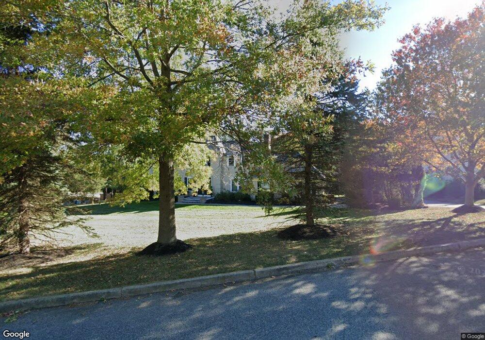
1019 Beaumont Rd Berwyn, PA 19312
Estimated Value: $1,224,163 - $1,411,000
4
Beds
3
Baths
2,730
Sq Ft
$483/Sq Ft
Est. Value
About This Home
This home is located at 1019 Beaumont Rd, Berwyn, PA 19312 and is currently estimated at $1,317,291, approximately $482 per square foot. 1019 Beaumont Rd is a home located in Chester County with nearby schools including Beaumont Elementary School, Tredyffrin-Easttown Middle School, and Conestoga Senior High School.
Ownership History
Date
Name
Owned For
Owner Type
Purchase Details
Closed on
Jun 30, 2006
Sold by
Murphy Jerome J and Murphy Christine R
Bought by
Papadopoulos George and Papadopoulos Andrea
Current Estimated Value
Home Financials for this Owner
Home Financials are based on the most recent Mortgage that was taken out on this home.
Original Mortgage
$278,000
Outstanding Balance
$20,378
Interest Rate
6.67%
Mortgage Type
Purchase Money Mortgage
Estimated Equity
$1,296,913
Purchase Details
Closed on
Jan 21, 1997
Sold by
Darcy Denis E and Darcy Kathleen E
Bought by
Murphy Jerome J and Murphy Christine R
Home Financials for this Owner
Home Financials are based on the most recent Mortgage that was taken out on this home.
Original Mortgage
$240,000
Interest Rate
7.5%
Create a Home Valuation Report for This Property
The Home Valuation Report is an in-depth analysis detailing your home's value as well as a comparison with similar homes in the area
Home Values in the Area
Average Home Value in this Area
Purchase History
| Date | Buyer | Sale Price | Title Company |
|---|---|---|---|
| Papadopoulos George | $702,500 | None Available | |
| Murphy Jerome J | $300,000 | -- |
Source: Public Records
Mortgage History
| Date | Status | Borrower | Loan Amount |
|---|---|---|---|
| Open | Papadopoulos George | $278,000 | |
| Previous Owner | Murphy Jerome J | $240,000 |
Source: Public Records
Tax History Compared to Growth
Tax History
| Year | Tax Paid | Tax Assessment Tax Assessment Total Assessment is a certain percentage of the fair market value that is determined by local assessors to be the total taxable value of land and additions on the property. | Land | Improvement |
|---|---|---|---|---|
| 2025 | $11,295 | $302,810 | $89,300 | $213,510 |
| 2024 | $11,295 | $302,810 | $89,300 | $213,510 |
| 2023 | $10,561 | $302,810 | $89,300 | $213,510 |
| 2022 | $10,272 | $302,810 | $89,300 | $213,510 |
| 2021 | $10,049 | $302,810 | $89,300 | $213,510 |
| 2020 | $9,769 | $302,810 | $89,300 | $213,510 |
| 2019 | $9,497 | $302,810 | $89,300 | $213,510 |
| 2018 | $9,333 | $302,810 | $89,300 | $213,510 |
| 2017 | $9,122 | $302,810 | $89,300 | $213,510 |
| 2016 | -- | $302,810 | $89,300 | $213,510 |
| 2015 | -- | $302,810 | $89,300 | $213,510 |
| 2014 | -- | $302,810 | $89,300 | $213,510 |
Source: Public Records
Map
Nearby Homes
- 709 Newtown Rd
- 1179 Beaumont Rd
- 837 Nathan Hale Rd
- 0 Prescott Rd Unit PACT2110528
- 1052 Prescott Rd
- 191 Stony Point Dr
- 718 Lot 1 Waterloo
- 206 Yorktown Place Unit 106
- 659 Andover Rd
- 641 Andover Rd
- 600 Waynesfield Dr
- 6 Wingstone Ln
- 201 Church Rd
- 422 S Waterloo Rd
- 3314 Saint Davids Rd
- 120 S Devon Ave
- 520 Hawthorne Place
- 1 Dunminning Rd
- 404 Dorset Rd
- 225 Charles Ellis Dr
- 1020 Beaumont Rd
- 1022 Beaumont Rd
- 810 Newtown Rd
- 1023 Beaumont Rd
- 1025 Beaumont Rd
- 1024 Beaumont Rd
- 1026 Beaumont Rd
- 808 Newtown Rd
- 812 Newtown Rd
- 1028 Beaumont Rd
- 806 Newtown Rd
- 814 Newtown Rd
- 1030 Beaumont Rd
- 710 Newtown Rd
- 816 Newtown Rd
- 1031 Beaumont Rd
- 1012 Derwydd Ln
- 1018 Derwydd Ln
- 1032 Beaumont Rd
- 1035 Beaumont Rd