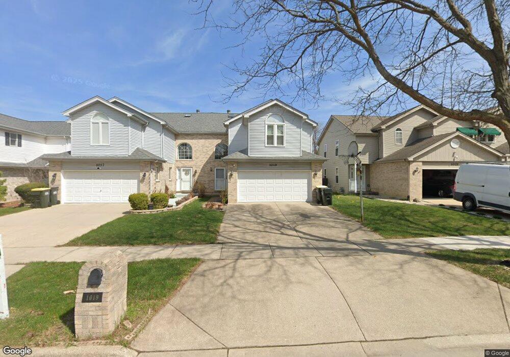
1019 Beninford Ln Westmont, IL 60559
South Westmont NeighborhoodEstimated Value: $488,000 - $541,000
3
Beds
3
Baths
2,447
Sq Ft
$211/Sq Ft
Est. Value
About This Home
This home is located at 1019 Beninford Ln, Westmont, IL 60559 and is currently estimated at $516,177, approximately $210 per square foot. 1019 Beninford Ln is a home located in DuPage County with nearby schools including Holmes Elementary School, Maercker Elementary School, and Westview Hills Middle School.
Ownership History
Date
Name
Owned For
Owner Type
Purchase Details
Closed on
Feb 28, 2007
Sold by
Munagala Rao Munagala and Munagala Lakshmi
Bought by
Zhang Jiwang and Zhang Shubin
Current Estimated Value
Home Financials for this Owner
Home Financials are based on the most recent Mortgage that was taken out on this home.
Original Mortgage
$310,000
Outstanding Balance
$187,844
Interest Rate
6.28%
Mortgage Type
Purchase Money Mortgage
Estimated Equity
$328,333
Purchase Details
Closed on
Apr 1, 1996
Sold by
Midwest Trust Services Inc
Bought by
Munagala Rao Munagala and Munagala Lakshmt
Home Financials for this Owner
Home Financials are based on the most recent Mortgage that was taken out on this home.
Original Mortgage
$163,250
Interest Rate
7.36%
Mortgage Type
Balloon
Create a Home Valuation Report for This Property
The Home Valuation Report is an in-depth analysis detailing your home's value as well as a comparison with similar homes in the area
Home Values in the Area
Average Home Value in this Area
Purchase History
| Date | Buyer | Sale Price | Title Company |
|---|---|---|---|
| Zhang Jiwang | $388,000 | First American Title Ins Co | |
| Munagala Rao Munagala | $204,500 | -- |
Source: Public Records
Mortgage History
| Date | Status | Borrower | Loan Amount |
|---|---|---|---|
| Open | Zhang Jiwang | $310,000 | |
| Previous Owner | Munagala Rao Munagala | $163,250 |
Source: Public Records
Tax History Compared to Growth
Tax History
| Year | Tax Paid | Tax Assessment Tax Assessment Total Assessment is a certain percentage of the fair market value that is determined by local assessors to be the total taxable value of land and additions on the property. | Land | Improvement |
|---|---|---|---|---|
| 2024 | $8,972 | $146,614 | $29,327 | $117,287 |
| 2023 | $8,576 | $134,780 | $26,960 | $107,820 |
| 2022 | $8,541 | $133,320 | $26,670 | $106,650 |
| 2021 | $8,251 | $131,810 | $26,370 | $105,440 |
| 2020 | $8,092 | $129,200 | $25,850 | $103,350 |
| 2019 | $7,823 | $123,960 | $24,800 | $99,160 |
| 2018 | $7,580 | $120,350 | $24,080 | $96,270 |
| 2017 | $7,192 | $115,810 | $23,170 | $92,640 |
| 2016 | $7,060 | $110,520 | $22,110 | $88,410 |
| 2015 | $6,973 | $103,980 | $20,800 | $83,180 |
| 2014 | $6,936 | $103,150 | $20,630 | $82,520 |
| 2013 | $6,724 | $102,660 | $20,530 | $82,130 |
Source: Public Records
Map
Nearby Homes
- 263 Deming Place
- 1205 Charleston Ct Unit 1205
- 1327 Cass Ln E Unit 301
- 107 65th Lake Dr Unit 202
- 55 W 64th St Unit 202
- 55 W 64th St Unit 102
- 12 James Dr
- 47 W Pier Dr Unit 102
- 245 Carlisle Ave
- 915 Carlisle Ave Unit 1
- 61 Pier Dr Unit 202
- 6145 Western Ave
- 907 S Williams St Unit 212
- 907 S Williams St Unit 206
- 907 S Williams St Unit 210
- 127 Hidden View Dr
- 824 High Ridge Ct
- 6655 S Cass Ave Unit 5D
- 511 S Cass Ave
- 6039 Bentley Ave
- 1017 Beninford Ln
- 1021 Beninford Ln
- 1023 Beninford Ln
- 1015 Beninford Ln
- 1013 Beninford Ln
- 1025 Beninford Ln
- 1011 Beninford Ln
- 1027 Beninford Ln
- 1020 Ashford Ln
- 1009 Beninford Ln
- 1016 Ashford Ln
- 1020 Beninford Ln
- 1029 Beninford Ln
- 1024 Ashford Ln
- 1014 Beninford Ln
- 1022 Beninford Ln
- 1028 Ashford Ln
- 1012 Ashford Ln
- 1007 Beninford Ln
- 1031 Beninford Ln