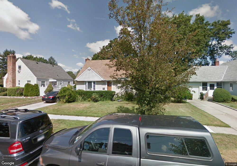
1019 Henhawk Rd North Baldwin, NY 11510
Estimated Value: $572,742 - $679,000
--
Bed
2
Baths
1,820
Sq Ft
$344/Sq Ft
Est. Value
About This Home
This home is located at 1019 Henhawk Rd, North Baldwin, NY 11510 and is currently estimated at $625,871, approximately $343 per square foot. 1019 Henhawk Rd is a home located in Nassau County with nearby schools including Baldwin Senior High School and Roosevelt Children's Academy.
Ownership History
Date
Name
Owned For
Owner Type
Purchase Details
Closed on
Mar 20, 2025
Sold by
Brown Winston and Greenwood Andre
Bought by
Brown Winston
Current Estimated Value
Home Financials for this Owner
Home Financials are based on the most recent Mortgage that was taken out on this home.
Original Mortgage
$510,000
Interest Rate
6.64%
Mortgage Type
New Conventional
Purchase Details
Closed on
Feb 27, 2023
Sold by
Brown Natoy A and Greenwood Andre
Bought by
Brown Winston and Greenwood Andre
Purchase Details
Closed on
Sep 24, 2007
Sold by
Brown Natoya
Purchase Details
Closed on
Nov 29, 1995
Sold by
Cotton William and Cotton Elizabeth
Bought by
Brown Winston and Harmon Daphne
Home Financials for this Owner
Home Financials are based on the most recent Mortgage that was taken out on this home.
Original Mortgage
$158,500
Interest Rate
7.44%
Create a Home Valuation Report for This Property
The Home Valuation Report is an in-depth analysis detailing your home's value as well as a comparison with similar homes in the area
Home Values in the Area
Average Home Value in this Area
Purchase History
| Date | Buyer | Sale Price | Title Company |
|---|---|---|---|
| Brown Winston | $249,000 | None Available | |
| Brown Winston | -- | Judicial Title | |
| Brown Winston | -- | Judicial Title | |
| Brown Winston | -- | Judicial Title | |
| -- | -- | -- | |
| -- | -- | -- | |
| Brown Winston | $167,000 | -- | |
| Brown Winston | $167,000 | -- |
Source: Public Records
Mortgage History
| Date | Status | Borrower | Loan Amount |
|---|---|---|---|
| Previous Owner | Brown Winston | $510,000 | |
| Previous Owner | Brown Winston | $158,500 |
Source: Public Records
Tax History Compared to Growth
Tax History
| Year | Tax Paid | Tax Assessment Tax Assessment Total Assessment is a certain percentage of the fair market value that is determined by local assessors to be the total taxable value of land and additions on the property. | Land | Improvement |
|---|---|---|---|---|
| 2025 | $13,039 | $458 | $149 | $309 |
| 2024 | $3,993 | $498 | $162 | $336 |
| 2023 | $13,741 | $498 | $162 | $336 |
| 2022 | $13,741 | $498 | $162 | $336 |
| 2021 | $19,260 | $483 | $157 | $326 |
| 2020 | $14,777 | $844 | $528 | $316 |
| 2019 | $14,950 | $844 | $528 | $316 |
| 2018 | $14,060 | $844 | $0 | $0 |
| 2017 | $8,661 | $844 | $528 | $316 |
| 2016 | $12,728 | $844 | $528 | $316 |
| 2015 | $3,860 | $844 | $528 | $316 |
| 2014 | $3,860 | $844 | $528 | $316 |
| 2013 | $3,615 | $844 | $528 | $316 |
Source: Public Records
Map
Nearby Homes
- 1020 Henhawk Rd
- 7 Mayfair Rd
- 1426 Forest Ave
- 1023 Schuman Place
- 62 Alhambra Rd
- 1459 Prince St
- 1070 Cramer Ct
- 1515 Paul St
- 1091 Cramer Ct
- 1154 Cramer Ct
- 156 Brookside Ave
- 150 Pennsylvania Ave
- 1014 Kings Pkwy
- 1535 Mattison St
- 915 School Dr
- 831 N William St
- 819 Edward St
- 293 Pennsylvania Ave
- 319 Maryland Ave
- 915 Wallace Ave
- 1011 Henhawk Rd
- 1029 Henhawk Rd
- 1018 Ardmore Rd
- 1012 Ardmore Rd
- 1028 Ardmore Rd
- 1035 Henhawk Rd
- 1395 Circle Dr W
- 1034 Ardmore Rd
- 17 Henhawk Rd
- 22 Henhawk Rd
- 1041 Henhawk Rd
- 1370 Circle Dr W
- 1032 Henhawk Rd
- 1040 Ardmore Rd
- 1396 Circle Dr W
- 997 Henhawk Rd
- 1038 Henhawk Rd
- 1021 Ardmore Rd
- 1047 Henhawk Rd
- 1029 Ardmore Rd