Estimated Value: $135,000 - $522,769
--
Bed
--
Bath
3,284
Sq Ft
$121/Sq Ft
Est. Value
About This Home
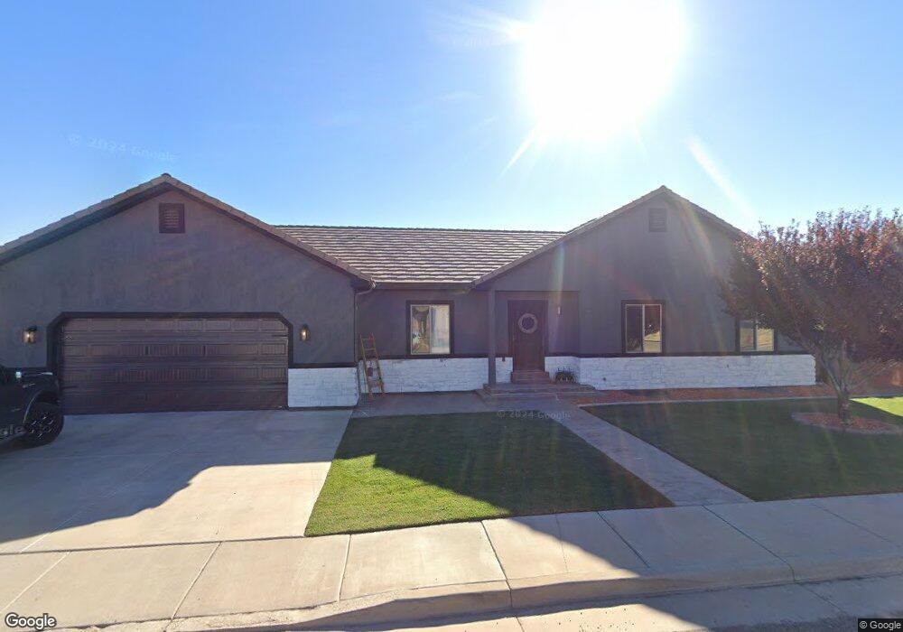
This home is located at 1019 S 10 W, Kanab, UT 84741 and is currently estimated at $397,192, approximately $120 per square foot. 1019 S 10 W is a home with nearby schools including Kanab Elementary School, Kanab Middle School, and Kanab High School.
Ownership History
Date
Name
Owned For
Owner Type
Purchase Details
Closed on
Mar 1, 2010
Sold by
Southern Dixie Investments Inc
Bought by
Lyman Nathan D and Lyman Elisa C
Current Estimated Value
Home Financials for this Owner
Home Financials are based on the most recent Mortgage that was taken out on this home.
Original Mortgage
$34,954
Outstanding Balance
$23,225
Interest Rate
5.03%
Estimated Equity
$373,967
Create a Home Valuation Report for This Property
The Home Valuation Report is an in-depth analysis detailing your home's value as well as a comparison with similar homes in the area
Home Values in the Area
Average Home Value in this Area
Purchase History
| Date | Buyer | Sale Price | Title Company |
|---|---|---|---|
| Lyman Nathan D | -- | -- |
Source: Public Records
Mortgage History
| Date | Status | Borrower | Loan Amount |
|---|---|---|---|
| Open | Lyman Nathan D | $34,954 |
Source: Public Records
Tax History Compared to Growth
Tax History
| Year | Tax Paid | Tax Assessment Tax Assessment Total Assessment is a certain percentage of the fair market value that is determined by local assessors to be the total taxable value of land and additions on the property. | Land | Improvement |
|---|---|---|---|---|
| 2025 | $2,674 | $286,665 | $52,404 | $234,261 |
| 2024 | $2,674 | $310,785 | $52,353 | $258,432 |
| 2023 | $2,392 | $284,799 | $49,860 | $234,939 |
| 2022 | $2,084 | $245,748 | $32,168 | $213,580 |
| 2021 | $1,880 | $332,640 | $44,990 | $287,650 |
| 2020 | $1,847 | $317,208 | $44,990 | $272,218 |
| 2019 | $1,928 | $322,621 | $40,016 | $282,605 |
| 2018 | $1,945 | $322,621 | $40,016 | $282,605 |
| 2017 | $1,890 | $299,279 | $42,300 | $256,979 |
| 2016 | $1,669 | $256,619 | $42,300 | $214,319 |
| 2015 | $1,442 | $263,908 | $42,300 | $221,608 |
| 2014 | $1,442 | $220,592 | $42,768 | $177,824 |
| 2013 | -- | $121,325 | $0 | $0 |
Source: Public Records
Map
Nearby Homes
- 931 S Hillside Dr
- 26 E Sedona Valley Rd
- 425 S Moki Dr Unit I-1
- 425 S Moki Dr Unit 117
- 818 S Highway 89a
- 80 E Red Shadow Cir
- 786 Cedar Cir
- 580 S Cedar Cir
- 559 S Cedar Cir
- 1117 S Terrel Dr
- 300 S 300 E Unit I-7
- 300 S 300 E Unit A5
- 0 U S Highway 89
- 325 S Main St
- 755 Fairway - Multiple Parcels
- 346 E 150 S
- 742 E Sage Trail
- 107 S 300 E
- 176 S 100 E
- 442 100 South - Casita
- 420 E 1100 S
- 1100 S 1100 S S
- 349 E 1100 S
- 525 E 1100 S
- 384 E 1100 S
- 384 E 1100 S
- 650 E 1100 S
- 322 E 950 S
- 379 E 1100 S
- 285 E 1100 S
- 1102 E 1100 S
- 374 E 1100 S
- 310 E 1100 S
- 304 E 900 S
- 1045 S Highway 89a
- 1068 E Country Estates Ln
- 1032 E Country Estates Ln
- 1098 E Country Estates Ln
- 1052 E Country Estates Ln
- 1037 E Country Estates Ln