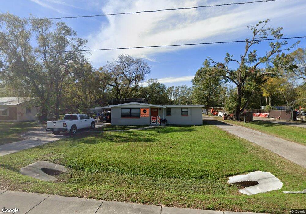
1019 S 82nd St Tampa, FL 33619
Great Palm River Point NeighborhoodEstimated Value: $221,000 - $331,847
2
Beds
1
Bath
1,166
Sq Ft
$252/Sq Ft
Est. Value
About This Home
This home is located at 1019 S 82nd St, Tampa, FL 33619 and is currently estimated at $294,212, approximately $252 per square foot. 1019 S 82nd St is a home located in Hillsborough County with nearby schools including Clair-Mel Elementary School, Dowdell Middle Magnet School, and Bloomingdale High School.
Ownership History
Date
Name
Owned For
Owner Type
Purchase Details
Closed on
Oct 1, 2014
Sold by
Hobbs Road Industrial Park Llc
Bought by
Mot Plans Holdings Llc
Current Estimated Value
Home Financials for this Owner
Home Financials are based on the most recent Mortgage that was taken out on this home.
Original Mortgage
$202,511
Outstanding Balance
$155,539
Interest Rate
4.15%
Mortgage Type
Unknown
Estimated Equity
$138,673
Purchase Details
Closed on
Feb 28, 2008
Sold by
Heard Ann and Rumore Virginia
Bought by
Hobbs Road Industrial Park Llc
Create a Home Valuation Report for This Property
The Home Valuation Report is an in-depth analysis detailing your home's value as well as a comparison with similar homes in the area
Home Values in the Area
Average Home Value in this Area
Purchase History
| Date | Buyer | Sale Price | Title Company |
|---|---|---|---|
| Mot Plans Holdings Llc | $188,300 | Tampa Title Company | |
| Mot Plans Holdings Llc | $50,000 | Tampa Title Company | |
| Hobbs Road Industrial Park Llc | $97,000 | Tampa Title Company |
Source: Public Records
Mortgage History
| Date | Status | Borrower | Loan Amount |
|---|---|---|---|
| Open | Mot Plans Holdings Llc | $202,511 |
Source: Public Records
Tax History Compared to Growth
Tax History
| Year | Tax Paid | Tax Assessment Tax Assessment Total Assessment is a certain percentage of the fair market value that is determined by local assessors to be the total taxable value of land and additions on the property. | Land | Improvement |
|---|---|---|---|---|
| 2024 | $3,537 | $250,766 | $121,440 | $129,326 |
| 2023 | $3,171 | $216,940 | $106,260 | $110,680 |
| 2022 | $2,957 | $214,887 | $91,080 | $123,807 |
| 2021 | $2,622 | $165,566 | $75,900 | $89,666 |
| 2020 | $2,271 | $133,111 | $51,612 | $81,499 |
| 2019 | $2,106 | $128,283 | $51,612 | $76,671 |
| 2018 | $1,901 | $105,898 | $0 | $0 |
| 2017 | $1,718 | $88,873 | $0 | $0 |
| 2016 | $1,529 | $64,810 | $0 | $0 |
| 2015 | $1,399 | $58,185 | $0 | $0 |
| 2014 | $1,369 | $57,875 | $0 | $0 |
| 2013 | -- | $52,614 | $0 | $0 |
Source: Public Records
Map
Nearby Homes
- 8609 Fish Lake Rd
- 8622 Woodridge Rd
- 707 Lime Tree Rd
- 8524 Fish Lake Rd
- 7420 Aripeka Dr
- 8528 Gold Ridge Cir
- 8706 Fish Lake Rd
- 7408 Celeste Ln
- 7406 Manchester Ln
- 7710 Coral Vine Ln
- 1721 Darlington Dr
- 815 Papaya Dr
- 7112 Robindale Rd
- 1716 Lancelot Loop
- 8506 Lee Place
- 1009 S 70th St
- 1718 Green Ridge Rd
- 7102 Reindeer Rd
- 2027 Warrington Way
- 7620 Dennison Dr
- 1021 S 82nd St
- 1017 S 82nd St
- 1024 Cardonna St
- 1007 S 82nd St
- 8021 Palm River Rd
- 8014 Tommy Ct
- 8015 Palm River Rd
- 1102 S 82nd St
- 1039 Cardonna St
- 8005 Tommy Ct
- 1108 S 82nd St
- 7901 Palm River Rd
- 7851 Palm River Rd
- 1118 Eau Claire Cir Unit 1
- 1120 Eau Claire Cir
- 7912 Rideout Rd
- 7914 Rideout Rd
- 7910 Rideout Rd
- 7916 Rideout Rd
- 7906 Rideout Rd