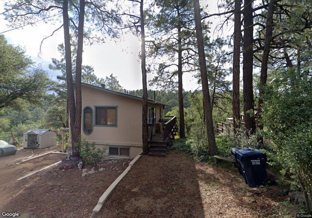
1019 S Apache Dr Prescott, AZ 86303
Estimated Value: $332,381 - $434,000
Studio
--
Bath
1,008
Sq Ft
$399/Sq Ft
Est. Value
About This Home
This home is located at 1019 S Apache Dr, Prescott, AZ 86303 and is currently estimated at $402,095, approximately $398 per square foot. 1019 S Apache Dr is a home located in Yavapai County with nearby schools including Lincoln Elementary School, Granite Mountain Middle School, and Prescott Mile High Middle School.
Ownership History
Date
Name
Owned For
Owner Type
Purchase Details
Closed on
Jun 28, 2012
Sold by
Zivic John S and Zivic Tamera L
Bought by
Department Of Transportation
Current Estimated Value
Purchase Details
Closed on
Nov 7, 2001
Sold by
Graves Richard and Graves Ruth
Bought by
Zivic John S and Zivic Tamera L
Home Financials for this Owner
Home Financials are based on the most recent Mortgage that was taken out on this home.
Original Mortgage
$113,950
Interest Rate
6.62%
Mortgage Type
New Conventional
Create a Home Valuation Report for This Property
The Home Valuation Report is an in-depth analysis detailing your home's value as well as a comparison with similar homes in the area
Purchase History
| Date | Buyer | Sale Price | Title Company |
|---|---|---|---|
| Department Of Transportation | -- | None Available | |
| Zivic John S | $119,999 | Chicago Title Insurance Co |
Source: Public Records
Mortgage History
| Date | Status | Borrower | Loan Amount |
|---|---|---|---|
| Previous Owner | Zivic John S | $113,950 |
Source: Public Records
Tax History
| Year | Tax Paid | Tax Assessment Tax Assessment Total Assessment is a certain percentage of the fair market value that is determined by local assessors to be the total taxable value of land and additions on the property. | Land | Improvement |
|---|---|---|---|---|
| 2026 | $1,210 | $28,217 | -- | -- |
| 2024 | $1,170 | $29,984 | -- | -- |
| 2023 | $1,170 | $24,965 | $10,300 | $14,665 |
| 2022 | $1,129 | $18,933 | $7,036 | $11,897 |
| 2021 | $1,143 | $17,983 | $6,013 | $11,970 |
| 2020 | $1,129 | $0 | $0 | $0 |
| 2019 | $1,104 | $0 | $0 | $0 |
| 2018 | $1,061 | $0 | $0 | $0 |
| 2017 | $1,008 | $0 | $0 | $0 |
| 2016 | $875 | $0 | $0 | $0 |
| 2015 | -- | $0 | $0 | $0 |
| 2014 | $821 | $0 | $0 | $0 |
Source: Public Records
Map
Nearby Homes
- 1033 Lucerne Dr
- 625 Aspen Way
- 627 W Maricopa Dr
- 1101 White Spar Rd
- 1101 White Spar Rd
- 910 Old Stage Rd Unit 4B
- 700 White Spar Rd Unit 50
- 847 W Clubhouse Dr
- 719 Pima Rd
- 639 Tiburon Dr
- 1101 S Milton Ave
- 734 E Pine Knoll Dr
- 509 Copper Basin Rd
- 235 Solar Heights Terrace
- 881 Alpha Ln
- 881 Alpha Ln Unit 1
- 671 Copper Basin Rd
- 510 Copper Basin Rd Unit 100
- 510 Copper Basin Rd Unit 88
- 708 Seri Dr
- 1019 S Apache Dr Unit 1
- 1021 S Apache Dr
- 1013 S Apache Dr
- 1016 S Apache Dr
- 1014 S Apache
- 1012 S Apache Dr
- 1020 S Apache Dr
- 1030 S Apache Dr
- 1027 S Apache Dr
- 1025 S Seminole Rd
- 1000 S Apache Dr
- 615 W Zuni Dr
- 615 W Zuni Dr
- 1020 Joseph St
- 1036 S Seminole Rd
- 1024 Joseph St
- 621 W Zuni Dr
- 665 W Hoover St
- 1026 Joseph St
- 1015 S Seminole Rd
Your Personal Tour Guide
Ask me questions while you tour the home.