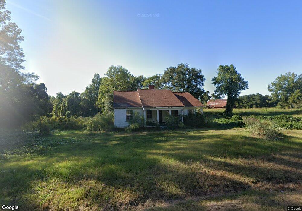
1019 S Highway 100 Bowdon, GA 30108
Estimated Value: $86,000 - $147,000
3
Beds
1
Bath
1,136
Sq Ft
$105/Sq Ft
Est. Value
About This Home
This home is located at 1019 S Highway 100, Bowdon, GA 30108 and is currently estimated at $118,819, approximately $104 per square foot. 1019 S Highway 100 is a home located in Carroll County with nearby schools including Bowdon Elementary School, Bowdon Middle School, and Bowdon High School.
Ownership History
Date
Name
Owned For
Owner Type
Purchase Details
Closed on
Mar 15, 2006
Sold by
Croft Emily Jo
Bought by
Smith Shonda Faye
Current Estimated Value
Purchase Details
Closed on
Sep 21, 2005
Sold by
Regions Bank
Bought by
Croft Emily Jo
Purchase Details
Closed on
Jul 5, 2005
Sold by
Johnson Marie M
Bought by
Regions Bank
Purchase Details
Closed on
Mar 8, 2003
Sold by
Driver & Associates Inc
Bought by
Johnson Marie M and Johnson Randy E
Purchase Details
Closed on
Feb 1, 2003
Sold by
Born David and Born Amanda
Bought by
Driver & Associates Inc
Purchase Details
Closed on
Aug 17, 2000
Sold by
Teal Properties Llc
Bought by
Born David and Born Amanda
Purchase Details
Closed on
Jan 1, 1998
Sold by
Teal Darrell L Etal
Bought by
Teal Properties Llc
Purchase Details
Closed on
Oct 28, 1992
Sold by
Bradley
Bought by
Teal
Create a Home Valuation Report for This Property
The Home Valuation Report is an in-depth analysis detailing your home's value as well as a comparison with similar homes in the area
Home Values in the Area
Average Home Value in this Area
Purchase History
| Date | Buyer | Sale Price | Title Company |
|---|---|---|---|
| Smith Shonda Faye | $44,500 | -- | |
| Croft Emily Jo | $25,000 | -- | |
| Regions Bank | $35,700 | -- | |
| Johnson Marie M | $72,000 | -- | |
| Driver & Associates Inc | -- | -- | |
| Born David | $50,000 | -- | |
| Teal Properties Llc | $34,100 | -- | |
| Teal | $29,000 | -- | |
| Bradley | -- | -- |
Source: Public Records
Tax History Compared to Growth
Tax History
| Year | Tax Paid | Tax Assessment Tax Assessment Total Assessment is a certain percentage of the fair market value that is determined by local assessors to be the total taxable value of land and additions on the property. | Land | Improvement |
|---|---|---|---|---|
| 2024 | $550 | $24,291 | $6,766 | $17,525 |
| 2023 | $550 | $21,346 | $5,414 | $15,932 |
| 2022 | $412 | $16,427 | $3,609 | $12,818 |
| 2021 | $358 | $13,945 | $2,887 | $11,058 |
| 2020 | $314 | $12,217 | $2,625 | $9,592 |
| 2019 | $289 | $11,185 | $2,625 | $8,560 |
| 2018 | $224 | $8,514 | $1,490 | $7,024 |
| 2017 | $224 | $8,514 | $1,490 | $7,024 |
| 2016 | $224 | $8,514 | $1,490 | $7,024 |
| 2015 | $523 | $18,708 | $4,386 | $14,323 |
| 2014 | $525 | $18,709 | $4,386 | $14,323 |
Source: Public Records
Map
Nearby Homes
- 721 Wedowee St
- 717 Wedowee St
- 674 Wedowee St
- 215 Wessmanor Dr
- 101 Winding Road - Lot 1a & 1b & Lot 2
- 110 Bevis Cir
- 425 Mitchell Ave
- 1195 Watts Rd
- 0 Magnolia St Unit 7657311
- 0 Magnolia St Unit 10614572
- 611 Mitchell Ave
- 700 W College St
- 710 Mitchell Ave
- 310 W College St
- 0 Hwy 100 Unit LotWP001 24911780
- 0 Hwy 100 Unit 10541558
- 313 Ellenwood Dr
- 1770 Georgia 100
- 1794 Georgia 100
- 110 Bartlett Cir
- 93 Reavesville Rd
- 1053 Georgia 100
- 1053 S Highway 100
- 896 S Highway 100
- 875 S Highway 100
- 80 New Hope Rd
- 1096 S Highway 100
- 872 S Highway 100
- 50 New Hope Rd
- 36 New Hope Rd
- 77 New Hope Rd
- 26 New Hope Rd
- 55 New Hope Rd
- 41 New Hope Rd
- 841 S Highway 100
- 24 Sylvia Dr
- 185 New Hope Rd
- 0 Wyatt Rd
- 0 Wyatt Rd Unit 7363783
- 0 Wyatt Rd Unit 8318251