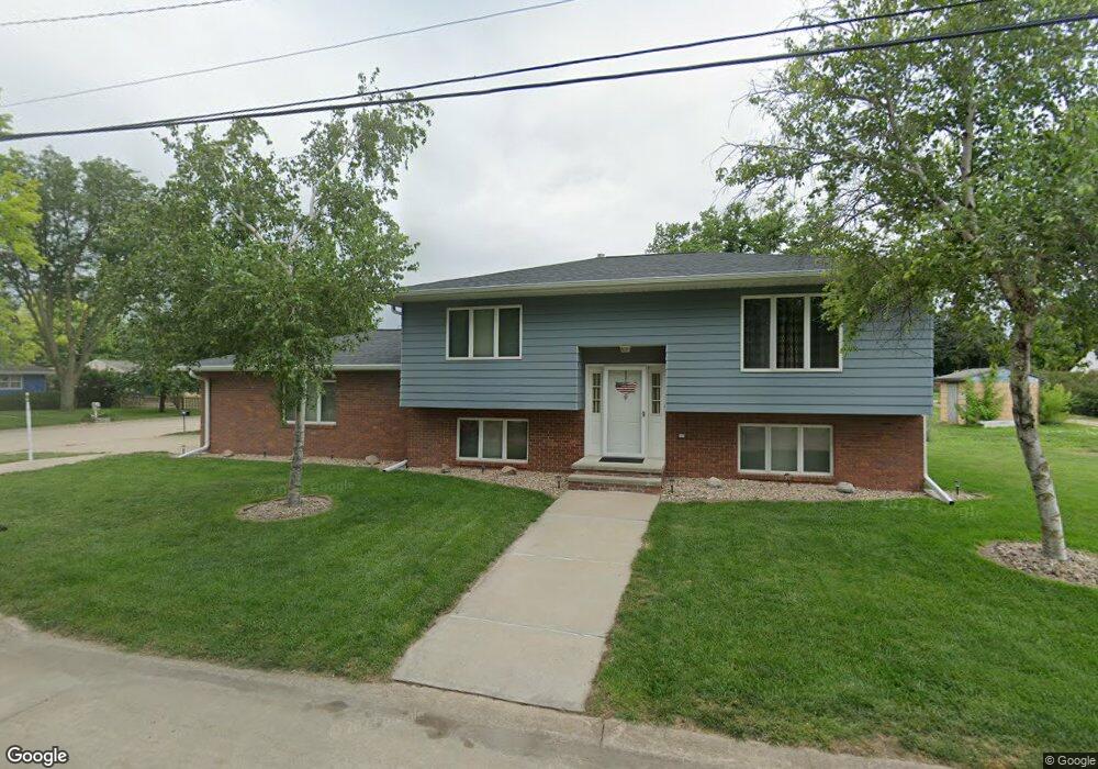
1019 University St Hastings, NE 68901
Estimated Value: $210,000 - $223,000
3
Beds
3
Baths
924
Sq Ft
$236/Sq Ft
Est. Value
About This Home
This home is located at 1019 University St, Hastings, NE 68901 and is currently estimated at $217,974, approximately $235 per square foot. 1019 University St is a home located in Adams County with nearby schools including Hastings Senior High School, St. Michael's Preschool & Elementary School, and St. Cecilia High School.
Ownership History
Date
Name
Owned For
Owner Type
Purchase Details
Closed on
Feb 21, 2006
Sold by
Breckner Rodney D and Breckner Brenda M
Bought by
Underwood Brent D
Current Estimated Value
Home Financials for this Owner
Home Financials are based on the most recent Mortgage that was taken out on this home.
Original Mortgage
$116,100
Outstanding Balance
$64,972
Interest Rate
6.1%
Mortgage Type
New Conventional
Estimated Equity
$153,002
Create a Home Valuation Report for This Property
The Home Valuation Report is an in-depth analysis detailing your home's value as well as a comparison with similar homes in the area
Home Values in the Area
Average Home Value in this Area
Purchase History
| Date | Buyer | Sale Price | Title Company |
|---|---|---|---|
| Underwood Brent D | $11,700 | None Available |
Source: Public Records
Mortgage History
| Date | Status | Borrower | Loan Amount |
|---|---|---|---|
| Open | Underwood Brent D | $116,100 |
Source: Public Records
Tax History Compared to Growth
Tax History
| Year | Tax Paid | Tax Assessment Tax Assessment Total Assessment is a certain percentage of the fair market value that is determined by local assessors to be the total taxable value of land and additions on the property. | Land | Improvement |
|---|---|---|---|---|
| 2024 | $2,768 | $174,413 | $18,750 | $155,663 |
| 2023 | $3,535 | $171,299 | $18,750 | $152,549 |
| 2022 | $3,287 | $145,909 | $18,750 | $127,159 |
| 2021 | $2,776 | $126,593 | $14,063 | $112,530 |
| 2020 | $2,614 | $121,234 | $14,063 | $107,171 |
| 2019 | $2,542 | $119,133 | $14,063 | $105,070 |
| 2018 | $2,394 | $111,635 | $6,565 | $105,070 |
| 2017 | $2,306 | $107,595 | $0 | $0 |
| 2016 | $2,265 | $105,615 | $6,565 | $99,050 |
| 2011 | -- | $96,020 | $6,250 | $89,770 |
Source: Public Records
Map
Nearby Homes
- 1215 University St
- 910 Ronan Dr
- 1303 Pleasant St
- 1111 E 6th St
- 523 N 2nd Ave
- 1227 E 5th St
- 907 E 3rd St
- 720 E 5th St
- 28 Kingston Dr
- 12 Avalon Ln
- 831 N Cedar Ave
- 411 University Ave
- 747 E 2nd St
- 406 E 6th St
- 234 Forest Blvd
- 216 Forest Blvd
- 208 Ringland Rd
- 418 E 2nd St
- 315 N California Ave
- 1327 N Cedar Ave
- 1105 University St
- 1014 Pleasant St
- 1007 University St
- 1018 University St
- 1100 Pleasant St
- 806 N 2nd Ave
- 820 N 2nd Ave
- 1102 University St
- 1115 University St
- 1010 University St
- 1106 University St
- 1112 Pleasant St
- 1002 University St
- 1110 University St
- 817 N 3rd Ave
- 1114 University St
- 1119 University St
- 720 N 3rd Ave Unit 722
- 1017 Waynoka St
- 734 N 2nd Ave