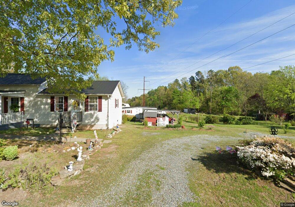
1019 Virgie Cole Rd South Boston, VA 24592
Estimated Value: $83,000 - $161,000
3
Beds
--
Bath
1,256
Sq Ft
$106/Sq Ft
Est. Value
About This Home
This home is located at 1019 Virgie Cole Rd, South Boston, VA 24592 and is currently estimated at $133,000, approximately $105 per square foot. 1019 Virgie Cole Rd is a home located in Halifax County with nearby schools including Cluster Springs Elementary School, Halifax County Middle School, and Halifax County High School.
Ownership History
Date
Name
Owned For
Owner Type
Purchase Details
Closed on
Aug 29, 2025
Sold by
Elliott Alma S and Elliott Ronnie Lee
Bought by
Terry John A and Terry Richard A
Current Estimated Value
Home Financials for this Owner
Home Financials are based on the most recent Mortgage that was taken out on this home.
Original Mortgage
$100,000
Outstanding Balance
$100,000
Interest Rate
6.74%
Mortgage Type
Credit Line Revolving
Estimated Equity
$33,000
Create a Home Valuation Report for This Property
The Home Valuation Report is an in-depth analysis detailing your home's value as well as a comparison with similar homes in the area
Home Values in the Area
Average Home Value in this Area
Purchase History
| Date | Buyer | Sale Price | Title Company |
|---|---|---|---|
| Terry John A | $140,000 | None Listed On Document |
Source: Public Records
Mortgage History
| Date | Status | Borrower | Loan Amount |
|---|---|---|---|
| Open | Terry John A | $100,000 |
Source: Public Records
Tax History Compared to Growth
Tax History
| Year | Tax Paid | Tax Assessment Tax Assessment Total Assessment is a certain percentage of the fair market value that is determined by local assessors to be the total taxable value of land and additions on the property. | Land | Improvement |
|---|---|---|---|---|
| 2025 | $393 | $78,554 | $8,075 | $70,479 |
| 2024 | $393 | $78,554 | $8,075 | $70,479 |
| 2023 | $315 | $62,999 | $8,075 | $54,924 |
| 2022 | $315 | $62,999 | $8,075 | $54,924 |
| 2021 | $278 | $55,557 | $8,075 | $47,482 |
| 2020 | $278 | $55,557 | $8,075 | $47,482 |
| 2019 | $278 | $55,557 | $8,075 | $47,482 |
| 2018 | $267 | $55,557 | $8,075 | $47,482 |
| 2016 | $271 | $56,471 | $8,075 | $48,396 |
| 2015 | $271 | $56,202 | $8,075 | $48,127 |
| 2014 | $259 | $56,202 | $8,075 | $48,127 |
| 2013 | $261 | $57,992 | $8,075 | $49,917 |
Source: Public Records
Map
Nearby Homes
- 00 Boyds Ferry Trail
- 2073 Hudson Rd
- 9043 Bill Tuck Hwy
- 1039 Azalea Ln
- 00 Kingswood Rd
- 9120 Bill Tuck Hwy
- 0 Wolf Trap Rd
- 65 AC Hudson Rd
- 00 Alphonse Dairy Rd
- 00 Good Trail
- 1085 White Oak Forks Rd
- 1094 White Oak Forks Rd
- 0 E Hyco Rd
- 1194 Wolf Trap Rd
- 1070 Carriage End Way
- 1220 E Hyco Rd
- 725 Magnolia Dr
- 4507 Brentwood Dr
- 618 Cedar Ave
- 00 Phillips Trail
- 1011 Virgie Cole Rd
- 6074 Bill Tuck Hwy
- 6080 Bill Tuck Hwy
- 1022 Virgie Cole Rd
- 1045 Virgie Cole Rd
- 1042 Virgie Cole Rd
- 6108 Bill Tuck Hwy
- 000 Bill Tuck Hwy
- 000 Virgie Cole Rd
- 1005 Boyds Ferry Trail
- 1053 Virgie Cole Rd
- 1056 Virgie Cole Rd
- 1061 Virgie Cole Rd
- 6049 Bill Tuck Hwy
- 1033 Stevens Rd
- 1050 Stevens Rd
- 1064 Virgie Cole Rd
- 1067 Virgie Cole Rd
- 6028 Bill Tuck Hwy
- 1058 Stevens Rd