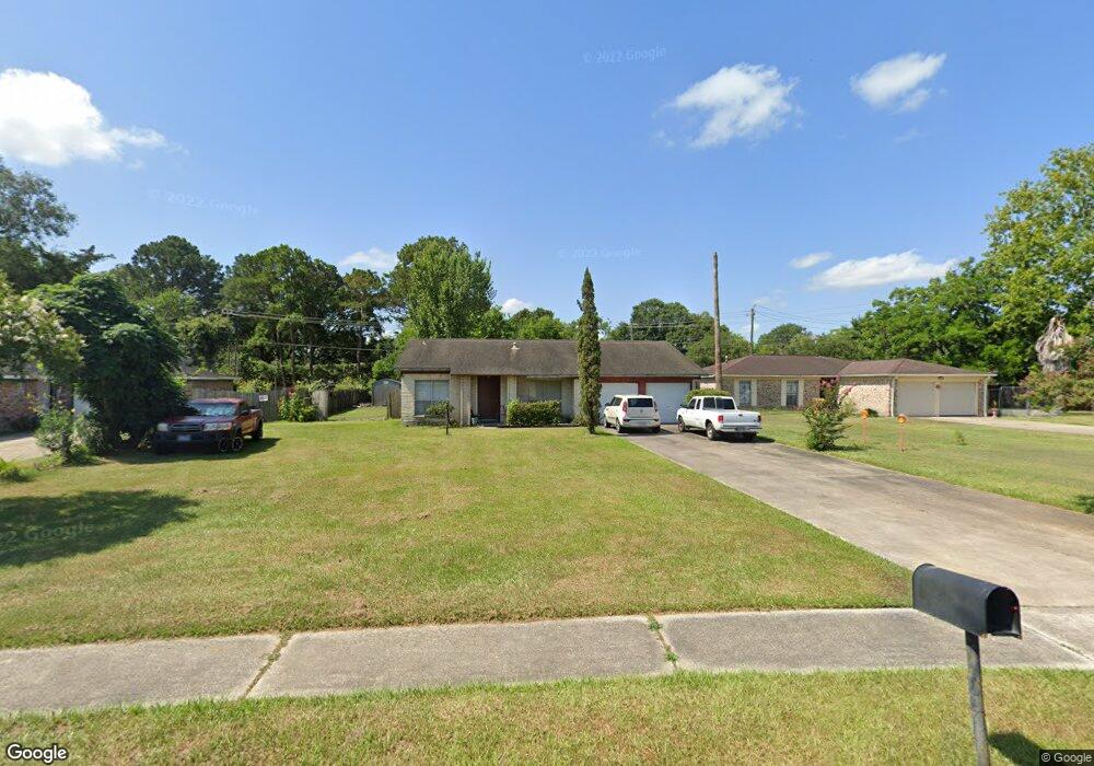
1019 W Bertrand St Houston, TX 77088
Hidden Valley NeighborhoodEstimated Value: $205,000 - $225,000
3
Beds
2
Baths
1,297
Sq Ft
$166/Sq Ft
Est. Value
About This Home
This home is located at 1019 W Bertrand St, Houston, TX 77088 and is currently estimated at $215,738, approximately $166 per square foot. 1019 W Bertrand St is a home located in Harris County with nearby schools including Jerry Keeble Ec/Pre-K, Goodman Elementary School, and Aldine Ninth Grade School.
Ownership History
Date
Name
Owned For
Owner Type
Purchase Details
Closed on
Sep 24, 2013
Sold by
Prashaw Emanuel G
Bought by
Prashaw Marianna
Current Estimated Value
Purchase Details
Closed on
Sep 25, 1997
Sold by
Martinez Alex and Martinez Alexander
Bought by
Prashaw Marianna and Prashaw Emanuel G
Home Financials for this Owner
Home Financials are based on the most recent Mortgage that was taken out on this home.
Original Mortgage
$48,900
Interest Rate
7.49%
Create a Home Valuation Report for This Property
The Home Valuation Report is an in-depth analysis detailing your home's value as well as a comparison with similar homes in the area
Home Values in the Area
Average Home Value in this Area
Purchase History
| Date | Buyer | Sale Price | Title Company |
|---|---|---|---|
| Prashaw Marianna | -- | None Available | |
| Prashaw Marianna | -- | -- |
Source: Public Records
Mortgage History
| Date | Status | Borrower | Loan Amount |
|---|---|---|---|
| Previous Owner | Prashaw Marianna | $48,900 |
Source: Public Records
Tax History Compared to Growth
Tax History
| Year | Tax Paid | Tax Assessment Tax Assessment Total Assessment is a certain percentage of the fair market value that is determined by local assessors to be the total taxable value of land and additions on the property. | Land | Improvement |
|---|---|---|---|---|
| 2025 | $2 | $228,016 | $70,386 | $157,630 |
| 2024 | $2 | $219,387 | $50,276 | $169,111 |
| 2023 | $2 | $224,609 | $50,276 | $174,333 |
| 2022 | $3,050 | $180,849 | $43,718 | $137,131 |
| 2021 | $2,904 | $159,574 | $24,045 | $135,529 |
| 2020 | $2,774 | $159,574 | $24,045 | $135,529 |
| 2019 | $2,644 | $120,349 | $24,045 | $96,304 |
| 2018 | $478 | $94,440 | $24,045 | $70,395 |
| 2017 | $2,095 | $89,709 | $24,045 | $65,664 |
| 2016 | $1,904 | $89,709 | $24,045 | $65,664 |
| 2015 | $313 | $80,904 | $24,045 | $56,859 |
| 2014 | $313 | $68,771 | $24,045 | $44,726 |
Source: Public Records
Map
Nearby Homes
- 954 W Bertrand St
- 8718 Glen Shadow Dr
- 1314 Tarberry Rd
- 9006 Winding River Dr
- 9018 Lazy River Ln
- 9022 Indian River Dr
- 1307 Saddle Rock Dr
- 0 Grenshaw
- 0 Marcolin St
- 8615 Citation Ct
- 8602 De Priest St
- 1559 Diplomat Way
- 958 Conklin St
- 0 Marjorie
- 905 Ferguson Way
- 907 Ferguson Way
- 1054 Dewalt St
- 769 Marjorie St
- 8314 De Priest St
- 1028 Marcolin St
- 1015 W Bertrand St
- 1023 W Bertrand St
- 1011 W Bertrand St
- 8703 Glen Shadow Dr
- 1007 W Bertrand St
- 8618 Whitecastle Ln
- 8614 Whitecastle Ln
- 1022 W Bertrand St
- 1014 W Bertrand St
- 8610 Whitecastle Ln
- 1003 W Bertrand St
- 1010 W Bertrand St
- 8707 Glen Shadow Dr
- 8606 Whitecastle Ln
- 8702 Glen Shadow Dr
- 1006 W Bertrand St
- 8602 Whitecastle Ln
- 8626 Whitecastle Ln
- 967 W Bertrand St
- 8711 Glen Shadow Dr