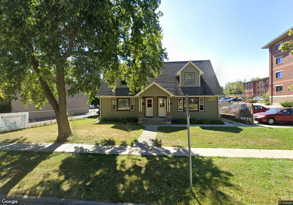
1019 W Starin Rd Whitewater, WI 53190
Estimated Value: $300,000 - $410,000
--
Bed
--
Bath
--
Sq Ft
10,454
Sq Ft Lot
About This Home
This home is located at 1019 W Starin Rd, Whitewater, WI 53190 and is currently estimated at $358,629. 1019 W Starin Rd is a home located in Walworth County with nearby schools including Whitewater High School, Jedi Virtual K-12, and Kettle Moraine Baptist Academy.
Ownership History
Date
Name
Owned For
Owner Type
Purchase Details
Closed on
Oct 10, 2012
Sold by
Stettler Dale N and Stettler Gayle M
Bought by
Starin Prince Rentals Llc
Current Estimated Value
Home Financials for this Owner
Home Financials are based on the most recent Mortgage that was taken out on this home.
Original Mortgage
$288,000
Outstanding Balance
$199,994
Interest Rate
3.57%
Mortgage Type
Purchase Money Mortgage
Estimated Equity
$158,635
Purchase Details
Closed on
Aug 3, 2012
Sold by
Oberle Gerald D
Bought by
Trustees Of The Dale N Stettler And Gayle M S
Create a Home Valuation Report for This Property
The Home Valuation Report is an in-depth analysis detailing your home's value as well as a comparison with similar homes in the area
Home Values in the Area
Average Home Value in this Area
Purchase History
| Date | Buyer | Sale Price | Title Company |
|---|---|---|---|
| Starin Prince Rentals Llc | $1,160,000 | None Available | |
| Trustees Of The Dale N Stettler And Gayle M S | $97,500 | -- |
Source: Public Records
Mortgage History
| Date | Status | Borrower | Loan Amount |
|---|---|---|---|
| Open | Starin Prince Rentals Llc | $288,000 |
Source: Public Records
Tax History Compared to Growth
Tax History
| Year | Tax Paid | Tax Assessment Tax Assessment Total Assessment is a certain percentage of the fair market value that is determined by local assessors to be the total taxable value of land and additions on the property. | Land | Improvement |
|---|---|---|---|---|
| 2024 | $5,427 | $356,300 | $46,100 | $310,200 |
| 2023 | $5,354 | $330,200 | $46,100 | $284,100 |
| 2022 | $5,543 | $308,600 | $46,100 | $262,500 |
| 2021 | $6,041 | $296,700 | $46,100 | $250,600 |
| 2020 | $5,438 | $265,800 | $46,100 | $219,700 |
| 2019 | $5,102 | $246,800 | $46,100 | $200,700 |
| 2018 | $5,088 | $246,800 | $46,100 | $200,700 |
| 2017 | $4,834 | $242,000 | $46,100 | $195,900 |
| 2016 | $5,056 | $242,000 | $46,100 | $195,900 |
| 2015 | $5,002 | $242,000 | $46,100 | $195,900 |
| 2014 | $3,792 | $232,500 | $46,100 | $186,400 |
| 2013 | $3,792 | $225,400 | $46,100 | $179,300 |
Source: Public Records
Map
Nearby Homes
- Lt8 Pearson Ct
- Lt9 Pearson Ct
- Lt7 Pearson Ct
- Lt1 Pearson Ct
- Lt1 W Main St
- Lt2 W Main St
- Lt13 Tripp Lake Estates
- 824 W Conger St
- 903 W Conger St
- 1139 W Highland St
- 201 N Esterly Ave
- 805 W Highland St
- 232 S Summit St
- 143 N Franklin St
- 255 N Park St
- 1229 W Bloomingfield Dr
- 1252 W Laurel St
- 1270 Black River Ct
- 1575 Meadowview Ct
- 328 W Main St
- 1007 W Starin Rd
- 1007 W Starin Rd
- 1031 W Starin Rd
- 1037 W Starin Rd
- 1037 W Starin Rd
- 1025 W Starin Rd
- 1043 W Starin Rd
- 281 N Tratt St
- 260 N Prince St
- 293 N Tratt St
- 256 N Prince St
- 275 N Tratt St
- 263 N Tratt St
- 248 N Prince St
- 257 N Tratt St
- 280 N Tratt St
- 240 N Prince St
- 290 N Tratt St
- 251 N Tratt St
- 258 N Tratt St