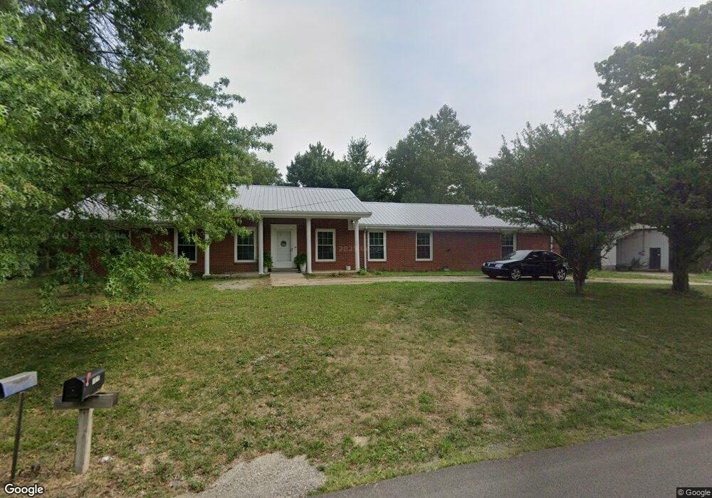
1019 Wildcat Rd Lawrenceburg, KY 40342
Estimated Value: $325,387 - $402,000
--
Bed
--
Bath
1,914
Sq Ft
$186/Sq Ft
Est. Value
About This Home
This home is located at 1019 Wildcat Rd, Lawrenceburg, KY 40342 and is currently estimated at $355,597, approximately $185 per square foot. 1019 Wildcat Rd is a home located in Anderson County with nearby schools including Saffell Street Elementary School, Anderson County Middle School, and Anderson County High School.
Ownership History
Date
Name
Owned For
Owner Type
Purchase Details
Closed on
Jul 5, 2023
Sold by
Hanks Edwin Boswell and Hanks Stacie Marie
Bought by
Searcy Bradley Colton and Darst Kennedy Paige
Current Estimated Value
Home Financials for this Owner
Home Financials are based on the most recent Mortgage that was taken out on this home.
Original Mortgage
$282,828
Outstanding Balance
$276,081
Interest Rate
6.79%
Mortgage Type
New Conventional
Estimated Equity
$79,516
Create a Home Valuation Report for This Property
The Home Valuation Report is an in-depth analysis detailing your home's value as well as a comparison with similar homes in the area
Home Values in the Area
Average Home Value in this Area
Purchase History
| Date | Buyer | Sale Price | Title Company |
|---|---|---|---|
| Searcy Bradley Colton | $280,000 | None Listed On Document |
Source: Public Records
Mortgage History
| Date | Status | Borrower | Loan Amount |
|---|---|---|---|
| Open | Searcy Bradley Colton | $282,828 |
Source: Public Records
Tax History Compared to Growth
Tax History
| Year | Tax Paid | Tax Assessment Tax Assessment Total Assessment is a certain percentage of the fair market value that is determined by local assessors to be the total taxable value of land and additions on the property. | Land | Improvement |
|---|---|---|---|---|
| 2024 | $2,881 | $280,000 | $20,000 | $260,000 |
| 2023 | $1,533 | $147,000 | $20,000 | $127,000 |
| 2022 | $1,118 | $105,000 | $20,000 | $85,000 |
| 2021 | $1,145 | $105,000 | $20,000 | $85,000 |
| 2020 | $1,172 | $105,000 | $20,000 | $85,000 |
| 2019 | $1,133 | $100,000 | $20,000 | $80,000 |
| 2018 | $1,123 | $100,000 | $20,000 | $80,000 |
| 2017 | $1,090 | $100,000 | $20,000 | $80,000 |
| 2016 | $1,060 | $100,000 | $20,000 | $80,000 |
| 2015 | $1,035 | $100,000 | $20,000 | $80,000 |
| 2014 | $1,031 | $100,000 | $20,000 | $80,000 |
| 2013 | $1,016 | $100,000 | $20,000 | $80,000 |
Source: Public Records
Map
Nearby Homes
- 1553 Harrodsburg Rd
- 1408 Harrodsburg Rd
- 1030 Virginia Ave
- 2020 Thorntree Ln
- 3017 Briar Creek Rd
- 139 Ray Ct
- 1108 Melanie Dr
- 1313 Bonnie Blue Loop
- 1060 Butler Dr
- 7 A Pumphouse Rd
- 7 B Pumphouse Rd
- 121 Plantation Dr
- 129 Plantation Dr
- 112 Jean St
- 111 Carlton Dr
- 1022 Forest Hill Dr
- 101 Carlton Dr Unit 115
- 104 Carlton Dr
- 103 Carlton Dr
- 102 Carlton Dr
- 1008 Wildcat Rd
- 1018 Wildcat Rd
- 1024 Wildcat Rd
- 1003 Wildcat Rd
- 1007 Wildcat Rd
- 1013 Wildcat Rd
- 1027 Wildcat Rd
- 1035 Wildcat Rd
- 1098 Wildcat Rd
- 1085 Wildcat Rd
- 1048 Wildcat Rd
- 1057 Wildcat Rd
- 1049 Wildcat Rd
- 1044 Wildcat Rd
- 1039 Wildcat Rd
- 1043 Wildcat Rd
- 1034 Wildcat Rd
- 1031 Wildcat Rd
- 1054 Wildcat Rd
- 1028 Wildcat Rd