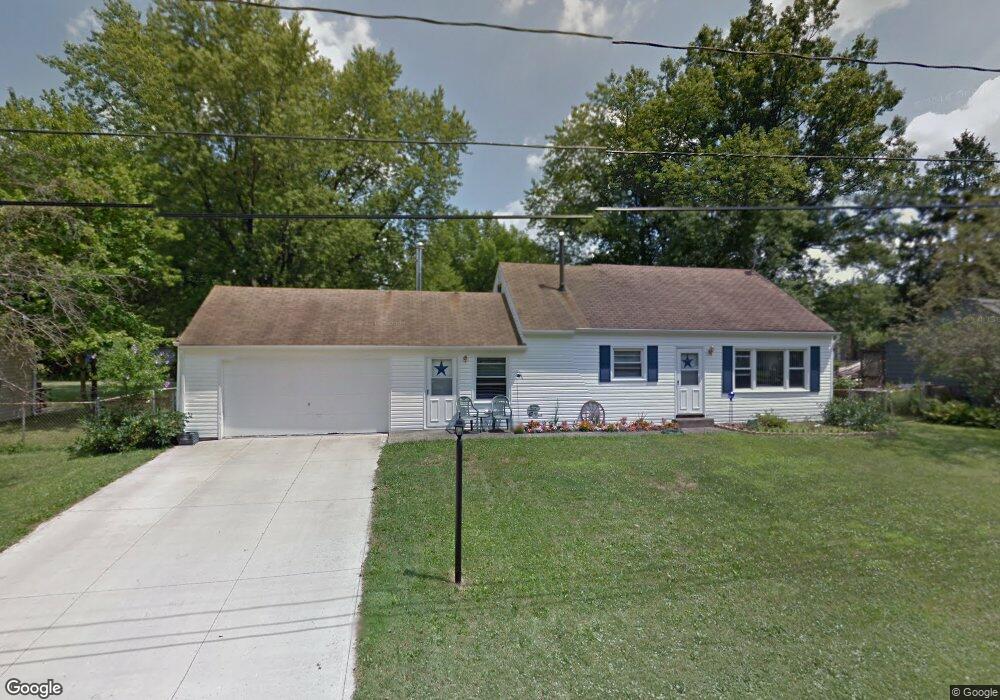
10191 Dupont Dr Columbia Station, OH 44028
Estimated Value: $216,000 - $246,000
3
Beds
1
Bath
1,649
Sq Ft
$142/Sq Ft
Est. Value
About This Home
This home is located at 10191 Dupont Dr, Columbia Station, OH 44028 and is currently estimated at $234,427, approximately $142 per square foot. 10191 Dupont Dr is a home located in Lorain County with nearby schools including Copopa Elementary School, Columbia Middle School, and Columbia High School.
Ownership History
Date
Name
Owned For
Owner Type
Purchase Details
Closed on
Nov 17, 2000
Sold by
Charles Wilmoth Wayne and Ann Jo
Bought by
Edmisten Eric L and Edmisten Laura A
Current Estimated Value
Home Financials for this Owner
Home Financials are based on the most recent Mortgage that was taken out on this home.
Original Mortgage
$76,000
Interest Rate
7.87%
Create a Home Valuation Report for This Property
The Home Valuation Report is an in-depth analysis detailing your home's value as well as a comparison with similar homes in the area
Home Values in the Area
Average Home Value in this Area
Purchase History
| Date | Buyer | Sale Price | Title Company |
|---|---|---|---|
| Edmisten Eric L | $80,000 | Insignia Title Agency Ltd |
Source: Public Records
Mortgage History
| Date | Status | Borrower | Loan Amount |
|---|---|---|---|
| Closed | Edmisten Eric L | $76,000 |
Source: Public Records
Tax History Compared to Growth
Tax History
| Year | Tax Paid | Tax Assessment Tax Assessment Total Assessment is a certain percentage of the fair market value that is determined by local assessors to be the total taxable value of land and additions on the property. | Land | Improvement |
|---|---|---|---|---|
| 2024 | $2,790 | $64,827 | $26,240 | $38,588 |
| 2023 | $2,193 | $44,510 | $16,884 | $27,626 |
| 2022 | $2,139 | $44,510 | $16,884 | $27,626 |
| 2021 | $2,161 | $44,510 | $16,880 | $27,630 |
| 2020 | $2,027 | $37,460 | $14,210 | $23,250 |
| 2019 | $2,015 | $37,460 | $14,210 | $23,250 |
| 2018 | $2,070 | $37,460 | $14,210 | $23,250 |
| 2017 | $2,107 | $36,020 | $9,370 | $26,650 |
| 2016 | $2,123 | $36,020 | $9,370 | $26,650 |
| 2015 | $2,161 | $36,020 | $9,370 | $26,650 |
| 2014 | $2,166 | $36,020 | $9,370 | $26,650 |
| 2013 | $2,174 | $36,020 | $9,370 | $26,650 |
Source: Public Records
Map
Nearby Homes
- V/L Aldridge Dr
- 8748 Bottle Brush Dr
- 8839 Leatherleaf Dr
- 8809 Leatherleaf Dr
- 10700 Whitewing Way
- 8981 Leatherleaf Dr
- 24628 Sprague Rd
- 9757 Wainwright Terrace
- 24835 W Northwood Dr
- 9675 E Northwood Dr
- Belleville Plan at The Estates of Columbia Ridge
- Ash Lawn Plan at The Estates of Columbia Ridge
- Brennan Plan at The Estates of Columbia Ridge
- Lyndhurst Plan at The Estates of Columbia Ridge
- Alden Plan at The Estates of Columbia Ridge
- Vanderburgh Plan at The Estates of Columbia Ridge
- Buchanan Plan at The Estates of Columbia Ridge
- 9672 E Northwood Dr
- 9797 Sugarbush Cir
- 25331 Tyndall Falls Dr
- 10163 Dupont Dr
- 10217 Dupont Dr
- 10174 Colfax Dr
- 10194 Colfax Dr
- 10152 Colfax Dr
- 10131 Dupont Dr
- 10216 Colfax Dr
- 10216 Dupont Dr
- 10216 Dupont Dr
- 10132 Colfax Dr
- 10190 Dupont Dr
- 10146 Dupont Dr
- 10115 Dupont Dr
- 10124 Dupont Dr
- 23676 Parkwood Dr
- 23667 Parkwood Dr
- 23690 Parkwood Dr
- 10102 Colfax Dr
- 23655 Parkwood Dr
- 10089 Dupont Dr