Estimated Value: $484,128 - $513,000
4
Beds
4
Baths
3,024
Sq Ft
$163/Sq Ft
Est. Value
About This Home
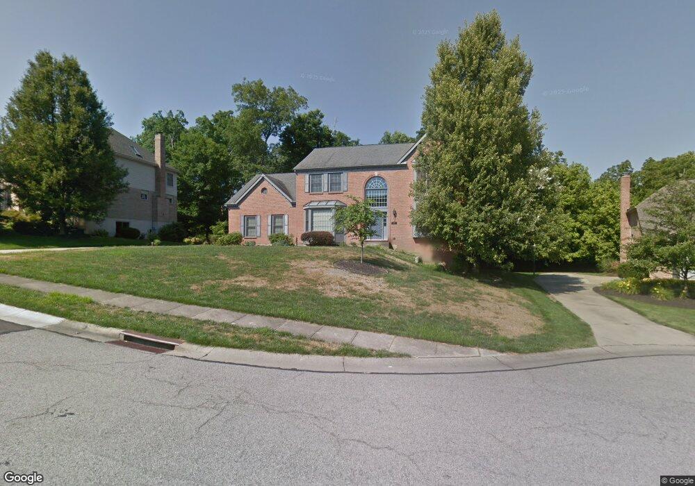
This home is located at 10191 Lewis Ln, Union, KY 41091 and is currently estimated at $493,782, approximately $163 per square foot. 10191 Lewis Ln is a home located in Boone County with nearby schools including Shirley Mann Elementary School, Gray Middle School, and Larry A. Ryle High School.
Ownership History
Date
Name
Owned For
Owner Type
Purchase Details
Closed on
Sep 27, 2011
Sold by
Federal National Mortgage Association
Bought by
Ikeda Chiaki
Current Estimated Value
Purchase Details
Closed on
May 21, 2010
Sold by
Burks James B and Burks Julia M
Bought by
Federal National Mortgage Association
Purchase Details
Closed on
Jun 17, 1994
Sold by
Drees Co
Bought by
Mealey Richard F and Mealey Donna E
Home Financials for this Owner
Home Financials are based on the most recent Mortgage that was taken out on this home.
Original Mortgage
$172,000
Interest Rate
8.52%
Mortgage Type
New Conventional
Create a Home Valuation Report for This Property
The Home Valuation Report is an in-depth analysis detailing your home's value as well as a comparison with similar homes in the area
Home Values in the Area
Average Home Value in this Area
Purchase History
| Date | Buyer | Sale Price | Title Company |
|---|---|---|---|
| Ikeda Chiaki | $168,000 | Kentucky Land Title Agency | |
| Federal National Mortgage Association | $186,667 | None Available | |
| Mealey Richard F | $235,850 | -- |
Source: Public Records
Mortgage History
| Date | Status | Borrower | Loan Amount |
|---|---|---|---|
| Previous Owner | Mealey Richard F | $172,000 |
Source: Public Records
Tax History Compared to Growth
Tax History
| Year | Tax Paid | Tax Assessment Tax Assessment Total Assessment is a certain percentage of the fair market value that is determined by local assessors to be the total taxable value of land and additions on the property. | Land | Improvement |
|---|---|---|---|---|
| 2024 | $3,796 | $338,700 | $35,000 | $303,700 |
| 2023 | $3,854 | $338,700 | $35,000 | $303,700 |
| 2022 | $3,339 | $297,410 | $35,000 | $262,410 |
| 2021 | $3,421 | $297,410 | $35,000 | $262,410 |
| 2020 | $3,405 | $297,410 | $35,000 | $262,410 |
| 2019 | $3,445 | $297,410 | $35,000 | $262,410 |
| 2018 | $3,468 | $297,410 | $35,000 | $262,410 |
| 2017 | $3,393 | $297,410 | $35,000 | $262,410 |
| 2015 | $3,352 | $297,410 | $35,000 | $262,410 |
| 2013 | -- | $245,000 | $30,000 | $215,000 |
Source: Public Records
Map
Nearby Homes
- 2011 Holderness Dr
- 10067 Hempsteade Dr
- 943 Lakepointe Ct
- 1110 Mount Zion Rd
- 10002 Irish Way
- 1449 R J Ln
- 10077 Russwill Ln
- 10208 Cedarwood Dr
- 760 Oakridge Dr
- 10445 Jasons Bluff
- 3 Lots Tiburon Dr
- 3832 Sonata Dr
- 985 Oakmont Ct
- 10880 Saint Andrews Dr
- 9807 Cherbourg Dr
- 1655 Frogtown Rd
- 1247 Adison Ridge
- 10481 Brookhurst Ln N
- 1134 Donner Dr
- 10723 Saint Leger Cir
- 10195 Lewis Ln
- 10187 Lewis Ln
- 10188 Waterside Ct
- 10184 Waterside Ct
- 10194 Lewis Ln
- 1024 Bayswater Dr
- 10192 Waterside Ct
- 10183 Lewis Ln
- 1018 Bayswater Dr
- 10190 Lewis Ln
- 2000 Holderness Dr
- 10186 Lewis Ln
- 10185 Waterside Ct
- 1014 Bayswater Dr
- 10189 Waterside Ct
- 10193 Waterside Ct
- 2004 Holderness Dr
- 2003 Holderness Dr
- 10204 Lewis Ln
- 10204 Lewis La