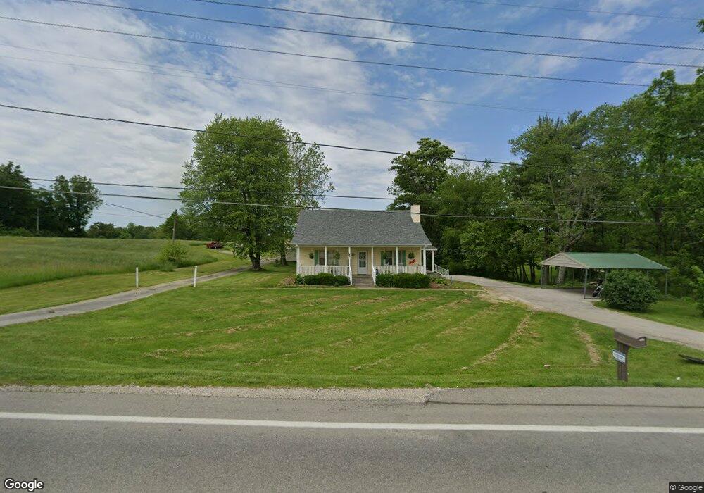
10199 Us Highway 231 Loogootee, IN 47553
Estimated Value: $203,000 - $286,000
3
Beds
3
Baths
1,620
Sq Ft
$144/Sq Ft
Est. Value
About This Home
This home is located at 10199 Us Highway 231, Loogootee, IN 47553 and is currently estimated at $232,905, approximately $143 per square foot. 10199 Us Highway 231 is a home located in Martin County with nearby schools including Loogootee Elementary School, Loogootee Middle School, and Loogootee Junior/Senior High School.
Ownership History
Date
Name
Owned For
Owner Type
Purchase Details
Closed on
May 23, 2017
Sold by
Greenwell Kenneth R and Greenwell Ruth A
Bought by
Wagoner Dennis L
Current Estimated Value
Purchase Details
Closed on
Jun 8, 2009
Sold by
Kenneth R Greenwell
Bought by
Colson Jason J and Colson Mary G
Purchase Details
Closed on
Jan 9, 2009
Sold by
Federal Home Loan Mortgage Corporation
Bought by
Kenneth Greenwell
Purchase Details
Closed on
Sep 24, 2008
Sold by
Anthony J Dant
Bought by
Leslie W Schickel
Create a Home Valuation Report for This Property
The Home Valuation Report is an in-depth analysis detailing your home's value as well as a comparison with similar homes in the area
Home Values in the Area
Average Home Value in this Area
Purchase History
| Date | Buyer | Sale Price | Title Company |
|---|---|---|---|
| Wagoner Dennis L | -- | -- | |
| Colson Jason J | $110,000 | -- | |
| Kenneth Greenwell | $31,500 | Statewide Title Company, Inc | |
| Leslie W Schickel | $78,000 | Feiwell & Hannoy |
Source: Public Records
Tax History Compared to Growth
Tax History
| Year | Tax Paid | Tax Assessment Tax Assessment Total Assessment is a certain percentage of the fair market value that is determined by local assessors to be the total taxable value of land and additions on the property. | Land | Improvement |
|---|---|---|---|---|
| 2024 | $2,261 | $148,000 | $13,300 | $134,700 |
| 2023 | $2,261 | $142,200 | $12,700 | $129,500 |
| 2022 | $1,802 | $132,300 | $12,100 | $120,200 |
| 2021 | $1,922 | $116,200 | $11,300 | $104,900 |
| 2020 | $1,822 | $109,800 | $10,900 | $98,900 |
| 2019 | $1,712 | $105,200 | $10,400 | $94,800 |
| 2018 | $1,715 | $101,400 | $10,100 | $91,300 |
| 2017 | $281 | $87,400 | $9,800 | $77,600 |
| 2016 | $258 | $85,600 | $9,600 | $76,000 |
| 2014 | $213 | $82,100 | $9,100 | $73,000 |
| 2013 | -- | $79,700 | $9,100 | $70,600 |
Source: Public Records
Map
Nearby Homes
- 690 E Southridge Rd
- 0 Friends Creek Rd
- 803 & 805 Reason Ave Unit INCLUDES 111 TRUELOV
- 513 Park St
- 108 SW 2nd St
- 419 SW 3rd St
- 102 Eastgate Ave
- 98+/- Acres U S 231
- 508 E Broadway St
- 501 E Main St
- 106 Queen St
- 1559 Scenic Hill Rd
- Lot 24 Country Court S D V
- Lot 6 Country Court S D V
- Lot 28 Country Court S D V
- Lot 12 Country Court S D V
- Lot 39 Country Court S D V
- Lot 7 Country Court S D V
- Lot 25 Country Court S D V
- Lot 20 Country Court S D V
- 10199 Us Highway 231
- 10199 Us Highway 231
- 10015 Us Highway 231
- 10009 Us Highway 231
- 10009 Us Highway 231 Unit S
- 10009 Us Highway 231
- 10297 Us Highway 231
- 10297 Us Highway 231
- 10399 Us Highway 231
- 10399 Us Highway 231
- 10431 Us Highway 231
- 10354 Us Highway 231
- 10469 Us Highway 231
- 540 Mount Pleasant Rd
- 10444 Us Highway 231
- 554 Mount Pleasant Rd
- 582 Mount Pleasant Rd
- 527 Mount Pleasant Rd
- 527 Mount Pleasant Rd
- 10086 Us Highway 231