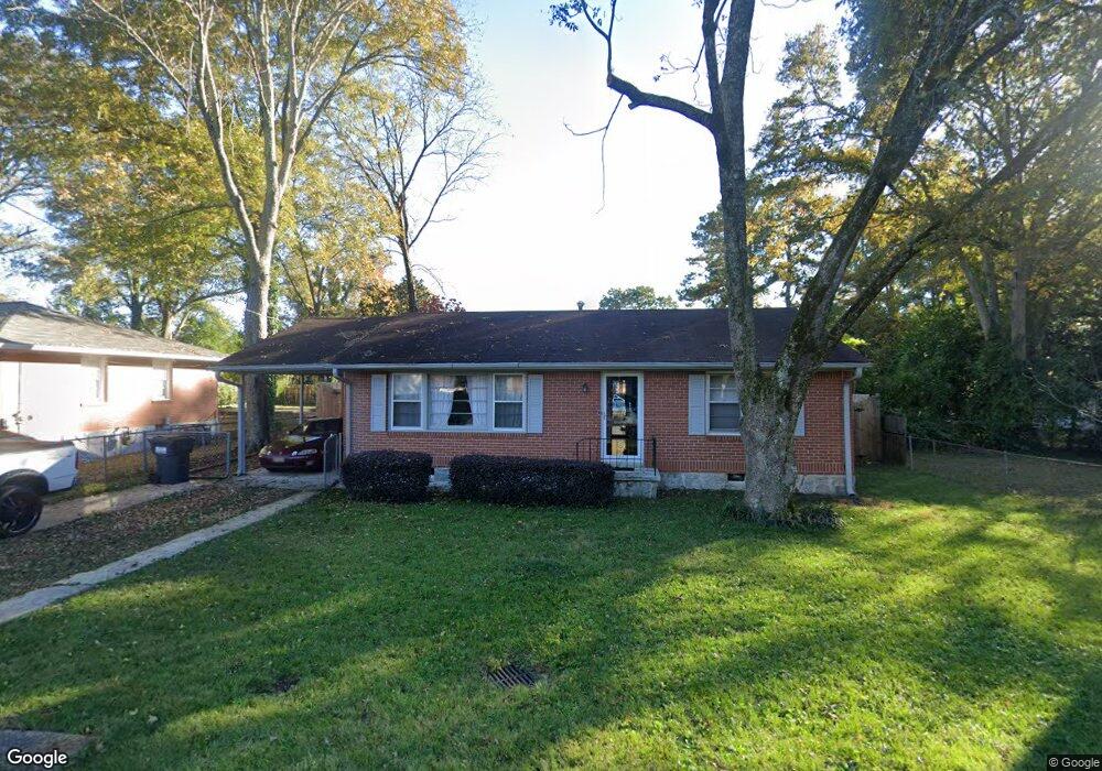
102 Adamson Dr Jonesboro, GA 30236
Estimated Value: $167,007 - $190,000
3
Beds
1
Bath
1,080
Sq Ft
$166/Sq Ft
Est. Value
About This Home
This home is located at 102 Adamson Dr, Jonesboro, GA 30236 and is currently estimated at $178,752, approximately $165 per square foot. 102 Adamson Dr is a home located in Clayton County with nearby schools including Lee Street Elementary School, Jonesboro Middle School, and Jonesboro High School.
Ownership History
Date
Name
Owned For
Owner Type
Purchase Details
Closed on
Oct 31, 2006
Sold by
Baldwin Cory E
Bought by
Meghee Larry P
Current Estimated Value
Home Financials for this Owner
Home Financials are based on the most recent Mortgage that was taken out on this home.
Original Mortgage
$75,200
Outstanding Balance
$44,581
Interest Rate
6.25%
Mortgage Type
New Conventional
Estimated Equity
$134,171
Purchase Details
Closed on
Aug 2, 2004
Sold by
Hooks Daniel W
Bought by
Baldwin Cory E
Home Financials for this Owner
Home Financials are based on the most recent Mortgage that was taken out on this home.
Original Mortgage
$89,000
Interest Rate
6.22%
Mortgage Type
New Conventional
Purchase Details
Closed on
Oct 8, 2003
Sold by
Hooks Evelyn E
Bought by
Hooks Daniel W and Hooks Timothy
Create a Home Valuation Report for This Property
The Home Valuation Report is an in-depth analysis detailing your home's value as well as a comparison with similar homes in the area
Home Values in the Area
Average Home Value in this Area
Purchase History
| Date | Buyer | Sale Price | Title Company |
|---|---|---|---|
| Meghee Larry P | $94,000 | -- | |
| Baldwin Cory E | $89,000 | -- | |
| Hooks Daniel W | -- | -- | |
| Hooks Daniel W | -- | -- |
Source: Public Records
Mortgage History
| Date | Status | Borrower | Loan Amount |
|---|---|---|---|
| Open | Meghee Larry P | $75,200 | |
| Previous Owner | Hooks Daniel W | $89,000 |
Source: Public Records
Tax History Compared to Growth
Tax History
| Year | Tax Paid | Tax Assessment Tax Assessment Total Assessment is a certain percentage of the fair market value that is determined by local assessors to be the total taxable value of land and additions on the property. | Land | Improvement |
|---|---|---|---|---|
| 2024 | $803 | $55,360 | $7,200 | $48,160 |
| 2023 | $1,762 | $48,800 | $7,200 | $41,600 |
| 2022 | $0 | $36,960 | $7,200 | $29,760 |
| 2021 | $289 | $28,800 | $7,200 | $21,600 |
| 2020 | $273 | $27,653 | $7,200 | $20,453 |
| 2019 | $229 | $25,109 | $5,600 | $19,509 |
| 2018 | $932 | $22,968 | $5,600 | $17,368 |
| 2017 | $744 | $18,286 | $5,600 | $12,686 |
| 2016 | $821 | $20,178 | $5,600 | $14,578 |
| 2015 | $962 | $0 | $0 | $0 |
| 2014 | $705 | $17,713 | $5,600 | $12,113 |
Source: Public Records
Map
Nearby Homes
- 130 Scarlett Dr
- 1170 Fifth Ave
- 135 5th Ave
- 408 N Mcdonough St
- 135 N Main St
- 9758 Highway 54
- 1198 Highway 138
- 1130 Georgia 138
- 1140 Spur 138
- 1198 Spur 138
- 961 Dixie Dr
- 1028 Dixie Dr
- 000 Beach Rd
- 7872 Tara Rd
- 1031 Lakeshore Dr
- 1250 Grove Pkwy
- 0 Lakeshore Dr Unit 10456397
- 139 Cecelia Cir
- 151 Irvin St
- 181 Dean St
- 104 Adamson Dr
- 110 Scarlett Dr
- 112 Scarlett Dr
- 0 Adamson Dr
- 101 Adamson Dr
- 114 Scarlett Dr
- 106 W Mimosa Dr
- 102 W Mimosa Dr
- 103 Adamson Dr
- 110 W Mimosa Dr
- 116 Scarlett Dr
- 111 Scarlett Dr
- 113 Scarlett Dr
- 109 Scarlett Dr
- 113 Woodhaven Dr
- 117 Woodhaven Dr
- W W Mimosa Dr
- 115 Woodhaven Dr
- 118 W Mimosa Dr
- 119 Woodhaven Dr