Estimated Value: $213,000 - $290,000
3
Beds
2
Baths
1,786
Sq Ft
$140/Sq Ft
Est. Value
About This Home
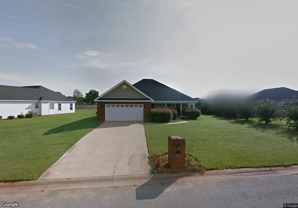
This home is located at 102 Ainsley Way, Byron, GA 31008 and is currently estimated at $250,714, approximately $140 per square foot. 102 Ainsley Way is a home located in Peach County with nearby schools including Kay Road Elementary School, Fort Valley Middle School, and Peach County High School.
Ownership History
Date
Name
Owned For
Owner Type
Purchase Details
Closed on
Nov 6, 2008
Sold by
Monte Carlo Homes Inc
Bought by
Story Carl M
Current Estimated Value
Home Financials for this Owner
Home Financials are based on the most recent Mortgage that was taken out on this home.
Original Mortgage
$100,000
Outstanding Balance
$24,562
Interest Rate
5.89%
Mortgage Type
New Conventional
Estimated Equity
$226,152
Purchase Details
Closed on
May 16, 2006
Sold by
Cottonwood Land Corporation
Bought by
Monte Carlo Homes Inc
Purchase Details
Closed on
Jun 3, 2003
Bought by
Cottonwood Land Corporation
Create a Home Valuation Report for This Property
The Home Valuation Report is an in-depth analysis detailing your home's value as well as a comparison with similar homes in the area
Home Values in the Area
Average Home Value in this Area
Purchase History
| Date | Buyer | Sale Price | Title Company |
|---|---|---|---|
| Story Carl M | $135,000 | -- | |
| Monte Carlo Homes Inc | -- | -- | |
| Cottonwood Land Corporation | -- | -- |
Source: Public Records
Mortgage History
| Date | Status | Borrower | Loan Amount |
|---|---|---|---|
| Open | Story Carl M | $100,000 |
Source: Public Records
Tax History Compared to Growth
Tax History
| Year | Tax Paid | Tax Assessment Tax Assessment Total Assessment is a certain percentage of the fair market value that is determined by local assessors to be the total taxable value of land and additions on the property. | Land | Improvement |
|---|---|---|---|---|
| 2024 | $2,639 | $75,440 | $10,000 | $65,440 |
| 2023 | $2,593 | $73,680 | $10,000 | $63,680 |
| 2022 | $1,710 | $65,520 | $10,000 | $55,520 |
| 2021 | $1,697 | $56,360 | $10,000 | $46,360 |
| 2020 | $1,791 | $59,360 | $10,000 | $49,360 |
| 2019 | $1,754 | $57,920 | $10,000 | $47,920 |
| 2018 | $1,612 | $53,120 | $10,000 | $43,120 |
| 2017 | $1,620 | $53,120 | $10,000 | $43,120 |
| 2016 | $1,613 | $53,120 | $10,000 | $43,120 |
| 2015 | $1,616 | $53,120 | $10,000 | $43,120 |
| 2014 | $1,618 | $53,120 | $10,000 | $43,120 |
| 2013 | -- | $53,120 | $10,000 | $43,120 |
Source: Public Records
Map
Nearby Homes
- 199 Red Tail Cir
- 109 Red Tail Cir
- 107 Red Tail Cir
- 152 Hawks Ridge Trace
- 120 Hawks Ridge Trace
- 120 Hawks Place
- 127 Hawks Ridge Trace
- 117 Hawks Ridge Trace
- 219 Rowland Cir
- 127 Erin Ct
- 0 Barker Rd Unit 243030
- 0 Barker Rd Unit 14258525
- 0 Barker Rd Unit 175053
- 0 Housers Mill Rd Unit 5515996
- 81 Idell Ct
- 24C Sterling Dr
- 800 John E Sullivan Rd
- 104 Ainsley Way
- 104 Schroer Dr
- 106 Ainsley Way
- 102 Schroer Dr
- 306 Brandon Way
- 0 Schroer Dr Unit 8772649
- 0 Schroer Dr Unit 8345729
- 0 Schroer Dr Unit 8140552
- 0 Schroer Dr Unit 7466376
- 103 Ainsley Way
- 100 Schroer Dr
- 108 Ainsley Way
- 108 Ainsley Way Unit 65
- 105 Ainsley Way
- 105 Ainsley Way Unit 111
- Lot 25 & 71 Schroer Dr
- Lot 70 & 69 Schroer Dr
- 107 Ainsley Way
- 109 Ainsley Way
- 105 Schroer Dr