
Seller's Agent in 2026
Rocio Mena
HomeSmart Connect LLC
(224) 489-4046
5 in this area
192 Total Sales
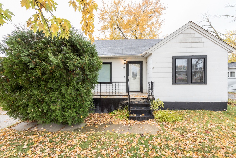
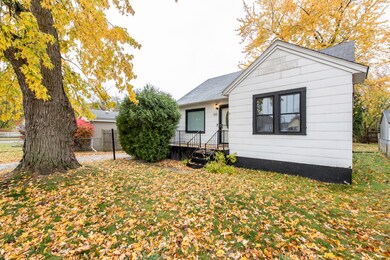

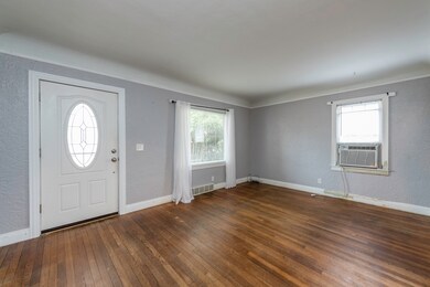
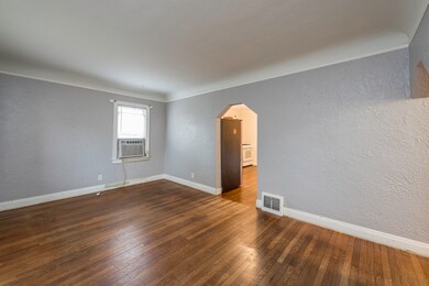
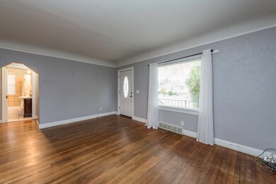
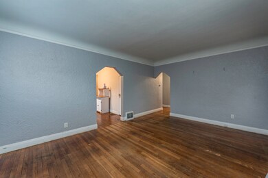
Bring your vision to live on this... solid 3-bed, 1.5-bath home with tons of potential for the right buyer. Perfect for an investor, flipper, or anyone looking to build instant equity with some updates and repairs. This property features a spacious kitchen, full basement, large yard, and additional finished attic space that could be reimagined. Good layout, good bones, and located on a quiet street near schools, parks, and shopping. Whether you're looking for your next project or a starter home you can make your own, this is a great chance to get into the market at a low price and add value fast. Property sold as-is. Cash, conventional, or rehab financing preferred.
Last Agent to Sell the Property
HomeSmart Connect LLC License #475160353 Listed on: 11/09/2025
| Date | Type | Sale Price | Title Company |
|---|---|---|---|
| Warranty Deed | $190,000 | Chicago Title | |
| Executors Deed | $141,000 | First American Title |
| Date | Status | Loan Amount | Loan Type |
|---|---|---|---|
| Open | $180,500 | New Conventional | |
| Previous Owner | $138,100 | Purchase Money Mortgage |
| Date | Event | Price | List to Sale | Price per Sq Ft |
|---|---|---|---|---|
| 01/02/2026 01/02/26 | Sold | $190,000 | +0.1% | $193 / Sq Ft |
| 11/21/2025 11/21/25 | Pending | -- | -- | -- |
| 11/09/2025 11/09/25 | For Sale | $189,900 | -- | $193 / Sq Ft |
| Year | Tax Paid | Tax Assessment Tax Assessment Total Assessment is a certain percentage of the fair market value that is determined by local assessors to be the total taxable value of land and additions on the property. | Land | Improvement |
|---|---|---|---|---|
| 2024 | $3,529 | $50,731 | $9,255 | $41,476 |
| 2023 | $3,456 | $45,421 | $8,287 | $37,134 |
| 2022 | $3,456 | $41,349 | $7,635 | $33,714 |
| 2021 | $3,062 | $35,367 | $6,522 | $28,845 |
| 2020 | $3,055 | $32,949 | $6,076 | $26,873 |
| 2019 | $3,022 | $30,193 | $5,568 | $24,625 |
| 2018 | $2,913 | $28,911 | $7,165 | $21,746 |
| 2017 | $2,785 | $25,578 | $6,339 | $19,239 |
| 2016 | $2,507 | $22,226 | $5,508 | $16,718 |
| 2015 | $2,347 | $19,893 | $4,930 | $14,963 |
| 2014 | $1,694 | $20,165 | $5,111 | $15,054 |
| 2012 | $2,660 | $21,848 | $5,538 | $16,310 |
Seller's Agent in 2026
Rocio Mena
HomeSmart Connect LLC
(224) 489-4046
5 in this area
192 Total Sales
P
Buyer's Agent in 2026
Patricia Contreras-Gebien
Baird Warner
(847) 392-1855
1 in this area
4 Total Sales
Source: Midwest Real Estate Data (MRED)
MLS Number: 12514407
APN: 08-19-402-023
Disclaimer: Certain information contained herein is derived from information provided by parties other than Homes.com. All information provided is deemed reliable, but is not guaranteed to be accurate and should be independently verified.
![]() Based on information submitted to the MLS GRID. All data is obtained from various sources and may not have been verified by broker or MLS GRID. Supplied Open House Information is subject to change without notice. All information should be independently reviewed and verified for accuracy. Properties may or may not be listed by the office/agent presenting the information. Some IDX listings have been excluded from this website.
Based on information submitted to the MLS GRID. All data is obtained from various sources and may not have been verified by broker or MLS GRID. Supplied Open House Information is subject to change without notice. All information should be independently reviewed and verified for accuracy. Properties may or may not be listed by the office/agent presenting the information. Some IDX listings have been excluded from this website.
Based on information submitted to the MLS GRID
Ask me questions while you tour the home.