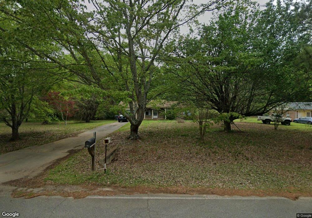
102 Brandywine Dr Forsyth, GA 31029
Estimated Value: $111,000 - $196,000
--
Bed
1
Bath
1,025
Sq Ft
$158/Sq Ft
Est. Value
About This Home
This home is located at 102 Brandywine Dr, Forsyth, GA 31029 and is currently estimated at $161,878, approximately $157 per square foot. 102 Brandywine Dr is a home located in Monroe County with nearby schools including Katherine B. Sutton Elementary School and Mary Persons High School.
Ownership History
Date
Name
Owned For
Owner Type
Purchase Details
Closed on
Mar 2, 2017
Bought by
Kinnard Kristin N
Current Estimated Value
Home Financials for this Owner
Home Financials are based on the most recent Mortgage that was taken out on this home.
Original Mortgage
$58,058
Outstanding Balance
$48,172
Interest Rate
4.19%
Mortgage Type
New Conventional
Estimated Equity
$113,706
Purchase Details
Closed on
Oct 4, 2016
Bought by
Usda Rural Development
Purchase Details
Closed on
Sep 11, 1990
Sold by
Emar Builders Inc
Bought by
Pritchett Dorothy C Est
Create a Home Valuation Report for This Property
The Home Valuation Report is an in-depth analysis detailing your home's value as well as a comparison with similar homes in the area
Home Values in the Area
Average Home Value in this Area
Purchase History
| Date | Buyer | Sale Price | Title Company |
|---|---|---|---|
| Kinnard Kristin N | $46,000 | -- | |
| Usda Rural Development | -- | -- | |
| Pritchett Dorothy C Est | $7,200 | -- |
Source: Public Records
Mortgage History
| Date | Status | Borrower | Loan Amount |
|---|---|---|---|
| Open | Kinnard Kristin N | $58,058 |
Source: Public Records
Tax History Compared to Growth
Tax History
| Year | Tax Paid | Tax Assessment Tax Assessment Total Assessment is a certain percentage of the fair market value that is determined by local assessors to be the total taxable value of land and additions on the property. | Land | Improvement |
|---|---|---|---|---|
| 2024 | $936 | $31,040 | $5,600 | $25,440 |
| 2023 | $901 | $28,920 | $5,600 | $23,320 |
| 2022 | $855 | $28,920 | $5,600 | $23,320 |
| 2021 | $883 | $28,920 | $5,600 | $23,320 |
| 2020 | $918 | $28,920 | $5,600 | $23,320 |
| 2019 | $924 | $28,920 | $5,600 | $23,320 |
| 2018 | $927 | $28,920 | $5,600 | $23,320 |
| 2017 | $834 | $26,000 | $4,800 | $21,200 |
| 2016 | $796 | $26,000 | $4,800 | $21,200 |
| 2015 | $759 | $26,000 | $4,800 | $21,200 |
| 2014 | $748 | $26,000 | $4,800 | $21,200 |
Source: Public Records
Map
Nearby Homes
- 4631 Capulet Ct Unit 331
- 4631 Capulet Ct
- 47 Ensign Rd
- 81 Langston Ave
- 24 George St
- 3487 Georgia 42
- 3271 Georgia 42
- 3471 Georgia 42
- 397 Ensign Rd
- 225 N Indian Springs Dr
- 84 Hillsdale Rd
- 200 Indian Springs Dr
- 5407 Felles Way Unit 356
- 5399 Felles Way Unit 358
- 5399 Felles Way
- 5393 Felles Way Unit 359
- 205 Solomon St
- 5387 Felles Way
- 5387 Felles Way Unit 360
- 4616 Capulet Ct
- 102 Brandywine Dr Unit 116
- 114 Brandywine Dr
- 92 Brandywine Dr
- 134 Brandywine Dr
- 101 Brandywine Dr
- 76 Brandywine Dr
- 111 Brandywine Dr
- 85 Brandywine Dr
- 121 Brandywine Dr
- 66 Brandywine Dr
- 79 Brandywine Dr
- 146 Brandywine Dr
- 137 Brandywine Dr
- 69 Brandywine Dr
- 56 Brandywine Dr
- 147 Brandywine Dr
- 156 Brandywine Dr
- 59 Brandywine Dr
- 44 Brandywine Dr
- 159 Brandywine Dr