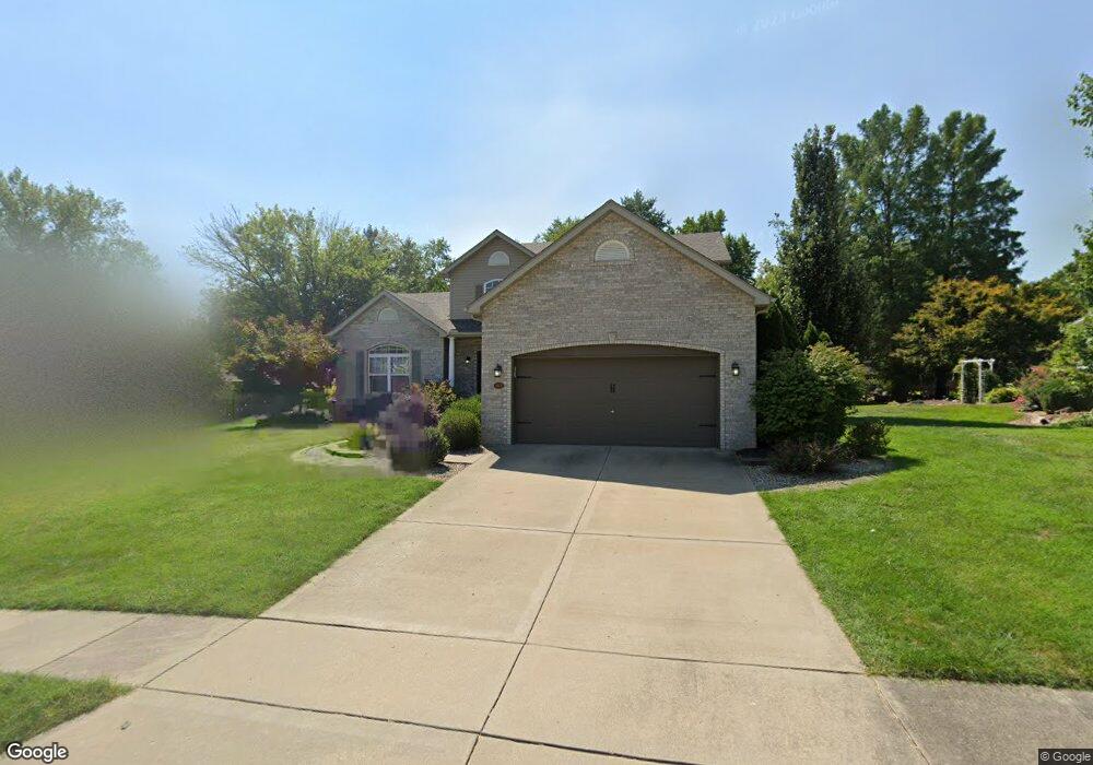
102 Burns Farm West Ct Edwardsville, IL 62025
Estimated Value: $397,000 - $438,000
5
Beds
5
Baths
558
Sq Ft
$748/Sq Ft
Est. Value
About This Home
This home is located at 102 Burns Farm West Ct, Edwardsville, IL 62025 and is currently estimated at $417,132, approximately $747 per square foot. 102 Burns Farm West Ct is a home located in Madison County with nearby schools including LeClaire Elementary School, Columbus Elementary School, and Liberty Middle School.
Ownership History
Date
Name
Owned For
Owner Type
Purchase Details
Closed on
Aug 19, 2011
Sold by
Churchwell Mark S and Churchwell Jennifer D
Bought by
Wiese Michael J and Wiese Aimee E
Current Estimated Value
Home Financials for this Owner
Home Financials are based on the most recent Mortgage that was taken out on this home.
Original Mortgage
$246,586
Outstanding Balance
$168,165
Interest Rate
4.25%
Mortgage Type
FHA
Estimated Equity
$248,967
Purchase Details
Closed on
Jul 19, 2007
Sold by
Presley Jennifer
Bought by
Churchwell Mark S and Churchwell Jennifer D
Home Financials for this Owner
Home Financials are based on the most recent Mortgage that was taken out on this home.
Original Mortgage
$343,500
Interest Rate
6.7%
Mortgage Type
Unknown
Create a Home Valuation Report for This Property
The Home Valuation Report is an in-depth analysis detailing your home's value as well as a comparison with similar homes in the area
Home Values in the Area
Average Home Value in this Area
Purchase History
| Date | Buyer | Sale Price | Title Company |
|---|---|---|---|
| Wiese Michael J | $253,000 | Abstracts & Titles Inc | |
| Churchwell Mark S | $235,000 | Abstracts & Titles Inc |
Source: Public Records
Mortgage History
| Date | Status | Borrower | Loan Amount |
|---|---|---|---|
| Open | Wiese Michael J | $246,586 | |
| Previous Owner | Churchwell Mark S | $343,500 |
Source: Public Records
Tax History Compared to Growth
Tax History
| Year | Tax Paid | Tax Assessment Tax Assessment Total Assessment is a certain percentage of the fair market value that is determined by local assessors to be the total taxable value of land and additions on the property. | Land | Improvement |
|---|---|---|---|---|
| 2024 | $7,925 | $117,010 | $19,440 | $97,570 |
| 2023 | $7,925 | $108,580 | $18,040 | $90,540 |
| 2022 | $7,430 | $100,370 | $16,680 | $83,690 |
| 2021 | $6,636 | $95,260 | $15,830 | $79,430 |
| 2020 | $6,421 | $92,310 | $15,340 | $76,970 |
| 2019 | $6,373 | $90,760 | $15,080 | $75,680 |
| 2018 | $6,262 | $86,690 | $14,410 | $72,280 |
| 2017 | $6,091 | $84,860 | $14,110 | $70,750 |
| 2016 | $5,506 | $84,860 | $14,110 | $70,750 |
| 2015 | $5,265 | $78,670 | $13,080 | $65,590 |
| 2014 | $5,265 | $78,670 | $13,080 | $65,590 |
| 2013 | $5,265 | $78,670 | $13,080 | $65,590 |
Source: Public Records
Map
Nearby Homes
- 1120 Franklin Ave
- 424 Circle Dr
- 4 Hadley Ct
- 629 Bollman Ave
- 808 Meade Ave
- 311 Barnett Dr
- 105 Barnett Dr
- 424 Hadley Ave
- 114 Barnett Dr
- 426 Roanoke Dr
- 503 Bollman Ave
- 821 Sherman Ave
- 417 Montclaire Ave
- 714 Sherman Ave
- 638 Yale Ave
- 221 4th Ave
- 502 Jaime Lynn Ct
- 613 Jaime Lynn Ct
- 514 Gueltig Ave
- 500 Monticello Place
- 102 Burns Farm Ct W
- 101 Burns Farm West Ct
- 103 Burns Farm West Ct
- 97 Burns Farm Blvd
- 101 Burns Farm Ct W
- 107 Burns Farm West Ct
- 104 Burns Farm West Ct
- 106 Burns Farm West Ct
- 1053 Franklin Ave
- 107 Burns Farm West Ct
- 95 Burns Farm Blvd
- 105 Burns Farm West Ct
- 102 Burns Farm Blvd
- 100 Burns Farm Blvd
- 108 Burns Farm Blvd
- 1041 Franklin Ave
- 1101 Franklin Ave
- 110 Burns Farm Blvd
- 1027 Franklin Ave
- 202 Burns Farm Blvd N