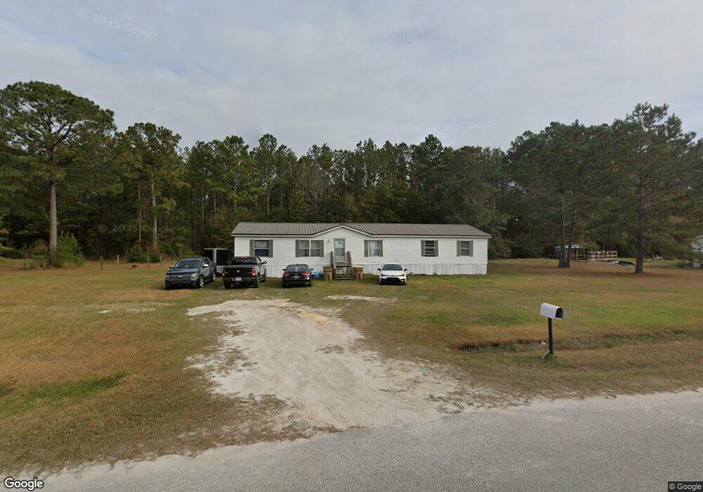
102 Burnt Tree Dr Guyton, GA 31312
Estimated Value: $76,432 - $511,000
--
Bed
--
Bath
1,960
Sq Ft
$109/Sq Ft
Est. Value
About This Home
This home is located at 102 Burnt Tree Dr, Guyton, GA 31312 and is currently estimated at $213,358, approximately $108 per square foot. 102 Burnt Tree Dr is a home located in Effingham County with nearby schools including Marlow Elementary School, South Effingham Middle School, and South Effingham High School.
Ownership History
Date
Name
Owned For
Owner Type
Purchase Details
Closed on
Apr 29, 2014
Sold by
Lorwill Land Corp
Bought by
Woods Michael Keith
Current Estimated Value
Home Financials for this Owner
Home Financials are based on the most recent Mortgage that was taken out on this home.
Original Mortgage
$24,000
Interest Rate
4.44%
Mortgage Type
New Conventional
Purchase Details
Closed on
Feb 6, 1998
Bought by
Lorwill Land Corp Etal
Create a Home Valuation Report for This Property
The Home Valuation Report is an in-depth analysis detailing your home's value as well as a comparison with similar homes in the area
Home Values in the Area
Average Home Value in this Area
Purchase History
| Date | Buyer | Sale Price | Title Company |
|---|---|---|---|
| Woods Michael Keith | $32,000 | -- | |
| Lorwill Land Corp Etal | $110,800 | -- |
Source: Public Records
Mortgage History
| Date | Status | Borrower | Loan Amount |
|---|---|---|---|
| Closed | Woods Michael Keith | $24,000 |
Source: Public Records
Tax History Compared to Growth
Tax History
| Year | Tax Paid | Tax Assessment Tax Assessment Total Assessment is a certain percentage of the fair market value that is determined by local assessors to be the total taxable value of land and additions on the property. | Land | Improvement |
|---|---|---|---|---|
| 2025 | $884 | $26,633 | $22,800 | $3,833 |
| 2024 | $884 | $14,960 | $12,806 | $2,154 |
| 2023 | $797 | $11,714 | $0 | $11,714 |
| 2022 | $806 | $14,960 | $12,000 | $2,960 |
| 2021 | $727 | $12,960 | $10,000 | $2,960 |
| 2020 | $694 | $12,960 | $10,000 | $2,960 |
| 2019 | $692 | $12,960 | $10,000 | $2,960 |
| 2018 | $625 | $10,960 | $8,000 | $2,960 |
| 2017 | $620 | $10,960 | $8,000 | $2,960 |
| 2016 | $604 | $10,960 | $8,000 | $2,960 |
| 2015 | -- | $16,652 | $6,400 | $10,252 |
| 2014 | -- | $14,252 | $4,000 | $10,252 |
Source: Public Records
Map
Nearby Homes
- 0 Low Ground Rd Unit 10630626
- 0 Low Ground Rd Unit 25321474
- 1379 Low Ground Rd
- 268 Appaloosa Way
- 1367 Low Ground Rd
- 100 Saratoga Dr
- 297 Horsepen Rd
- 128 Aquaduct Dr
- 189 Little Horsepen Rd
- 131 Saratoga Dr
- 105 Santa Anita Way
- 05 Little McCall Rd
- 06 Little McCall Rd
- 106 Meadowlands Dr
- 111 Oaklawn Dr
- 223 Blandford Crossing
- 105 Willow Dr
- 203 Timberlake Dr
- 208 Timberlake Dr
- 100 Cravey Ln
- 104 Burnt Tree Dr
- 100 Burnt Tree Dr
- 105 Burnt Tree Dr
- 0 Low Ground Rd Unit B 8439066
- 0 Low Ground Rd Unit 8426076
- 0 Low Ground Rd Unit Parcel A 8399628
- 0 Low Ground Rd Unit 48308
- 0 Low Ground Rd Unit 48293
- 0 Low Ground Rd Unit 48229
- 0 Low Ground Rd Unit 48232
- 0 Low Ground Rd Unit 48282
- 0 Low Ground Rd Unit 48227
- 0 Low Ground Rd Unit 48226
- 0 Low Ground Rd Unit 48283
- 0 Low Ground Rd Unit 48278
- 0 Low Ground Rd Unit 48284
- 0 Low Ground Rd Unit 48228
- 0 Low Ground Rd Unit 48121
- 0 Low Ground Rd Unit 76993
- 0 Low Ground Rd Unit 78214