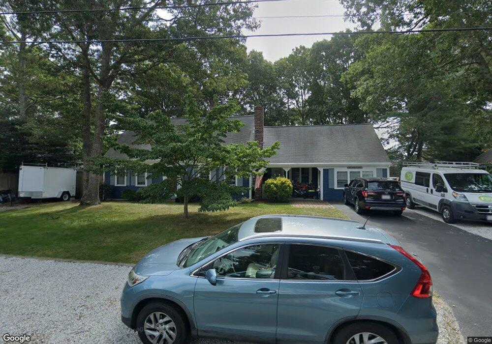
102 Captain Noyes Rd South Yarmouth, MA 02664
South Yarmouth NeighborhoodEstimated Value: $655,000 - $720,000
4
Beds
3
Baths
1,920
Sq Ft
$354/Sq Ft
Est. Value
About This Home
This home is located at 102 Captain Noyes Rd, South Yarmouth, MA 02664 and is currently estimated at $678,912, approximately $353 per square foot. 102 Captain Noyes Rd is a home located in Barnstable County with nearby schools including Dennis-Yarmouth Regional High School and St. Pius X. School.
Ownership History
Date
Name
Owned For
Owner Type
Purchase Details
Closed on
May 16, 1994
Sold by
Swanson Elizabeth H
Bought by
Desouza Jose F and Desouza Cathleen E
Current Estimated Value
Home Financials for this Owner
Home Financials are based on the most recent Mortgage that was taken out on this home.
Original Mortgage
$54,500
Interest Rate
7.93%
Mortgage Type
Purchase Money Mortgage
Create a Home Valuation Report for This Property
The Home Valuation Report is an in-depth analysis detailing your home's value as well as a comparison with similar homes in the area
Home Values in the Area
Average Home Value in this Area
Purchase History
| Date | Buyer | Sale Price | Title Company |
|---|---|---|---|
| Desouza Jose F | $100,000 | -- |
Source: Public Records
Mortgage History
| Date | Status | Borrower | Loan Amount |
|---|---|---|---|
| Closed | Desouza Jose F | $49,000 | |
| Closed | Desouza Jose F | $54,500 |
Source: Public Records
Tax History Compared to Growth
Tax History
| Year | Tax Paid | Tax Assessment Tax Assessment Total Assessment is a certain percentage of the fair market value that is determined by local assessors to be the total taxable value of land and additions on the property. | Land | Improvement |
|---|---|---|---|---|
| 2025 | $4,155 | $586,800 | $178,900 | $407,900 |
| 2024 | $3,817 | $517,200 | $151,300 | $365,900 |
| 2023 | $4,127 | $508,900 | $131,000 | $377,900 |
| 2022 | $3,711 | $404,300 | $119,000 | $285,300 |
| 2021 | $3,635 | $380,200 | $119,000 | $261,200 |
| 2020 | $3,487 | $348,700 | $119,000 | $229,700 |
| 2019 | $3,258 | $322,600 | $119,000 | $203,600 |
| 2018 | $3,138 | $305,000 | $101,400 | $203,600 |
| 2017 | $3,012 | $300,600 | $97,000 | $203,600 |
| 2016 | $2,912 | $291,800 | $88,200 | $203,600 |
| 2015 | $2,799 | $278,800 | $88,200 | $190,600 |
Source: Public Records
Map
Nearby Homes
- 35 Captain Percival Rd
- 48 Captain Dore Rd
- 18 Captain Stanley Rd
- 49 Captain Besse Rd
- 147 Captain Bacon Rd
- 24 Fast Brook Rd
- 21 Hazelmoor Rd
- 72 Quartermaster Row
- 3 Saturn Ln
- 11 Bob-O-link Ln
- 33 Sparrow Way
- 68 Bob-O-link Ln
- 299 Winslow Gray Rd
- 299-301 Winslow Gray Rd
- 33 Lake Rd
- 22 Powhatan Rd
- 15 Sharon Rd
- 0 Forsyth Ave
- 7 Sunset Pines Rd
- 23 Circuit Rd N
- 108 Captain Noyes Rd
- 82 Swift Brook Rd
- 96 Captain Noyes Rd
- 76 Swift Brook Rd
- 120 Winding Brook Rd
- 101 Captain Noyes Rd
- 58 Capt Blount Rd
- 112 Captain Noyes Rd
- 58 Captain Blount Rd
- 298 Captain Noyes Rd
- 72 Swift Brook Rd
- 58 Village Brook Rd
- 125 Winding Brook Rd
- 51 Captain Percival Rd
- 112 Winding Brook Rd
- 89 Captain Noyes Rd
- 129 Winding Brook Rd
- 119 Winding Brook Rd
- 73 Swift Brook Rd
- 118 Captain Noyes Rd