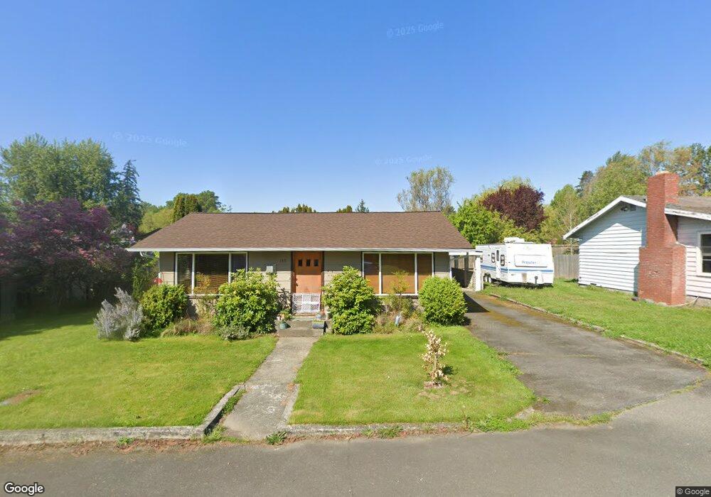
102 Carter Dr Bellingham, WA 98225
Birchwood NeighborhoodEstimated Value: $512,606 - $648,000
2
Beds
1
Bath
815
Sq Ft
$681/Sq Ft
Est. Value
About This Home
This home is located at 102 Carter Dr, Bellingham, WA 98225 and is currently estimated at $555,152, approximately $681 per square foot. 102 Carter Dr is a home located in Whatcom County with nearby schools including Birchwood Elementary School, Shuksan Middle School, and Bellingham High School.
Ownership History
Date
Name
Owned For
Owner Type
Purchase Details
Closed on
Sep 8, 2010
Sold by
Smyth Geoffrey M
Bought by
Myers Newell Willow
Current Estimated Value
Home Financials for this Owner
Home Financials are based on the most recent Mortgage that was taken out on this home.
Original Mortgage
$152,900
Outstanding Balance
$101,169
Interest Rate
4.48%
Mortgage Type
New Conventional
Estimated Equity
$453,983
Purchase Details
Closed on
Sep 7, 2010
Sold by
Newell Bradley G
Bought by
Myers Newell Willow
Home Financials for this Owner
Home Financials are based on the most recent Mortgage that was taken out on this home.
Original Mortgage
$152,900
Outstanding Balance
$101,169
Interest Rate
4.48%
Mortgage Type
New Conventional
Estimated Equity
$453,983
Create a Home Valuation Report for This Property
The Home Valuation Report is an in-depth analysis detailing your home's value as well as a comparison with similar homes in the area
Home Values in the Area
Average Home Value in this Area
Purchase History
| Date | Buyer | Sale Price | Title Company |
|---|---|---|---|
| Myers Newell Willow | $247,280 | Whatcom Land Title | |
| Myers Newell Willow | -- | Whatcom Land Title |
Source: Public Records
Mortgage History
| Date | Status | Borrower | Loan Amount |
|---|---|---|---|
| Open | Myers Newell Willow | $152,900 |
Source: Public Records
Tax History Compared to Growth
Tax History
| Year | Tax Paid | Tax Assessment Tax Assessment Total Assessment is a certain percentage of the fair market value that is determined by local assessors to be the total taxable value of land and additions on the property. | Land | Improvement |
|---|---|---|---|---|
| 2024 | $3,421 | $420,906 | $218,015 | $202,891 |
| 2023 | $3,421 | $439,413 | $227,601 | $211,812 |
| 2022 | $2,959 | $385,450 | $199,650 | $185,800 |
| 2021 | $2,213 | $318,554 | $165,000 | $153,554 |
| 2020 | $2,140 | $224,881 | $116,828 | $108,053 |
| 2019 | $1,914 | $210,153 | $109,238 | $100,915 |
| 2018 | $1,981 | $188,498 | $97,988 | $90,510 |
| 2017 | $1,723 | $166,784 | $86,700 | $80,084 |
| 2016 | $1,576 | $151,631 | $78,900 | $72,731 |
| 2015 | $1,667 | $144,367 | $75,000 | $69,367 |
| 2014 | -- | $147,762 | $72,240 | $75,522 |
| 2013 | -- | $141,909 | $70,000 | $71,909 |
Source: Public Records
Map
Nearby Homes
- 2829 Cottonwood Ave
- 2850 W Maplewood Ave
- 3057 Mcleod Rd
- 2715 W Maplewood Ave Unit 122
- 2713 W Maplewood Ave Unit 311
- 3085 W Maplewood Ave
- 3333 Redwood Ave Unit 9
- 3222 Mcleod Rd
- 2817 Mcleod Rd
- 2812 Nome St
- 3352 Northwest Ave Unit 2101
- 3350 Northwest Ave Unit 1102
- 2833 Mcleod Rd
- 3222 Locust Ave
- 2705 W Maryland St
- 3410 Forest Ct
- 2721 Mcleod Rd
- 3305 Hollywood Ave
- 3333 Hollywood Ave
- 3319 Hollywood Ave
- 104 Carter Dr
- 100 Carter Dr
- 3035 Cottonwood Ave
- 106 Carter Dr
- 103 Carter Dr
- 3037 Cottonwood Ave
- 105 Carter Dr
- 101 Carter Dr
- 3024 Cottonwood Ave
- 107 Carter Dr
- 3028 Cottonwood Ave
- 3020 Cottonwood Ave
- 109 Carter Dr
- 110 Carter Dr
- 3103 Cottonwood Ave
- 3032 Cottonwood Ave
- 3017 Cottonwood Ave
- 3036 Cottonwood Ave
- 3016 Cottonwood Ave
- 3105 Cottonwood Ave