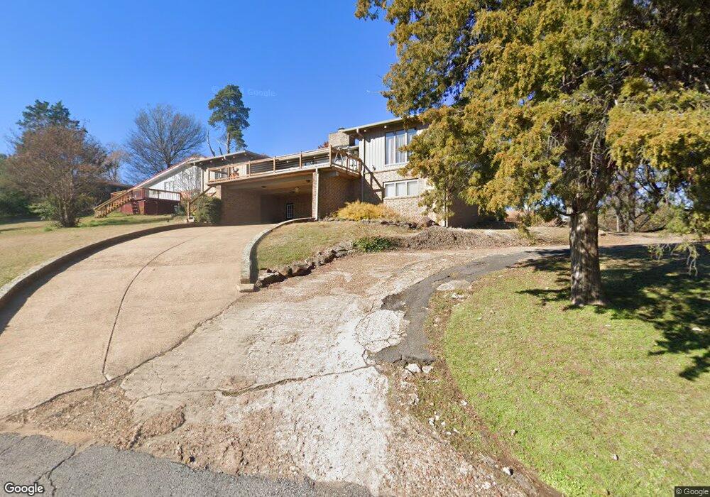
102 Cedarcrest Dr Morrilton, AR 72110
Estimated Value: $186,000 - $269,000
Studio
2
Baths
2,467
Sq Ft
$97/Sq Ft
Est. Value
About This Home
This home is located at 102 Cedarcrest Dr, Morrilton, AR 72110 and is currently estimated at $240,053, approximately $97 per square foot. 102 Cedarcrest Dr is a home located in Conway County with nearby schools including Morrilton Primary School, Morrilton Elementary School, and Morrilton Intermediate School.
Ownership History
Date
Name
Owned For
Owner Type
Purchase Details
Closed on
Feb 23, 2009
Sold by
Arey Dewell Franklin and Arey Anita Jo
Bought by
Lee Brian and Cooper Kimberly Michelle
Current Estimated Value
Home Financials for this Owner
Home Financials are based on the most recent Mortgage that was taken out on this home.
Original Mortgage
$104,000
Interest Rate
5.13%
Purchase Details
Closed on
Oct 18, 2000
Bought by
Arey Dewell F and Arey Iii
Purchase Details
Closed on
Dec 28, 1998
Bought by
Brown Larry R
Purchase Details
Closed on
Jan 1, 1984
Bought by
Holmes Holmes B and Holmes W
Create a Home Valuation Report for This Property
The Home Valuation Report is an in-depth analysis detailing your home's value as well as a comparison with similar homes in the area
Home Values in the Area
Average Home Value in this Area
Purchase History
| Date | Buyer | Sale Price | Title Company |
|---|---|---|---|
| Lee Brian | -- | -- | |
| Arey Dewell F | $128,000 | -- | |
| Brown Larry R | $125,000 | -- | |
| Holmes Holmes B | -- | -- |
Source: Public Records
Mortgage History
| Date | Status | Borrower | Loan Amount |
|---|---|---|---|
| Open | Holmes Holmes B | $83,861 | |
| Closed | Lee Brian | $104,000 |
Source: Public Records
Tax History
| Year | Tax Paid | Tax Assessment Tax Assessment Total Assessment is a certain percentage of the fair market value that is determined by local assessors to be the total taxable value of land and additions on the property. | Land | Improvement |
|---|---|---|---|---|
| 2025 | $1,703 | $44,760 | $4,160 | $40,600 |
| 2024 | $1,686 | $44,760 | $4,160 | $40,600 |
| 2023 | $1,686 | $44,760 | $4,160 | $40,600 |
| 2022 | $1,640 | $44,760 | $4,160 | $40,600 |
| 2021 | $1,544 | $35,470 | $2,700 | $32,770 |
| 2020 | $1,544 | $35,470 | $2,700 | $32,770 |
| 2019 | $1,544 | $35,470 | $2,700 | $32,770 |
| 2018 | $1,549 | $35,470 | $2,700 | $32,770 |
| 2017 | $1,463 | $35,470 | $2,700 | $32,770 |
| 2016 | $1,354 | $31,910 | $2,700 | $29,210 |
| 2015 | $1,230 | $31,910 | $2,700 | $29,210 |
| 2014 | $1,166 | $31,910 | $2,700 | $29,210 |
Source: Public Records
Map
Nearby Homes
- 4 Winthrop Dr
- 00 Winthrop Dr
- 13 Eugenia St
- 1413 View St
- 00 S Burrow St
- 9 W Winthrop Rd
- 705 E Commerce St
- 903 & 905 S Moose St
- 901 & 902 S Moose St
- 303 S Saint Joseph St
- 7 Sunset Blvd
- 1310 Branch St
- 401 S Moose St
- 600 Oaklawn Dr
- 1207 E Rock St
- 403 S West St
- 0 Airport Rd
- 1 Moonlight Dr
- 30 Sunny Dr
- 31 Sunny Dr
- 0 Cedar Crest Dr
- 104 Cedarcrest Dr
- 508 S Bridge St
- 502 S Bridge St
- 505 S Bridge St
- 106 Cedarcrest Dr
- 1096 View St
- 509 S Bridge St
- 500 S Bridge St
- 1 Winthrop Dr
- 100 Crestview Dr
- 107 Cedarcrest Dr
- 108 Cedarcrest Dr
- 0 Winthrop Dr Unit 17002455
- 1100 View St
- E Winthrop Dr
- 8 Stroud Dr
- 607 S Bridge St
- 1102 View St
- 1065 View St
Your Personal Tour Guide
Ask me questions while you tour the home.