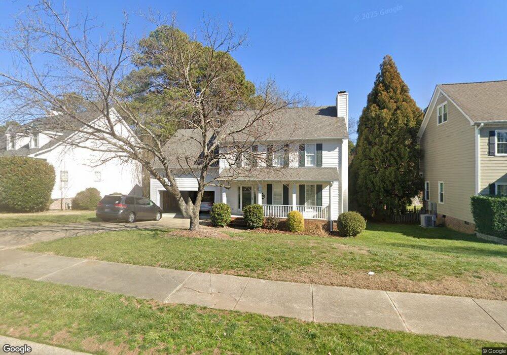
102 Chestone Ct Cary, NC 27513
West Cary NeighborhoodEstimated Value: $570,550 - $649,000
4
Beds
3
Baths
2,142
Sq Ft
$286/Sq Ft
Est. Value
About This Home
This home is located at 102 Chestone Ct, Cary, NC 27513 and is currently estimated at $613,638, approximately $286 per square foot. 102 Chestone Ct is a home located in Wake County with nearby schools including Weatherstone Elementary School, Davis Drive Middle, and Green Hope High.
Ownership History
Date
Name
Owned For
Owner Type
Purchase Details
Closed on
Dec 27, 2007
Sold by
Hill Kenneth Glen and Hill Bridgit M
Bought by
Jackson Lashawn L and Jackson Jennifer
Current Estimated Value
Purchase Details
Closed on
May 23, 2001
Sold by
Williams Gregory A
Bought by
Hill Kenneth Glen and Hill Bridgit M
Home Financials for this Owner
Home Financials are based on the most recent Mortgage that was taken out on this home.
Original Mortgage
$168,800
Interest Rate
7.02%
Mortgage Type
Balloon
Create a Home Valuation Report for This Property
The Home Valuation Report is an in-depth analysis detailing your home's value as well as a comparison with similar homes in the area
Home Values in the Area
Average Home Value in this Area
Purchase History
| Date | Buyer | Sale Price | Title Company |
|---|---|---|---|
| Jackson Lashawn L | $287,500 | None Available | |
| Hill Kenneth Glen | $211,000 | -- |
Source: Public Records
Mortgage History
| Date | Status | Borrower | Loan Amount |
|---|---|---|---|
| Previous Owner | Hill Kenneth Glen | $168,800 | |
| Closed | Hill Kenneth Glen | $31,650 |
Source: Public Records
Tax History
| Year | Tax Paid | Tax Assessment Tax Assessment Total Assessment is a certain percentage of the fair market value that is determined by local assessors to be the total taxable value of land and additions on the property. | Land | Improvement |
|---|---|---|---|---|
| 2025 | $4,399 | $510,908 | $180,000 | $330,908 |
| 2024 | $4,304 | $510,908 | $180,000 | $330,908 |
| 2023 | $3,554 | $352,697 | $128,000 | $224,697 |
| 2022 | $3,422 | $352,697 | $128,000 | $224,697 |
| 2021 | $3,353 | $352,697 | $128,000 | $224,697 |
| 2020 | $3,371 | $352,697 | $128,000 | $224,697 |
| 2019 | $3,144 | $291,801 | $120,000 | $171,801 |
| 2018 | $2,951 | $291,801 | $120,000 | $171,801 |
| 2017 | $2,836 | $291,801 | $120,000 | $171,801 |
| 2016 | $2,794 | $291,801 | $120,000 | $171,801 |
| 2015 | $2,557 | $257,720 | $86,000 | $171,720 |
| 2014 | $2,412 | $257,720 | $86,000 | $171,720 |
Source: Public Records
Map
Nearby Homes
- 128 Wheatsbury Dr
- 101 Paladin Place
- 112 Hidden Rock Ct
- 111 Gingergate Dr
- 104 Foxcrest Ct
- 106 Stokesay Ct
- 208 Trailview Dr
- 266 Joshua Glen Ln
- 113 Fetzer Ct
- 2005 Valleystone Dr
- 3001 Valleystone Dr
- 305 Bebington Dr
- 146 Swan Quarter Dr
- 304 Arlington Ridge
- 121 Marquette Dr
- 104 Fawley Ct
- 316 Arlington Ridge
- 410 Widdington Ln
- 502 Heathridge Ln
- 217 Old Dock Trail
- 100 Chestone Ct
- 104 Chestone Ct
- 106 Chestone Ct
- 103 Chestone Ct
- 105 Chestone Ct
- 101 Chestone Ct
- 107 Chestone Ct
- 108 Chestone Ct
- 308 Swordgate Dr
- 130 Wheatsbury Dr
- 109 Chestone Ct
- 111 Chestone Ct
- 110 Chestone Ct
- 311 Swordgate Dr
- 114 Paladin Place
- 112 Paladin Place
- 306 Swordgate Dr
- 112 Chestone Ct
- 309 Swordgate Dr
- 126 Wheatsbury Dr
Your Personal Tour Guide
Ask me questions while you tour the home.